
Advanced Search for Maps
Showing 1-2 of 2
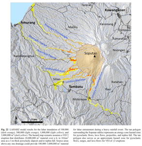
Figure in a journal article
LAHARZ model results for the lahar inundation of 100,000 (dark orange), 300,000 (light orange), 1,000,000 (light yellow), and 3,000,000 m³ (dark yellow)
Figure 22 in: Kushendratno, Pallister, J.S., Kristianto, Bina, F.R., McCausland, W., Carn, S., Haerani, N., Griswold, J., & Keeler, R. (2012). Recent explosive eruptions and volcano hazards at Soputan volcano—a basalt stratovolcano in north Sulawesi, Indonesia. Bulletin of volcanology, 74(7), 1581-1609. https://doi.org/10.1007/s00445-012-0620-2
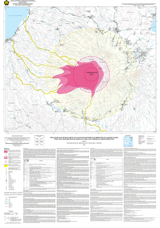
Official, Map sheet or poster
Volcanic Hazard Map of Soputan Volcano, North Sulawesi Province
Hadisantono, R.D., Abdurachman, E.K., Surmayadi, M., & Martono, A. (2006). Volcanic Hazard Map of Soputan Volcano, North Sulawesi Province. Center for Volcanology and Geological Hazard Mitigation (CVGHM).