
Advanced Search for Maps
Showing 1-8 of 8
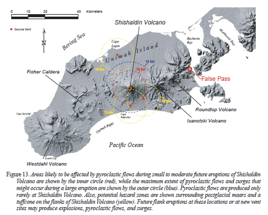
Official, Figure in hazard assessment
Areas likely to be affected by pyroclastic flows during small to moderate future eruptions of Shishaldin Volcano
Figure 13 in: Beget, J.E., Nye, C.J., Schaefer, J.R. & Stelling, P.L. (2003). Preliminary volcano-hazard assessment for Shishaldin Volcano, Alaska. Alaska Division of Geological & Geophysical Surveys, Report of Investigations 2002-4, 28 p., 1 sheet, scale 1:500,000. http://doi.org/10.14509/2872
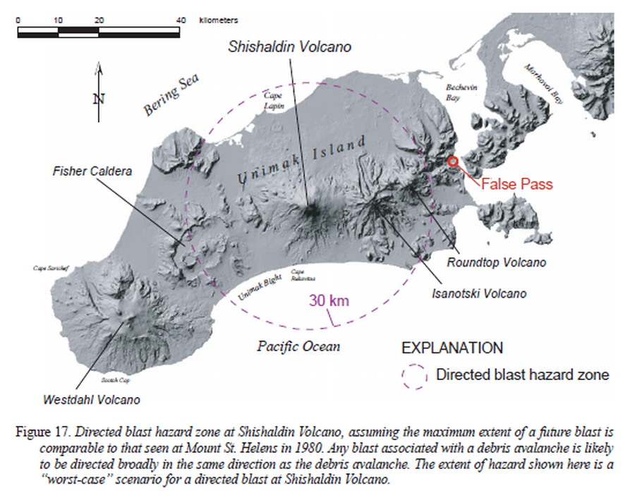
Official, Figure in hazard assessment
Directed blast hazard zone at Shishaldin Volcano
Figure 17 in: Beget, J.E., Nye, C.J., Schaefer, J.R. & Stelling, P.L. (2003). Preliminary volcano-hazard assessment for Shishaldin Volcano, Alaska. Alaska Division of Geological & Geophysical Surveys, Report of Investigations 2002-4, 28 p., 1 sheet, scale 1:500,000. http://doi.org/10.14509/2872
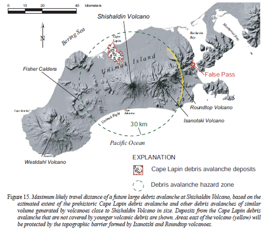
Official, Figure in hazard assessment
Maximum likely travel distance of a future large debris avalanche at Shishaldin Volcano
Figure 15 in: Beget, J.E., Nye, C.J., Schaefer, J.R. & Stelling, P.L. (2003). Preliminary volcano-hazard assessment for Shishaldin Volcano, Alaska. Alaska Division of Geological & Geophysical Surveys, Report of Investigations 2002-4, 28 p., 1 sheet, scale 1:500,000. http://doi.org/10.14509/2872
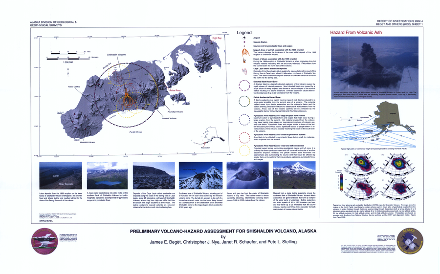
Official, Insert/poster-size map with accompanying report
Preliminary Volcano-Hazard Assessment for Shishaldin Volcano, Alaska
Sheet 1 in: Beget, J.E., Nye, C.J., Schaefer, J.R. & Stelling, P.L. (2003). Preliminary volcano-hazard assessment for Shishaldin Volcano, Alaska. Alaska Division of Geological & Geophysical Surveys, Report of Investigations 2002-4, 28 p., 1 sheet, scale 1:500,000. http://doi.org/10.14509/2872
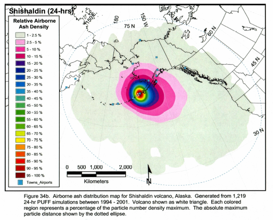
Figure in a thesis or dissertation
Shishaldin 24-hrs. Airborne ash distribution map for Shishaldin volcano, Alaska
Figure 34b in: Papp, K. (2002). An analysis of volcanic ash plume movement and dispersion within the North Pacific. University of Alaska Fairbanks, M.S. Thesis. https://scholarworks.alaska.edu/handle/11122/6307
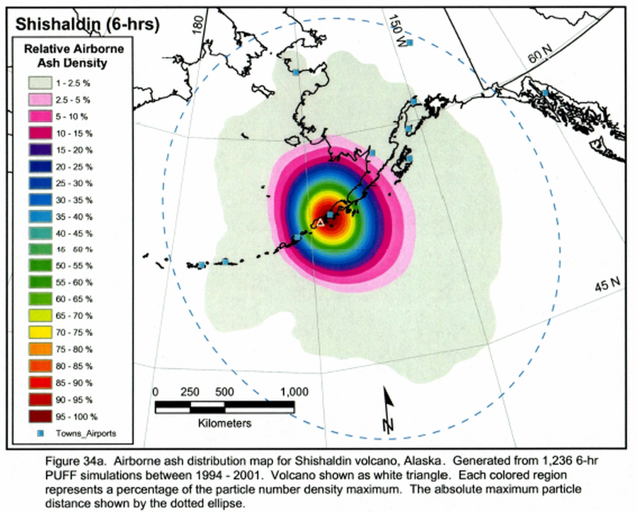
Figure in a thesis or dissertation
Shishaldin 6-hrs. Airborne ash distribution map for Shishaldin volcano, Alaska
Figure 34a in: Papp, K. (2002). An analysis of volcanic ash plume movement and dispersion within the North Pacific. University of Alaska Fairbanks, M.S. Thesis. https://scholarworks.alaska.edu/handle/11122/6307
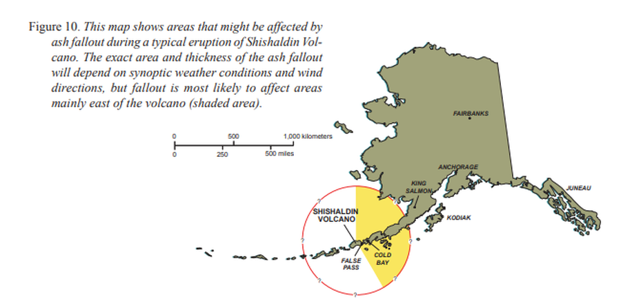
Official, Figure in hazard assessment
This map shows areas that might be affected by ash fallout during a typical eruption of Shishaldin Volcano
Figure 10 in: Beget, J.E., Nye, C.J., Schaefer, J.R. & Stelling, P.L. (2003). Preliminary volcano-hazard assessment for Shishaldin Volcano, Alaska. Alaska Division of Geological & Geophysical Surveys, Report of Investigations 2002-4, 28 p., 1 sheet, scale 1:500,000. http://doi.org/10.14509/2872
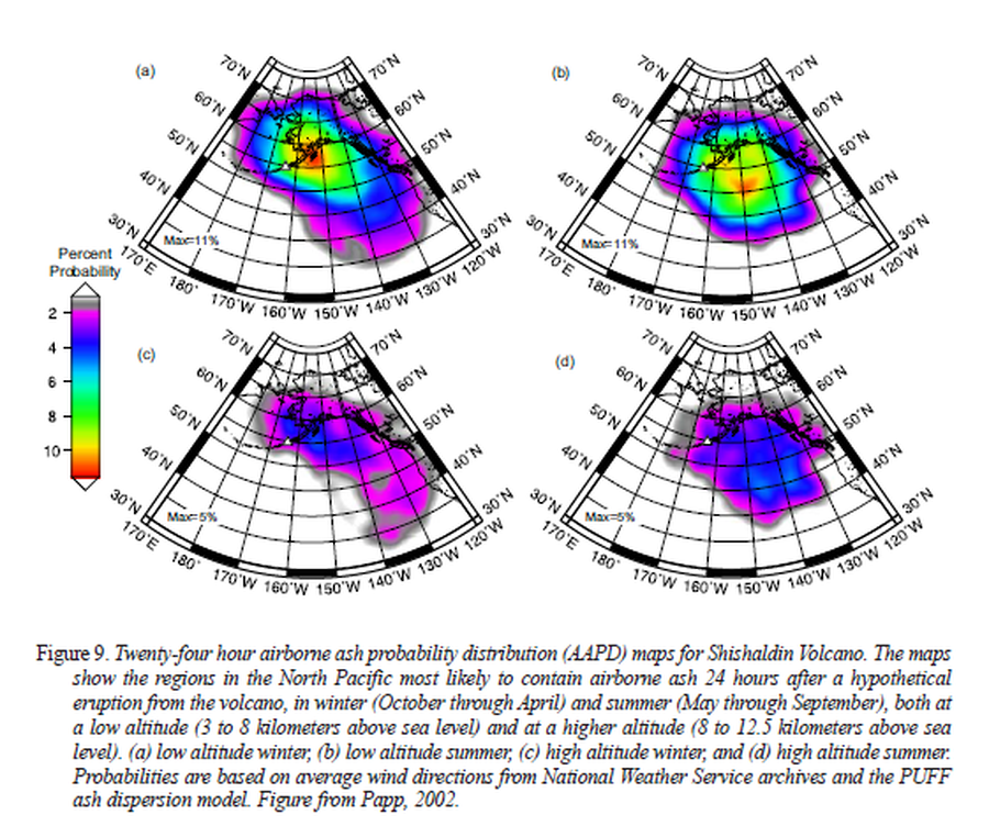
Official, Figure in hazard assessment
Twenty-four hour airborne ash probability distribution (AAPD) maps for Shishaldin Volcano.
Figure 9 in: Beget, J.E., Nye, C.J., Schaefer, J.R. & Stelling, P.L. (2003). Preliminary volcano-hazard assessment for Shishaldin Volcano, Alaska. Alaska Division of Geological & Geophysical Surveys, Report of Investigations 2002-4, 28 p., 1 sheet, scale 1:500,000. http://doi.org/10.14509/2872. (Modified from: Papp 2002)