
Maximum likely travel distance of a future large debris avalanche at Shishaldin Volcano
Shishaldin, United States, 2003
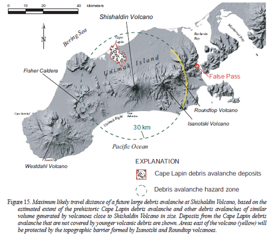
Figure 15 in: Beget, J.E., Nye, C.J., Schaefer, J.R. & Stelling, P.L. (2003). Preliminary volcano-hazard assessment for Shishaldin Volcano, Alaska. Alaska Division of Geological & Geophysical Surveys, Report of Investigations 2002-4, 28 p., 1 sheet, scale 1:500,000. http://doi.org/10.14509/2872
This map was produced by an official agency, but may not be the most recent, most complete, or main operational map.
For the current operational hazard map, please consult the proper institutional authorities.
Click on image for full-size map. If link seems broken, try the archived version.
Beget, J.E., Nye, C.J., Schaefer, J.R. & Stelling, P.L. (2003). Preliminary volcano-hazard assessment for Shishaldin Volcano, Alaska. Alaska Division of Geological & Geophysical Surveys, Report of Investigations 2002-4, 28 p., 1 sheet, scale 1:500,000. http://doi.org/10.14509/2872Map Set
http://doi.org/10.14509/2872
Other Maps In Set: