
Advanced Search for Maps
Showing 1-2 of 2
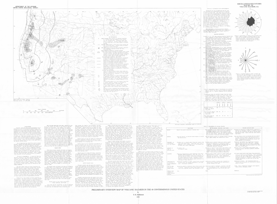
Official, Map sheet or poster
Preliminary Overview Map of Volcanic Hazards in the 48 Coterminous United States
Mullineaux, D.R. (1978). Preliminary overview map of volcanic hazards in the 48 conterminous United States. U.S. Geological Survey, Miscellaneous Field Studies Map 786. https://doi.org/10.3133/mf786
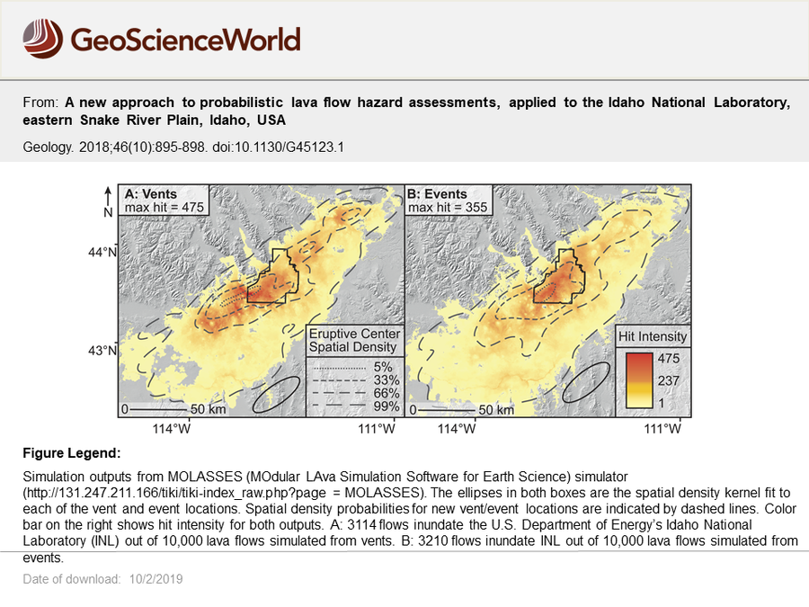
Figure in a journal article
Simulation outputs from MOLASSES (MOdular LAva Simulation Software for Earth Science) simulator
Figure 3 in: Gallant, E., Richardson, J., Connor, C., Wetmore, P., Connor, L. (2018). A new approach to probabilistic lava flow hazard assessments, applied to the Idaho National Laboratory, eastern Snake River Plain, Idaho, USA. Geology, 46 (10), p. 895–898. https://doi.org/10.1130/G45123.1