
Advanced Search for Maps
Showing 1-3 of 3
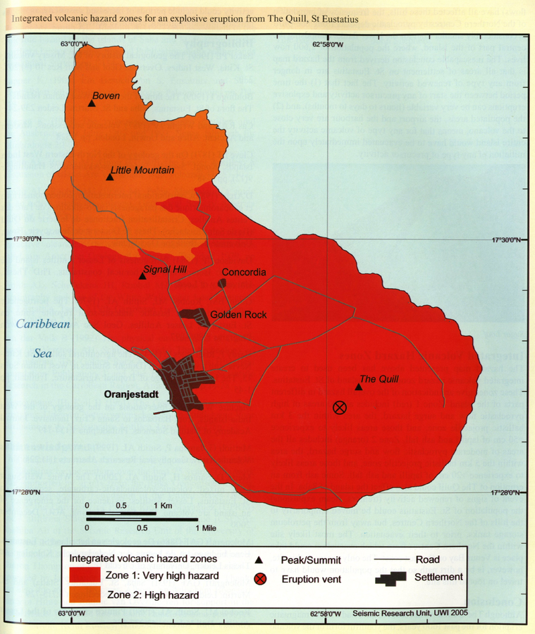
Official, Figure in hazard assessment
Integrated volcanic hazard zones for an explosive eruption from The Quill, St Eustatius
Page 200 in: Smith, A.L. & Roobol, M.J. (2005). St. Eustatius. In: Lindsay, J.M., Shepherd, J.B., Robertson, R.E.A., & Ali, S. (Eds) Volcanic hazard atlas of the Lesser Antilles. Seismic Research Unit, The University of the West Indies, Trinidad and Tobago, W.I., p. 193-203
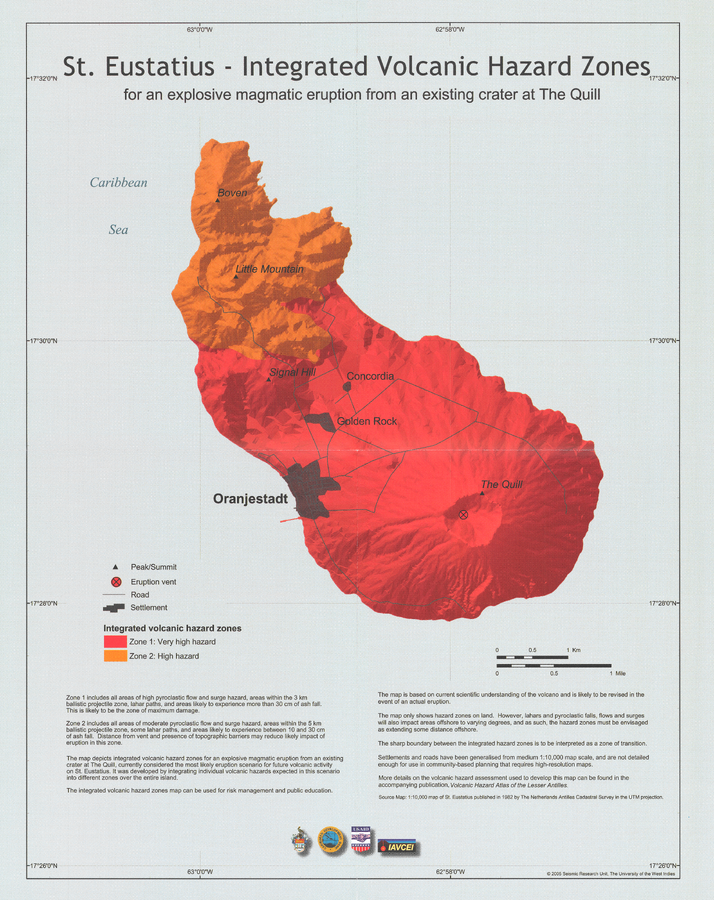
Official, Insert/poster-size map with accompanying report
St. Eustatius - Integrated Volcanic Hazard Zones for an explosive magmatic eruption from an existing crater at The Quill
Pocket Insert in: Smith, A.L. & Roobol, M.J. (2005). St. Eustatius. In: Lindsay, J.M., Shepherd, J.B., Robertson, R.E.A., & Ali, S. (Eds) Volcanic hazard atlas of the Lesser Antilles. Seismic Research Unit, The University of the West Indies, Trinidad and Tobago, W.I., p. 193-203
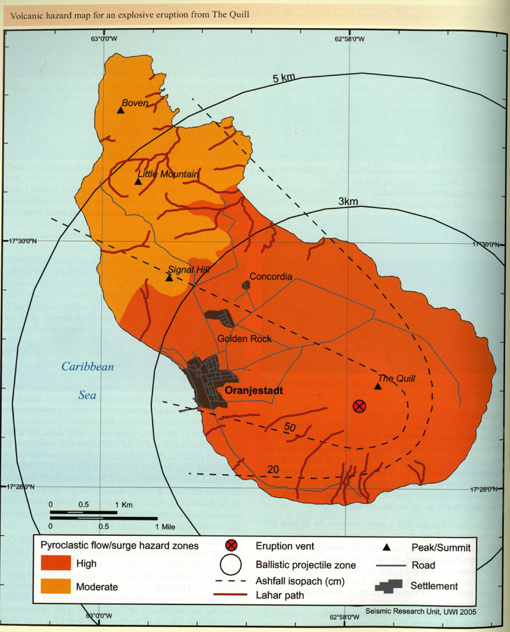
Official, Figure in hazard assessment
Volcanic hazard map for an explosive eruption from The Quill
Page 199 in: Smith, A.L. & Roobol, M.J. (2005). St. Eustatius. In: Lindsay, J.M., Shepherd, J.B., Robertson, R.E.A., & Ali, S. (Eds) Volcanic hazard atlas of the Lesser Antilles. Seismic Research Unit, The University of the West Indies, Trinidad and Tobago, W.I., p. 193-203