
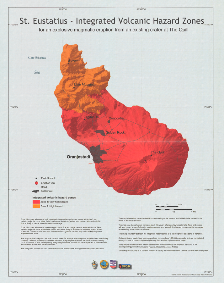
St. Eustatius - Integrated Volcanic Hazard Zones for an explosive magmatic eruption from an existing crater at The Quill
The Quill, Saint Eustatius [Netherlands], 2005
Pocket Insert in: Smith, A.L. & Roobol, M.J. (2005). St. Eustatius. In: Lindsay, J.M., Shepherd, J.B., Robertson, R.E.A., & Ali, S. (Eds) Volcanic hazard atlas of the Lesser Antilles. Seismic Research Unit, The University of the West Indies, Trinidad and Tobago, W.I., p. 193-203
This map was produced by an official agency, but is NOT the most recent, most complete, or main operational map.
For the current operational hazard map, please consult the proper institutional authorities.
Map Set
Smith, A.L. & Roobol, M.J. (2005). St. Eustatius. In: Lindsay, J.M., Shepherd, J.B., Robertson, R.E.A., & Ali, S. (Eds) Volcanic hazard atlas of the Lesser Antilles. Seismic Research Unit, The University of the West Indies, Trinidad and Tobago, W.I., p. 193-203
https://uwiseismic.com/wp-content/uploads/2021/10/StEustatius.pdf
Other Maps In Set: