
Advanced Search for Maps
Showing 1-7 of 7
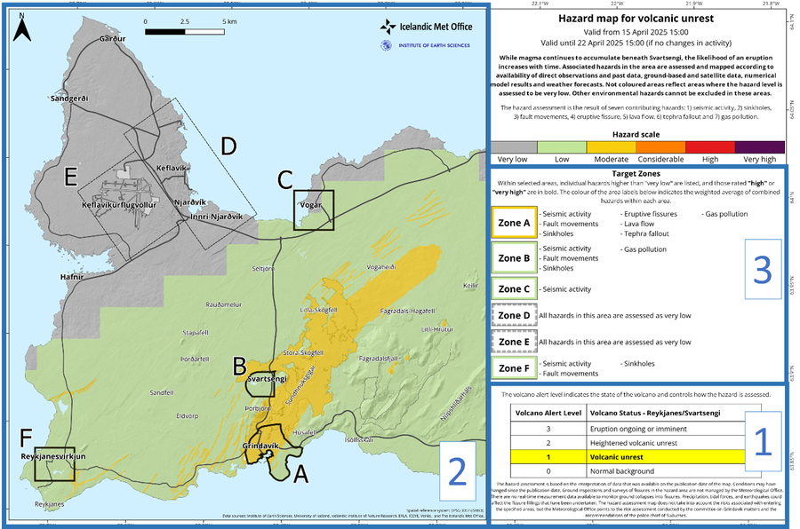
Official, Figure on website
Hazard map for volcanic unrest
Icelandic Meteorological Office (IMO). (2025). New hazard map covering a larger area, 15 April 2025. https://en.vedur.is/about-imo/news/uplift-continues-beneath-svartsengi
Official, Figure on website
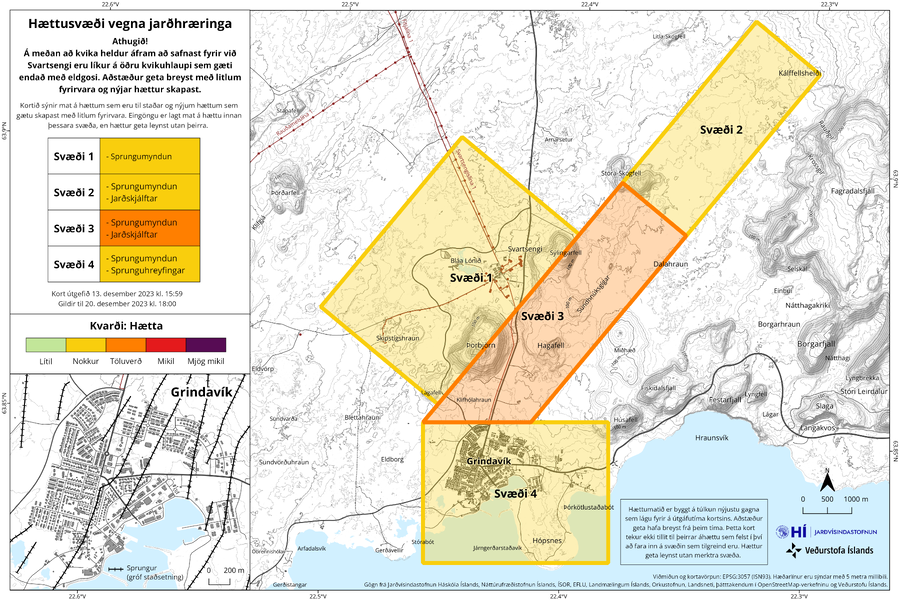
Hættusvæði vegna jarðhræringa
(Danger zone due to earthquakes)
Icelandic Meteorological Office (IMO). (2023). Hættusvæði vegna jarðhræringa, 13. desember 2023.
Official, Figure on website
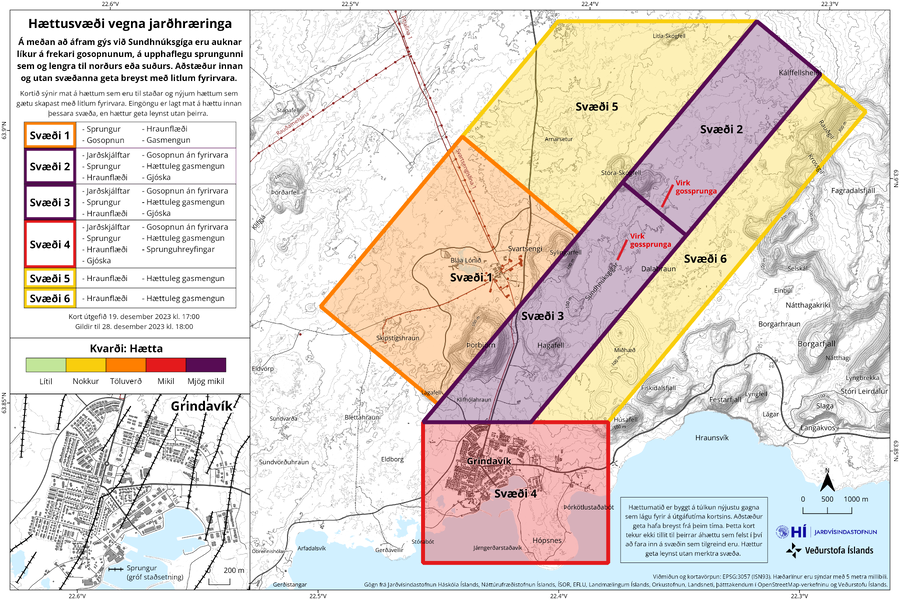
Hættusvæði vegna jarðhræringa
(Danger zone due to earthquakes)
Icelandic Meteorological Office (IMO). (2023). Hættusvæði vegna jarðhræringa, 19. desember 2023.
Official, Figure on website
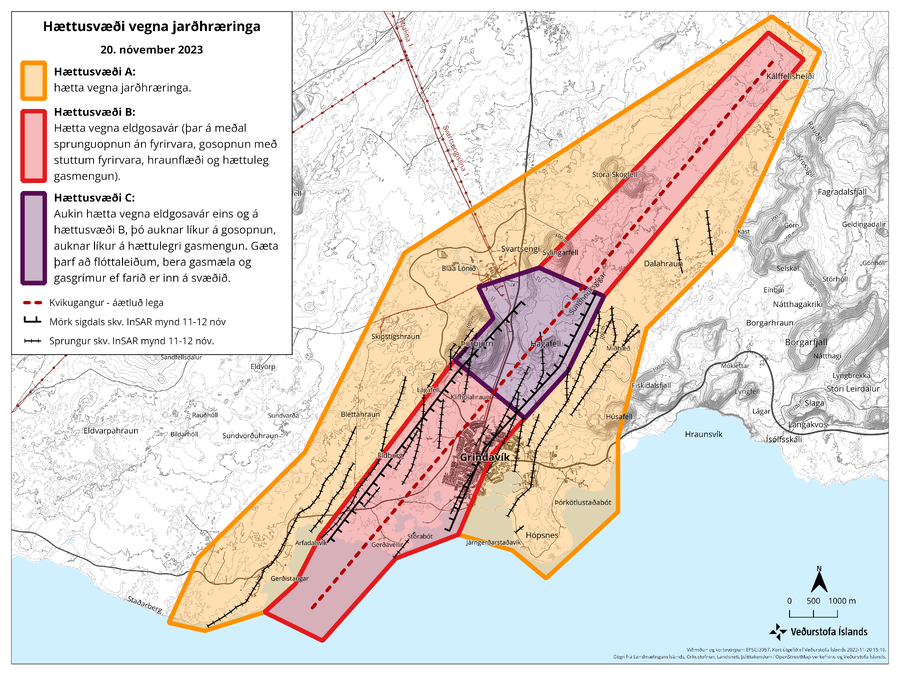
Hættusvæði vegna jarðhræringa, 20. nóvember 2023
(Danger zone due to earthquakes, November 20, 2023)
Icelandic Meteorological Office (IMO). (2023). Hættusvæði vegna jarðhræringa, 20. nóvember 2023.
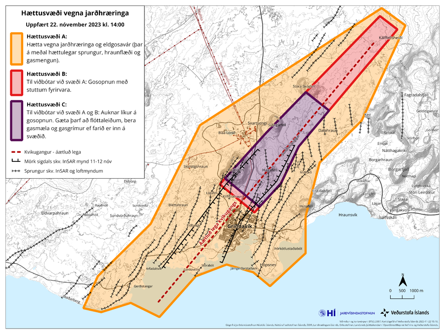
Official, Figure on website
Hættusvæði vegna jarðhræringa, Uppfært 22. nóvember 2023 kl. 14:00
(Danger zone due to earthquakes, Updated November 22, 2023 at 14:00)
Icelandic Meteorological Office (IMO). (2023). Hættusvæði vegna jarðhræringa, 20. nóvember 2023.
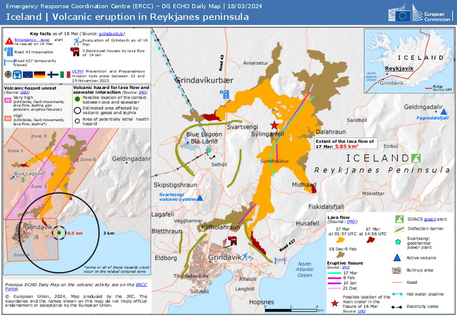
Official, Figure on website
Iceland | Volcanic eruption in Reykjanes peninsula
Emergency Response Coordination Centre (ERCC). (2024). ECHO Daily Map of 18 March 2024. https://erccportal.jrc.ec.europa.eu/ECHO-Products/Maps#/maps/4825
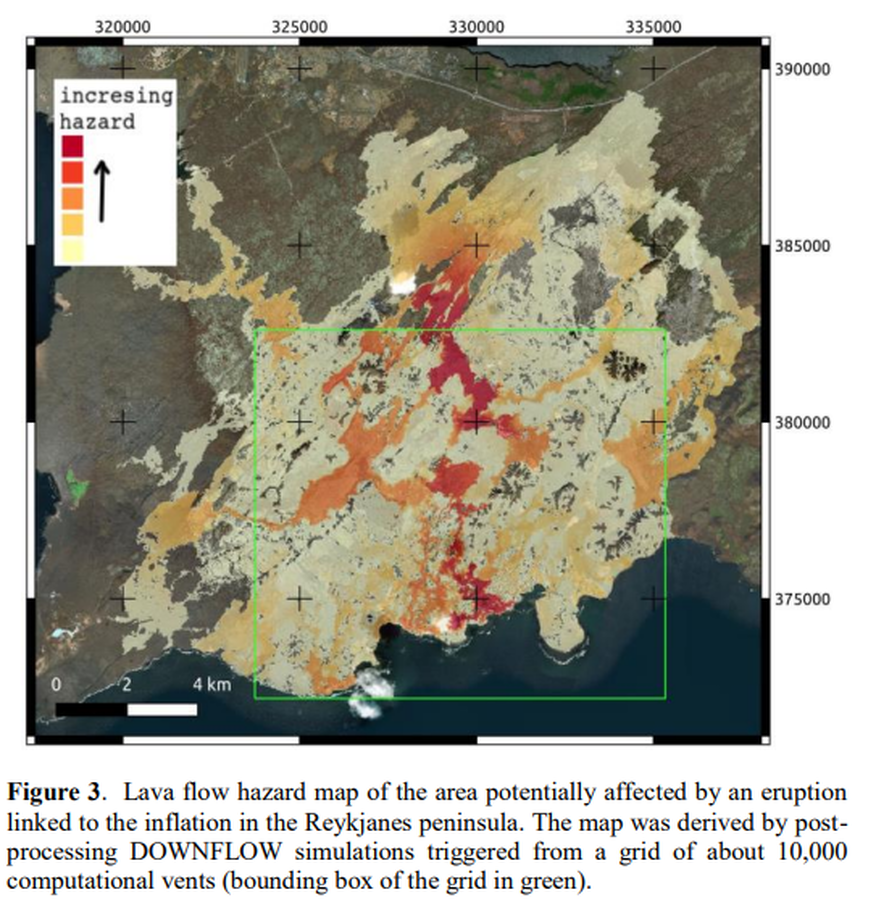
Figure in a conference presentation
Lava flow hazard map of the area potentially affected by an eruption linked to the inflation in the Reykjanes peninsula
Figure 3 in: Tarquini, S., Favalli, M., Pfeffer, M., de'Michieli Vitturi, M., Barsotti, S., Pedersen, G., Óladóttir, B., & Jensen, E. H. (2020). Assessing the impact of lava flows during the 2020 unrest of the Svartsengi volcanic system on the Reykjanes peninsula, Iceland. Geomorphometry, Perugia, Italy. https://doi.org/10.30437/GEOMORPHOMETRY2020