
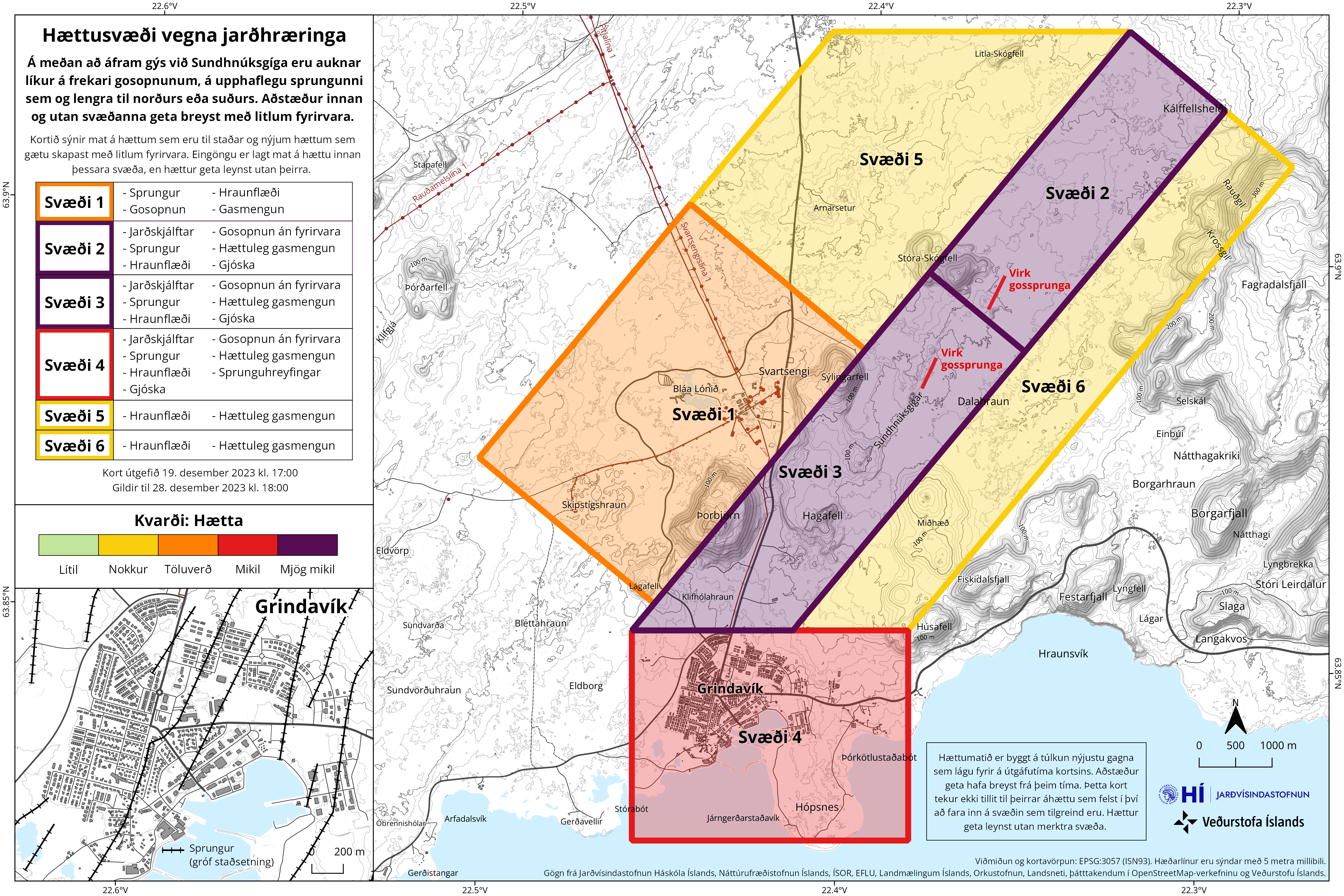
Hættusvæði vegna jarðhræringa
Danger zone due to earthquakes
Svartsengi (Reykjanes), Iceland, 2023
Icelandic Meteorological Office (IMO). (2023). Hættusvæði vegna jarðhræringa, 19. desember 2023.
This map was produced by an official agency, but is NOT the most recent, most complete, or main operational map.
For the current operational hazard map, please consult the proper institutional authorities.
Click on thumbnail for full-size map. We do not have copyright permission to display the full-size image. If you are the copyright holder and wish to provide copyright, please contact us at admin@volcanichazardmaps.org. If link seems broken, try the archived version.
Icelandic Meteorological Office (IMO). (2023). News. https://www.vedur.is/um-vi/frettir/jardskjalftahrina-nordan-vid-grindavik-hofst-i-nottMap Set
https://www.vedur.is/um-vi/frettir/jardskjalftahrina-nordan-vid-grindavik-hofst-i-nott
Other Maps In Set: