
Advanced Search for Maps
Showing 1-2 of 2
Official, Figure or insert in a report
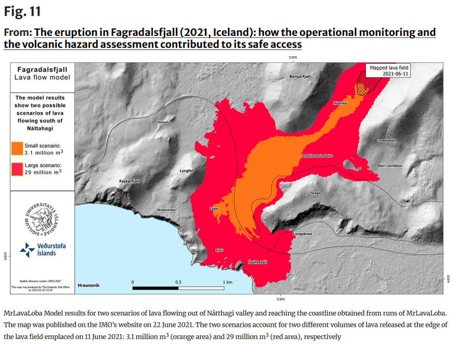
Fagradalsfjall Lava flow model
Figure 11 in: Icelandic Meteorological Office (IMO). (2021). Fagradalsfjall Lava Flow Model. (Reproduced in: Barsotti, S., Parks, M. M., Pfeffer, M. A., Óladóttir, B. A., Barnie, T., Titos, M. M., ... & Sigurðsson, E. M. (2023). The eruption in Fagradalsfjall (2021, Iceland): how the operational monitoring and the volcanic hazard assessment contributed to its safe access. Natural Hazards, 116(3), 3063-3092.)
Official, Figure or insert in a report
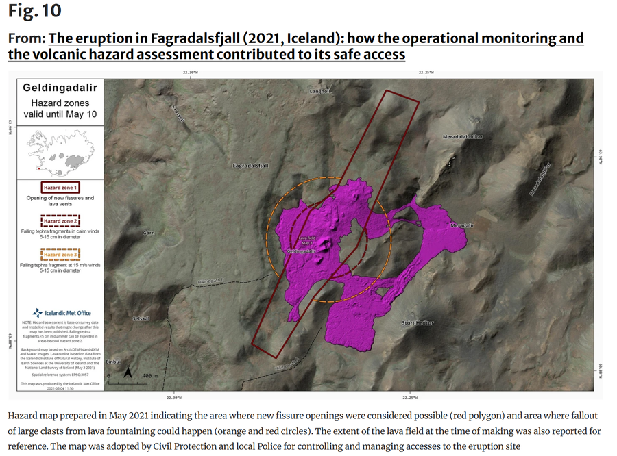
Geldingadalir Hazard Zones valid until May 10
Figure 10 in: Icelandic Meteorological Office (IMO). (2021). Geldingadalir Hazard Zones valid until May 10. (Reproduced in: Barsotti, S., Parks, M. M., Pfeffer, M. A., Óladóttir, B. A., Barnie, T., Titos, M. M., ... & Sigurðsson, E. M. (2023). The eruption in Fagradalsfjall (2021, Iceland): how the operational monitoring and the volcanic hazard assessment contributed to its safe access. Natural Hazards, 116(3), 3063-3092.)