
Geldingadalir Hazard Zones valid until May 10
Fagradalsfjall, Iceland, 2021
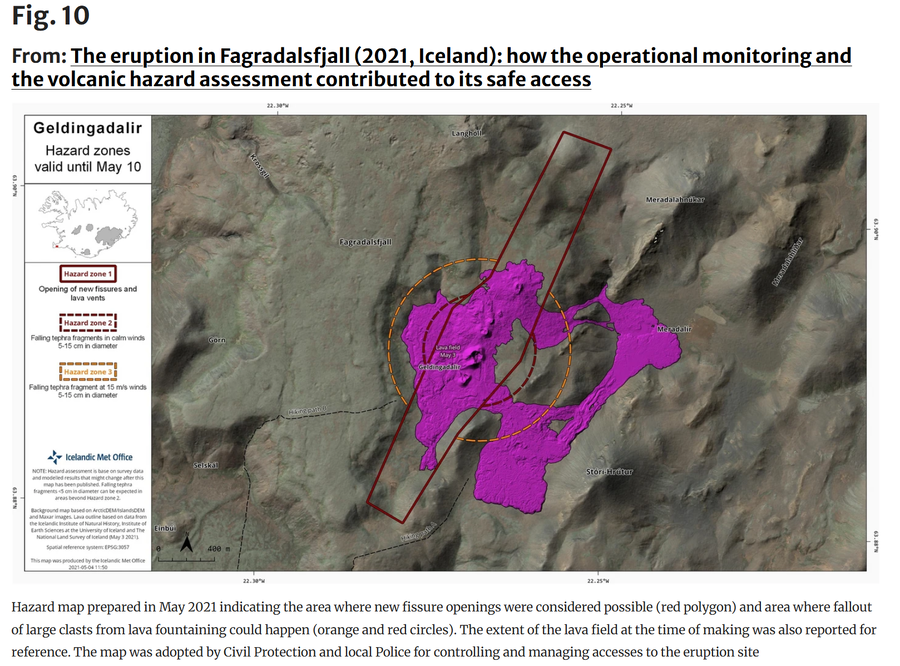
Figure 10 in: Icelandic Meteorological Office (IMO). (2021). Geldingadalir Hazard Zones valid until May 10. (Reproduced in: Barsotti, S., Parks, M. M., Pfeffer, M. A., Óladóttir, B. A., Barnie, T., Titos, M. M., ... & Sigurðsson, E. M. (2023). The eruption in Fagradalsfjall (2021, Iceland): how the operational monitoring and the volcanic hazard assessment contributed to its safe access. Natural Hazards, 116(3), 3063-3092.)
This map was produced by an official agency, but is NOT the most recent, most complete, or main operational map.
For the current operational hazard map, please consult the proper institutional authorities.
Click on image for full-size map. If link seems broken, try the archived version.
Barsotti, S., Parks, M. M., Pfeffer, M. A., Óladóttir, B. A., Barnie, T., Titos, M. M., ... & Sigurðsson, E. M. (2023). The eruption in Fagradalsfjall (2021, Iceland): how the operational monitoring and the volcanic hazard assessment contributed to its safe access. Natural Hazards, 116(3), 3063-3092.Map Set
https://doi.org/10.1007/s11069-022-05798-7
Other Maps In Set: