
Advanced Search for Maps
Showing 1-10 of 30
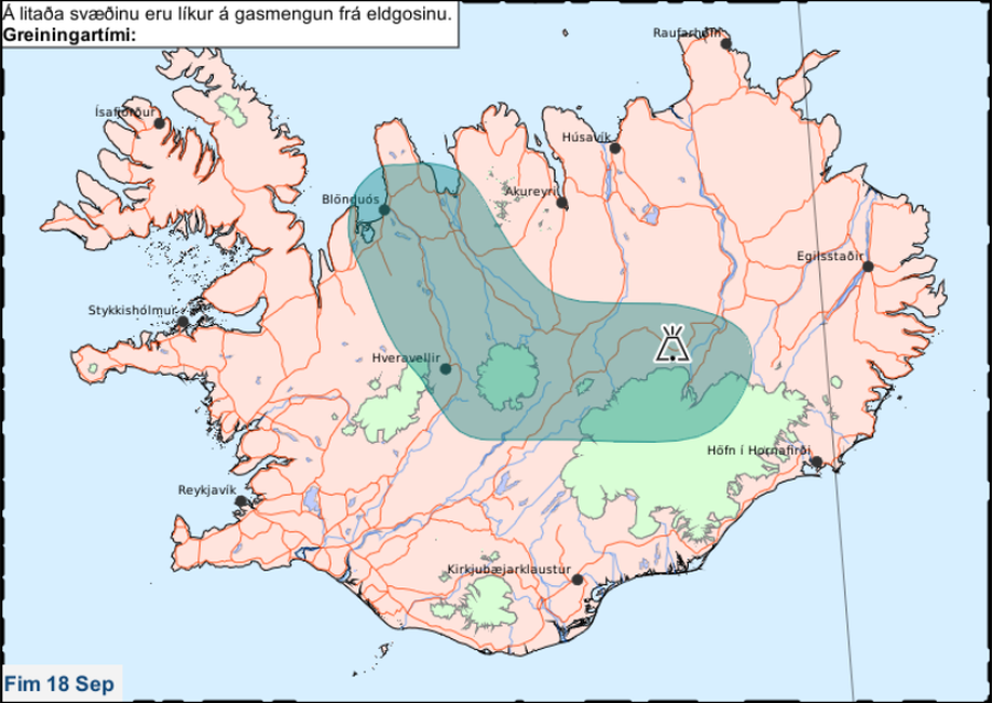
Official, Map in an information statement
Á litaða svæðinu eru líkur á gasmengun frá eldgosinu. Fim 18 Sep.
(In the colored area there is a likelihood of gas pollution from the eruption. Thu 18 Sep.)
Iceland Meteorological Office (IMO). (2014). Á litaða svæðinu eru líkur á gasmengun frá eldgosinu. Fim 18 Sep.
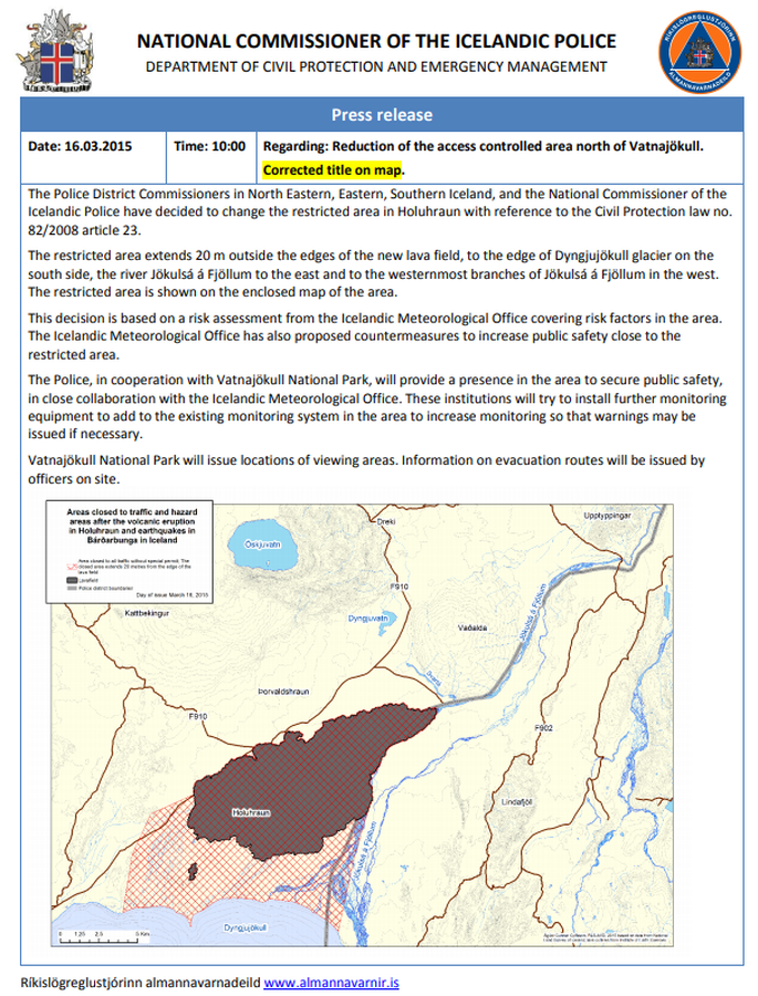
Official, Map in an information statement
Areas closed to traffic and hazard areas after the volcanic eruption in Holuhraun and earthquakes in Bárðarbunga in Iceland
National Commisioner of the Icelandic Police. (2015). Press Release 16.03.2015 10:00 Regarding: Reduction of the access controlled area north of Vatnajökull.
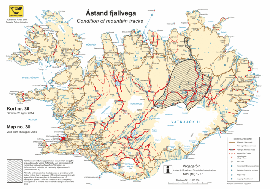
Official, Map in an information statement
Ástand fjallvega
(Condition of mountain tracks)
Icelandic Road and Coastal Administration. (2014). Condition of mountain tracks. Map no. 30, valid from 25 August 2014.
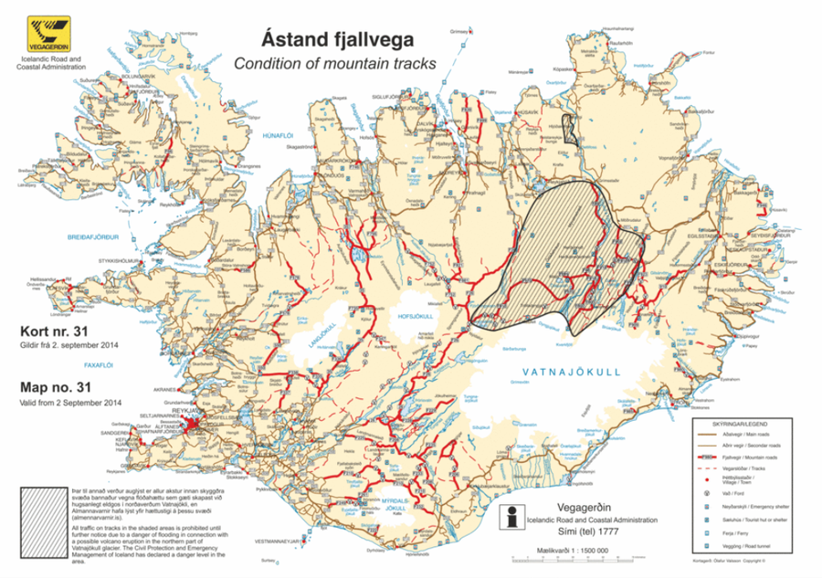
Official, Map in an information statement
Ástand fjallvega
(Condition of mountain tracks)
Icelandic Road and Coastal Administration. (2014). Condition of mountain tracks. Map no. 31, valid from 2 September 2014.
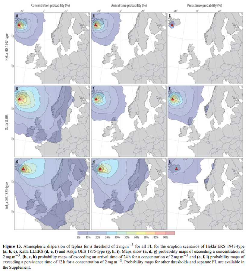
Figure in a journal article
Atmospheric dispersion of tephra for a threshold of 2 mg m−3 for all FL for the eruption scenarios of Hekla ERS 1947-type (a, b, c), Katla LLERS (d, e, f) and Askja OES 1875-type (g, h, i)
Figure 13 in: Biass, S., Scaini, C., Bonadonna, C., Folch, A., Smith, K., & Höskuldsson, A. (2014). A multi-scale risk assessment for tephra fallout and airborne concentration from multiple Icelandic volcanoes–Part 1: Hazard assessment. Natural hazards and earth system sciences, 14(8), 2265-2287. https://doi.org/10.5194/nhess-14-2265-2014
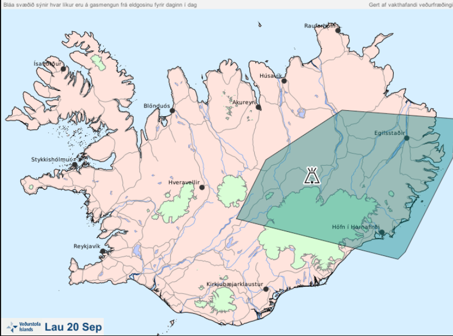
Official, Map in an information statement
Bláa svæðið sýnir hvar líkur eru á gasmengun frá eldgosinu fyrir daginn í dag lau 20 Sep
(The blue area shows the probability of gas pollution from the eruption before today Sat Sep 20)
Iceland Meteorological Office (IMO). (2014). Bláa svæðið sýnir hvar líkur eru á gasmengun frá eldgosinu fyrir daginn í dag lau 20 Sep
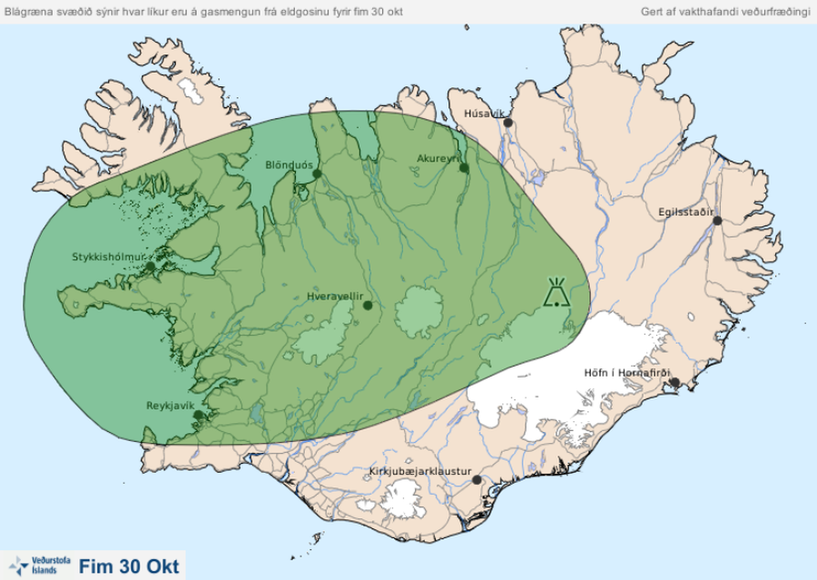
Official, Map in an information statement
Blágræna svæðið sýnir hvar líkur eru á gasmengun frá eldgosinu fyrir fim 30 okt
(The blue-green area shows the probability of gas pollution from the volcanic eruption before Oct. 30)
Iceland Meteorological Office (IMO). (2014). Blágræna svæðið sýnir hvar líkur eru á gasmengun frá eldgosinu fyrir fim 30 okt
Official, Map in an information statement
Blágræna svæðið sýnir hvar líkur eru á gasmengun frá eldgosinu fyrir fös 12 des
(The blue-green area shows the probability of gas pollution from the eruption before Fri Dec 12)
Iceland Meteorological Office (IMO). (2014). Blágræna svæðið sýnir hvar líkur eru á gasmengun frá eldgosinu fyrir fös 12 des
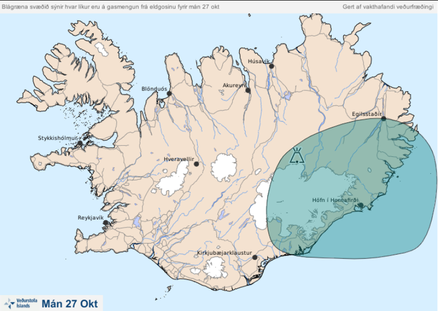
Official, Map in an information statement
Blágræna svæðið sýnir hvar líkur eru á gasmengun frá eldgosinu fyrir mán 27 okt
(The blue-green area shows the likelihood of gas pollution from the eruption before Mon Oct 27)
Iceland Meteorological Office (IMO). (2014). Blágræna svæðið sýnir hvar líkur eru á gasmengun frá eldgosinu fyrir mán 27 okt
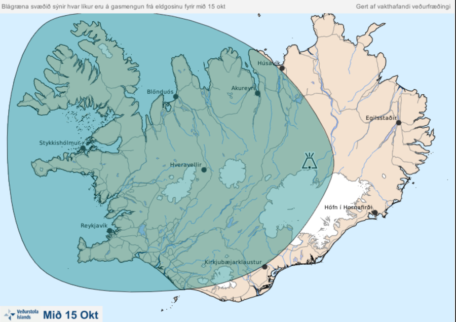
Official, Map in an information statement
Blágræna svæðið sýnir hvar líkur eru á gasmengun frá eldgosinu fyrir mið 15 okt.
(The blue-green area shows the probability of gas pollution from the volcanic eruption by mid-15 oct.)
Iceland Meteorological Office (IMO). (2014). Blágræna svæðið sýnir hvar líkur eru á gasmengun frá eldgosinu fyrir mið 15 okt.