← Back to Search Results

Areas closed to traffic and hazard areas after the volcanic eruption in Holuhraun and earthquakes in Bárðarbunga in Iceland

Holuhraun (Askja) & Bárdarbunga, Iceland, 2015

National Commisioner of the Icelandic Police. (2015). Press Release 16.03.2015 10:00 Regarding: Reduction of the access controlled area north of Vatnajökull.


This map was produced by an official agency, but is NOT the most recent, most complete, or main operational map. For the current operational hazard map, please consult the proper institutional authorities.


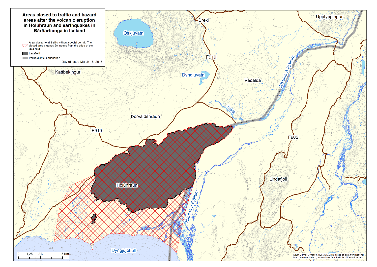
Click on image for full-size map. If link seems broken, try the archived version.

Map Data

Map ID1368
Hazard Process(es)Access or danger zone
Hazard Zone PresentationHazard level-focused: All or most hazards are combined by hazard level on a main map panel
Temporal ScaleCrisis, or short-term, map (hours to decades)
Spatial ScaleVolcano and surrounding area
Publication FormatPart of an information statement, bulletin, or other alert product
Zonation Method(s)Geologic history
Zonation Model(s)
Scenario(s) ConsideredCurrent conditions
Hazard Zone Label(s)Access (exclusion, danger, or safe zones)
Probability Definition(s)No probability definition was discernable from the map
PurposeCrisis management and response: Intended to be used for managing, responding to, and taking action during an eruption; often includes evacuation routes, access restrictions, actions to take, etc.
AudienceMultiple audiences (usually the public, civil authorities, and land-use planners)
Language(s)English
Basemap(s)Contour lines
Basemap overlay(s)Street map
DiemsionalityPlanimetric (2D or map) view
Color SchemeSingle color
Go to Global Volcanism Program page for Holuhraun (Askja) & Bárdarbunga →