
Advanced Search for Maps
Showing 1-1 of 1
Official, Insert/poster-size map with accompanying report
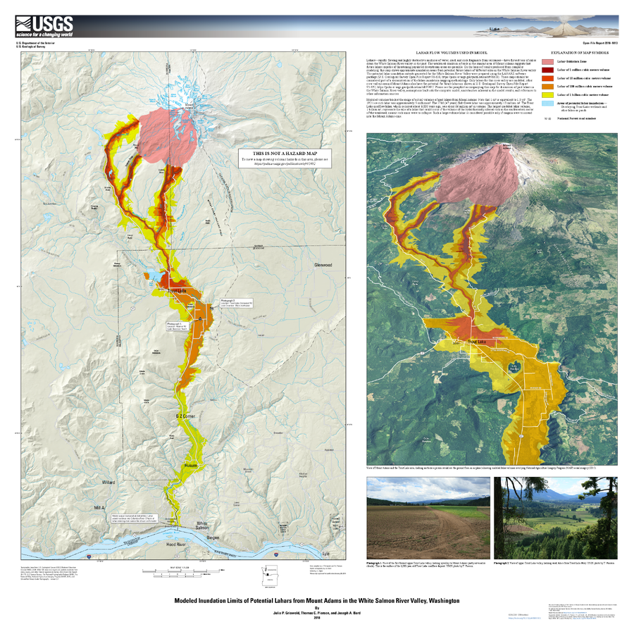
Modeled Inundation Limits of Potential Lahars from Mount Adams in the White Salmon River Valley, Washington
Griswold, J.P., Pierson, T.C., and Bard J.A. (2018). Modeled inundation limits of potential lahars from Mount Adams in the White Salmon River valley, Washington. U.S. Geological Survey Open-File Report 2018–1013, scale 1:75,000, 14 p. https://doi.org/10.3133/ofr20181013