← Back to Search Results

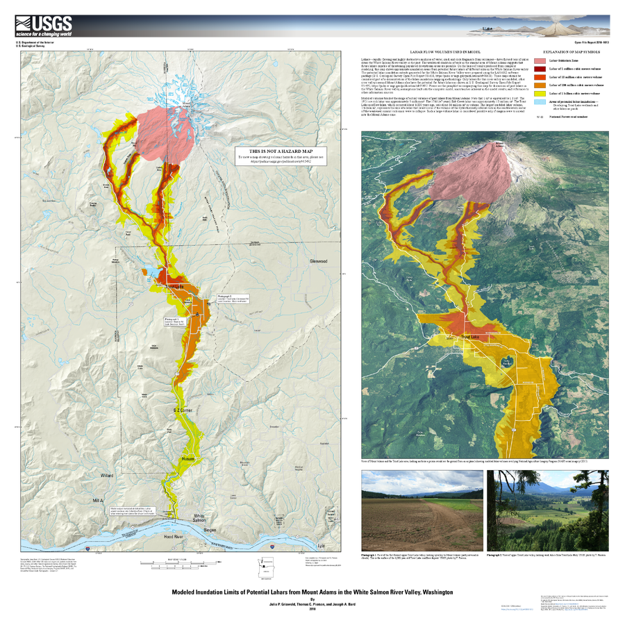
Modeled Inundation Limits of Potential Lahars from Mount Adams in the White Salmon River Valley, Washington

Adams, United States, 2018

Griswold, J.P., Pierson, T.C., and Bard J.A. (2018). Modeled inundation limits of potential lahars from Mount Adams in the White Salmon River valley, Washington. U.S. Geological Survey Open-File Report 2018–1013, scale 1:75,000, 14 p. https://doi.org/10.3133/ofr20181013


This map was produced by an official agency, but may not be the most recent, most complete, or main operational map. For the current operational hazard map, please consult the proper institutional authorities.


Click on image for full-size map. If link seems broken, try the archived version.

Map Data

Map ID3958
Hazard Process(es)Lahars; Proximal hazards
Hazard Zone PresentationSingle hazard: A single hazard process is represented on a series of small map panels of similar sizes
Temporal ScaleBackground, or long-term, map
Spatial ScalePart of volcano (flank or drainage)
Publication FormatPoster-style map insert in hazard assessment
Zonation Method(s)Scenario modeling
Zonation Model(s)Energy cone or line (Heim 1932; Sheridan 1979; Sheridan & Malin 1983); LAHARZ or modified version (such as PFZ) (Iverson et al. 1998; Schilling 1998; Schilling 2014)
Scenario(s) ConsideredSize, VEI, or intensity; Source location or direction
Hazard Zone Label(s)Scenario name
Probability Definition(s)Scenarios imply probability
PurposeScientific interest: Intended for scientific research and general scientific interest; usually published in academic journals
AudienceScientists (usually in scientific publication)
Language(s)English
Basemap(s)Multiple or user-selectable basemaps
Basemap overlay(s)Hillshade; Photograph; Street map; Topographic map (colored contour map)
DiemsionalityMultiple view types on a series of small maps
Color SchemeRed to Yellow
Go to Global Volcanism Program page for Adams →