
Advanced Search for Maps
Showing 1-7 of 7
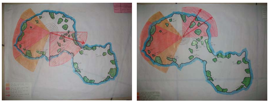
Figure in hazard assessment
Amenaza por Caida de Ceniza en el Volcán Concepción
(Threat due to Ash Fall in the Concepción Volcano)
Obando, T. & Navarro, M. (2009). Propuestade Rutas de Evacuación ante peligros por Caída de Cenizas y Flujos Piroclásticos en la Isla de Ometepe (Rivas, Nicaragua). https://1library.co/document/y621ejgz-propuesta-evacuacion-peligros-caida-cenizas-piroclasticos-ometepe-nicaragua.html

Figure in a thesis or dissertation
Batur Community Hazard Map
Figure 5.5 in: Donovan, K.H.M. (2010). Cultural responses to volcanic hazards on Mt Merapi, Indonesia. University of Plymouth, PhD Dissertation.
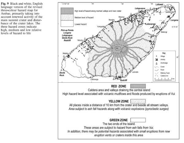
Figure in a journal article
Black and white, English language version of the revised three-colour hazard map for Ambae, primarily taking into account renewed activity of the main summit crater and disturbance of the crater lakes
Figure 9 in: Cronin, S.J., Gaylord, D.R., Charley, D., Alloway, B.V., Wallez, S., & Esau, J.W. (2004). Participatory methods of incorporating scientific with traditional knowledge for volcanic hazard management on Ambae Island, Vanuatu. Bulletin of volcanology, 66(7), p. 652-668. https://doi.org/10.1007/s00445-004-0347-9
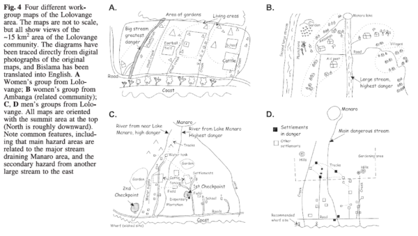
Figure in a journal article
Four different workgroup maps of the Lolovange area
Figure 4 in: Cronin, S.J., Gaylord, D.R., Charley, D., Alloway, B.V., Wallez, S., & Esau, J.W. (2004). Participatory methods of incorporating scientific with traditional knowledge for volcanic hazard management on Ambae Island, Vanuatu. Bulletin of volcanology, 66(7), p. 652-668. https://doi.org/10.1007/s00445-004-0347-9
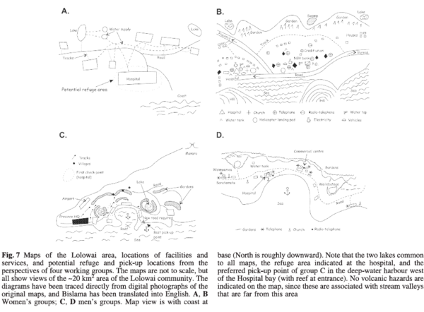
Figure in a journal article
Maps of the Lolowai area, locations of facilities and services, and potential reuge and pick-up locations form the perspectives of four working groups.
Figure 7 in: Cronin, S.J., Gaylord, D.R., Charley, D., Alloway, B.V., Wallez, S., & Esau, J.W. (2004). Participatory methods of incorporating scientific with traditional knowledge for volcanic hazard management on Ambae Island, Vanuatu. Bulletin of volcanology, 66(7), p. 652-668. https://doi.org/10.1007/s00445-004-0347-9
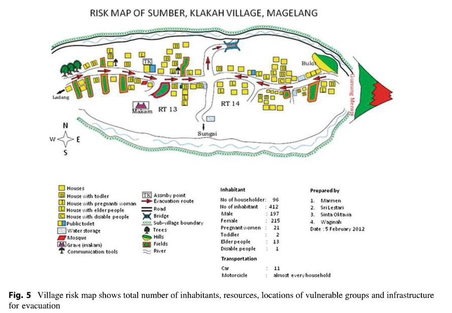
Figure in a journal article
Risk Map of Sumber, Klakah Village, Magelang
Figure 5 (in reprint) in: Marmen, Sri Lestari, Sinta Oktavia, & Waginah. (2012). Risk Map of Sumber, Klakah Village, Magelang. (Reprinted in: Andreastuti, S., Budianto, A., & Paripurno, E.T. (2017). Integrating social and physical perspectives of mitigation policy and practice in Indonesia. In: Fearnley, C.J., Bird, D.K., Haynes, K., McGuire, W.J., Jolly, G. (Eds.) Observing the Volcano World (p. 307-320). Springer, Cham. https://doi.org/10.1007/11157_2016_36.)
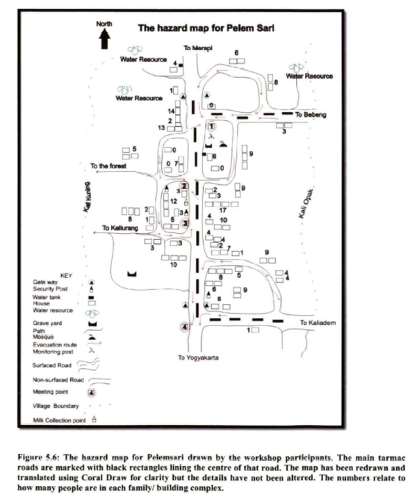
Figure in a thesis or dissertation
The hazard map for Pelem Sari
Figure 5.6 in: Donovan, K.H.M. (2010). Cultural responses to volcanic hazards on Mt Merapi, Indonesia. University of Plymouth, PhD Dissertation.