
Advanced Search for Maps
Showing 1-10 of 42
Official, Insert/poster-size map with accompanying report
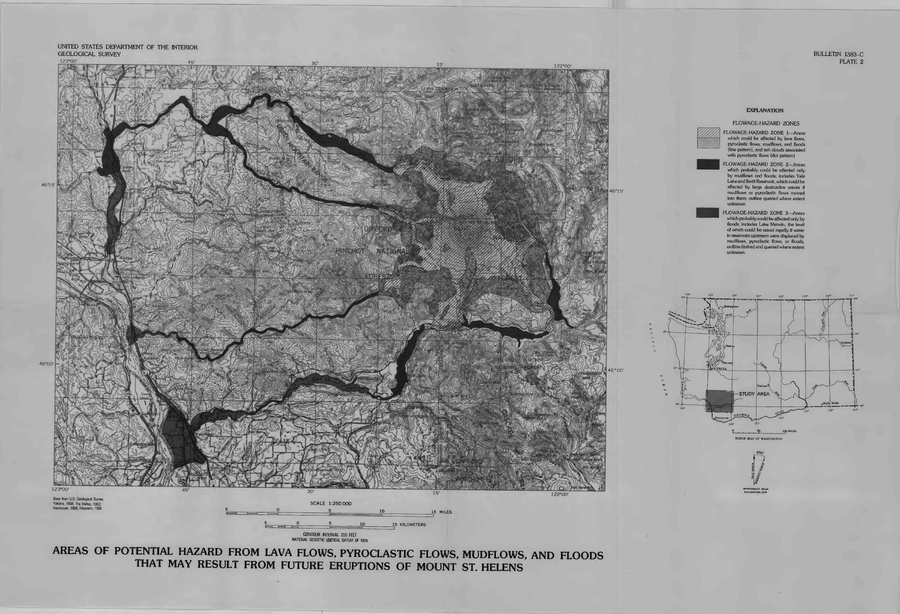
Areas of Potential Hazard from Lava Flows, Pyroclastic Flows, Mudflows, and Floods that May Result from Future Eruptions of Mount St. Helens
Plate 2 in: Crandell, D.R. & Mullineaux, D.R. (1978). Potential Hazards from Future Eruptions of Mount St. Helens Volcano, Washington. U.S. Geological Survey, Bulletin 1383-C, 26 p. https://doi.org/10.3133/b1383C
Official, Map sheet or poster
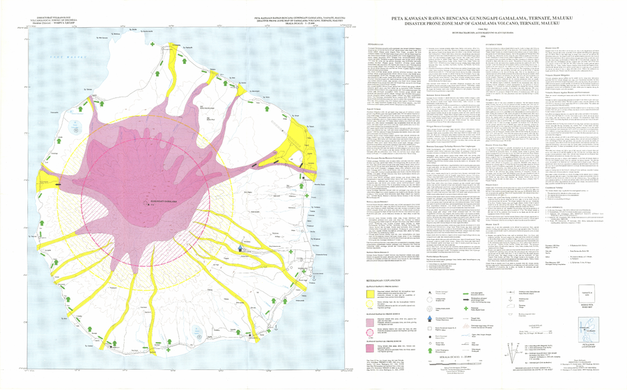
Disaster Prone Zone Map of Gamalama Volcano, Ternate, Maluku
Bacharudin, R., Martono, A., & Djuhara, A. (1996). Disaster Prone Zone Map of Gamalama Volcano, Ternate, Maluku. Volcanological Survey of Indonesia (VSI).
Official, Map sheet or poster
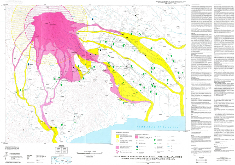
Disaster Prone Zone Map of Semeru Volcano, East Java
Bronto, S., Hamidi, S., & Martono, A. (1996). Disaster Prone Zone Map of Semeru Volcano, East Java. Volcanological Survey of Indonesia (VSI).
Official, Map in a booklet, long fact-sheet, or handbook
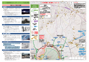
Hazard map of small to medium-scale eruptions (snow season)
Asamayama Volcanic Disaster Prevention Committee. (2019). Asamayama Volcanic Disaster Prevention Map. Tsumagoi Village.
Official, Map in a booklet, long fact-sheet, or handbook
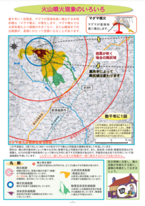
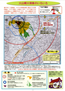
Hazard map of small to medium-scale eruptions (snowless period)
Asamayama Volcanic Disaster Prevention Committee. (2019). Asamayama Volcanic Disaster Prevention Map. Tsumagoi Village.
Official, Map in a booklet, long fact-sheet, or handbook
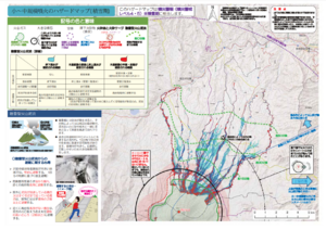
Magma eruption hazard map
Page 7 in: Nasudake Volcano Disaster Prevention Council. (2014). Nasudake Volcano Disaster Prevention Handbook.
Official, Map in a booklet, long fact-sheet, or handbook
Magma eruption hazard map
Page 7 in: Nasudake Volcano Disaster Prevention Council. (2010). Volcanic disaster prevention handbook of Mt. Nasudake.
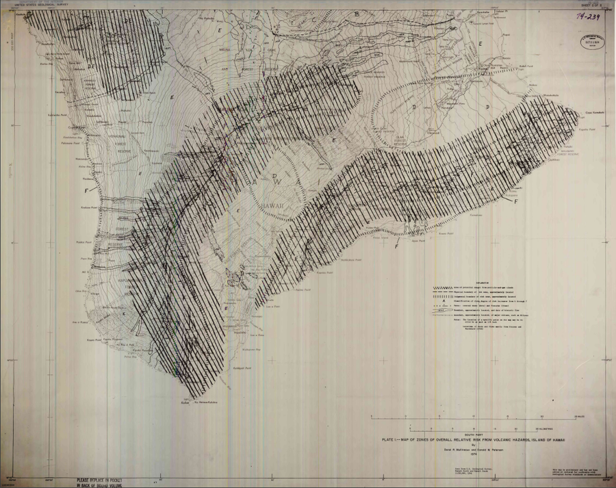
Official, Insert/poster-size map with accompanying report
Map of Zones of Overall Relative Risk From Volcanic Hazards, Island of Hawaii
Plate 1 in: Mullineaux, D.R. & Peterson, D.W. (1974). Volcanic hazards on the Island of Hawaii. U.S. Geological Survey, Open-File Report 74-239. https://doi.org/10.3133/ofr74239
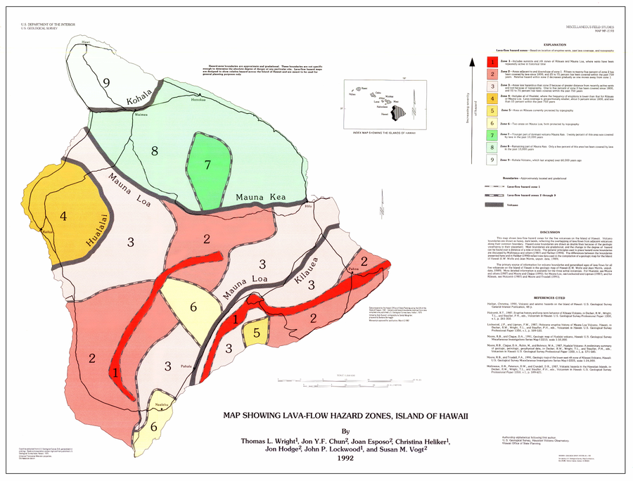
Official, Map sheet or poster
Map Showing Lava-Flow Hazard Zones, Island of Hawaii
Wright, T.L., Chun, J.Y.F., Exposo, J., Heliker, C., Hodge, J., Lockwood, J.P., & Vogt, S.M. (1992). Map showing lava-flow hazard zones, Island of Hawaii. U.S. Geological Survey, Miscellaneous Field Studies Map 2193, scale 1:250,000. https://doi.org/10.3133/mf2193
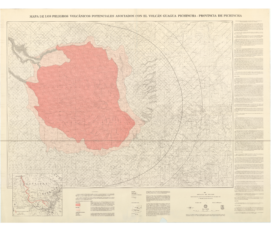
Official, Map sheet or poster
Mapa de los Peligros Volcánicos Asociados con el Volcán Guagua Pichincha - Provincia de Pichincha
(Map of Volcanic Hazards Associated with the Guagua Pichincha Volcano - Pichincha Province)
Hall, M.L. and von Hillebrandt, C.G. (1988). Mapa de los Peligros Volcánicos Asociados con el Volcán Guagua Pichincha - Provincia de Pichincha. Intituto Geofísico de la Escuela Politécnica Nacional (IG-EPN).