
Advanced Search for Maps
Showing 1-5 of 5
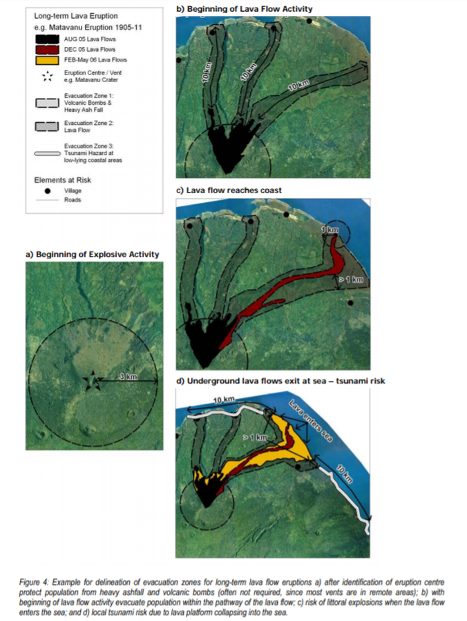
Official, Figure in hazard assessment
Long-term Lava Eruption e.g. Matavanu Eruption 1905-11
Figure 4 in: Cronin, S., Bonte-Grapentin, M. & Nemeth, K. (2006). Samoa technical report - Review of volcanic hazard maps for Savai'i and Upolu. Pacific Islands Applied Geoscience Commission (SOPAC) Project Report 59.
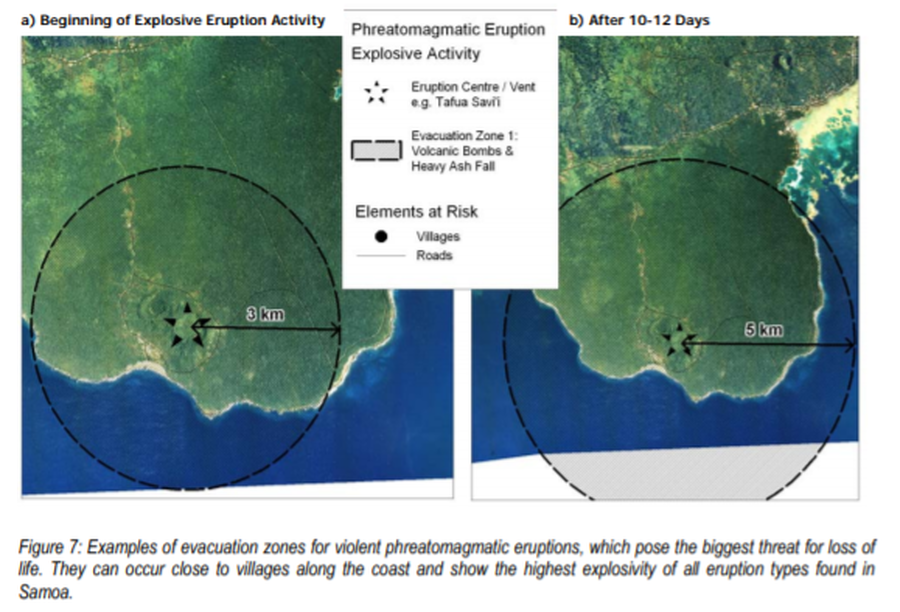
Official, Figure in hazard assessment
Phreatomagmatic Eruption Explosive Activity
Figure 7 in: Cronin, S., Bonte-Grapentin, M. & Nemeth, K. (2006). Samoa technical report - Review of volcanic hazard maps for Savai'i and Upolu. Pacific Islands Applied Geoscience Commission (SOPAC) Project Report 59.
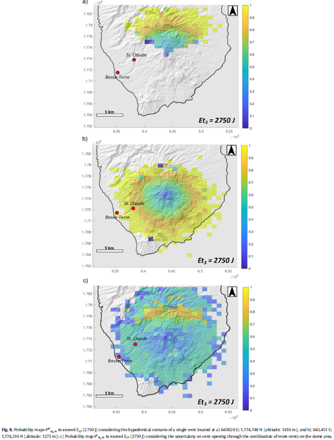
Figure in a journal article
Probability maps to exceed Et3 (2750 J) considering the hypothetical scenario of a single vent
Figure 8 in: Massaro, S., Rossi, E., Sandri, L., Bonadonna, C., Selva, J., Moretti, R., & Komorowski, J. C. (2022). Assessing hazard and potential impact associated with volcanic ballistic projectiles: The example of La Soufrière de Guadeloupe volcano (Lesser Antilles). Journal of volcanology and geothermal research, 423, 107453. https://doi.org/10.1016/j.jvolgeores.2021.107453
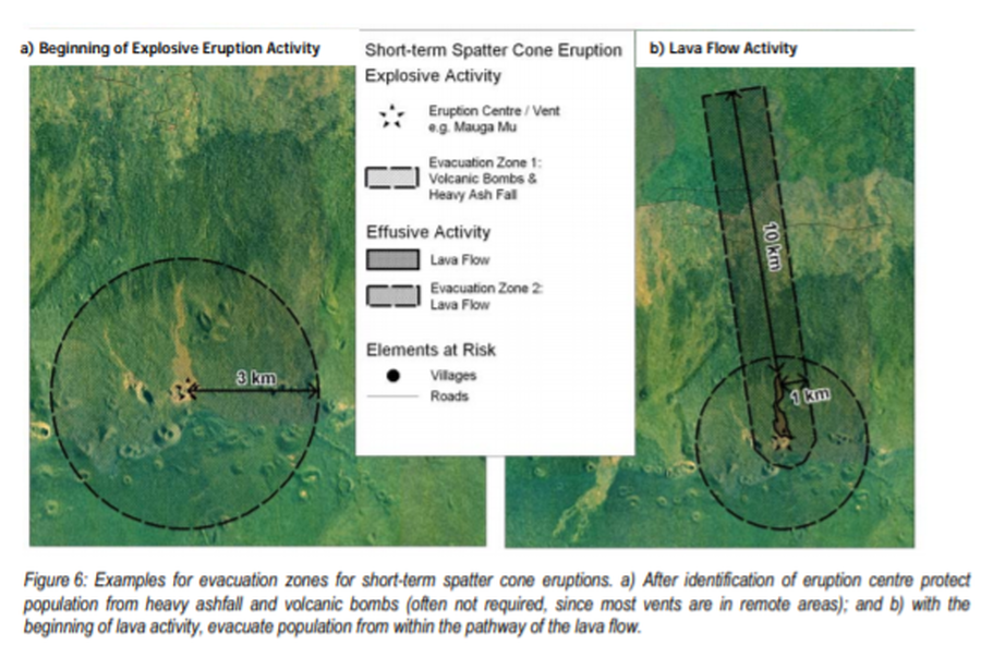
Official, Figure in hazard assessment
Short-term Spatter Cone Eruption Explosive Activity
Figure 6 in: Cronin, S., Bonte-Grapentin, M. & Nemeth, K. (2006). Samoa technical report - Review of volcanic hazard maps for Savai'i and Upolu. Pacific Islands Applied Geoscience Commission (SOPAC) Project Report 59.
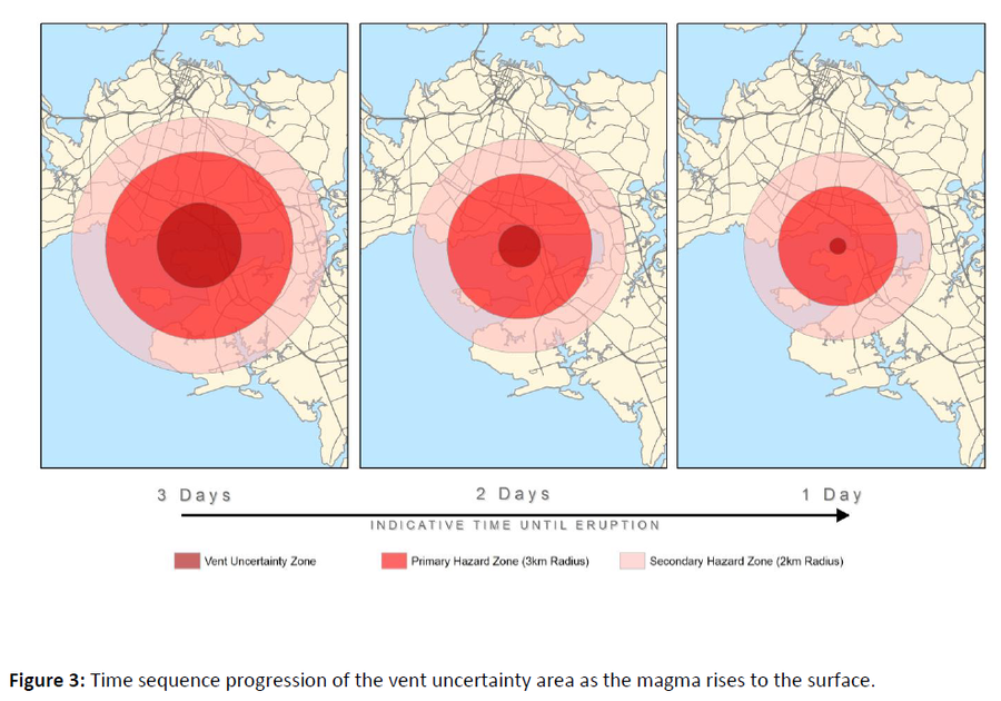
Official, Figure in hazard assessment
Time sequence progression of the vent uncertainty area as the magma rises to the surface
Figure 3 in: Auckland Council (2015). Auckland Volcanic Field Contingency Plan March 2015. Civil Defence and Emergency Management. Auckland. 50 p.