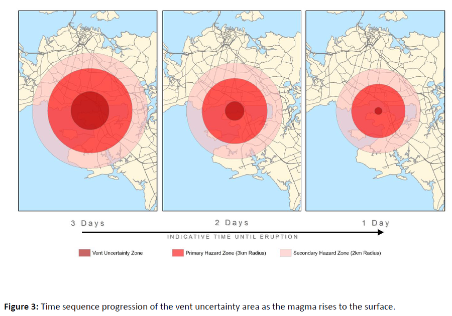
Time sequence progression of the vent uncertainty area as the magma rises to the surface
Auckland Volcanic Field, New Zealand, 2015
Figure 3 in: Auckland Council (2015). Auckland Volcanic Field Contingency Plan March 2015. Civil Defence and Emergency Management. Auckland. 50 p.
This map was produced by an official agency, but is NOT the most recent, most complete, or main operational map.
For the current operational hazard map, please consult the proper institutional authorities.

Click on image for full-size map. If link seems broken, try the archived version.
Map Data
Map ID | 1415 |
---|---|
Hazard Process(es) | Vent-opening hazards |
Hazard Zone Presentation | Hazard level-focused: All or most hazards are combined by hazard level on a series of small map panels of similar sizes |
Temporal Scale | Crisis, or short-term, map (hours to decades) |
Spatial Scale | Regional |
Publication Format | Figure in a hazard assessment or mitigation plan |
Zonation Method(s) | Geologic history |
Zonation Model(s) | |
Scenario(s) Considered | Duration or timing; Hypothetical location |
Hazard Zone Label(s) | Qualitative relative probability (e.g. high-medium-low) |
Probability Definition(s) | Qualitative relative probability (e.g. high-medium-low) |
Purpose | Crisis management and response: Intended to be used for managing, responding to, and taking action during an eruption; often includes evacuation routes, access restrictions, actions to take, etc. |
Audience | Civil protection authorities (emergency managers, first responders, etc.) |
Language(s) | English |
Basemap(s) | Street map |
Basemap overlay(s) | |
Diemsionality | Planimetric (2D or map) view |
Color Scheme | Dark to Light (color) |