
Advanced Search for Maps
Showing 1721-1730 of 2217
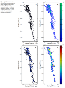
Figure in a journal article
Spatial recurrence rate estimates
Figure 6 in: Runge, M. G., Bebbington, M. S., Cronin, S. J., Lindsay, J. M., Kenedi, C. L., & Moufti, M. R. H. (2014). Vents to events: determining an eruption event record from volcanic vent structures for the Harrat Rahat, Saudi Arabia. Bulletin of Volcanology, 76(3), 1-16. https://doi.org/10.1007/s00445-014-0804-z
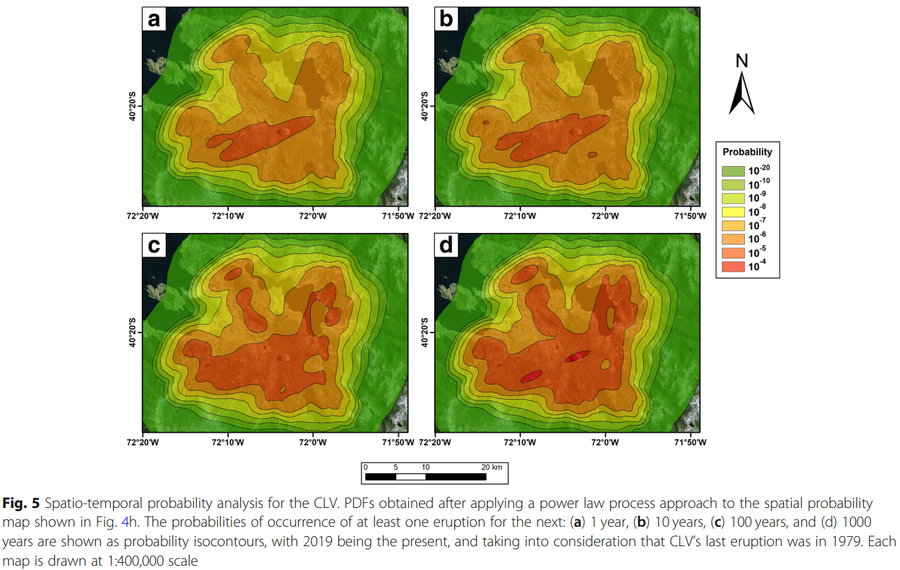
Figure in a journal article
Spatio-temporal probability analysis for the CLV
Figure 5 in: Bertin, D., Lindsay, J. M., Becerril, L., Cronin, S. J., & Bertin, L. J. (2019). MatHaz: a Matlab code to assist with probabilistic spatio-temporal volcanic hazard assessment in distributed volcanic fields. Journal of Applied Volcanology, 8(1), 1-25. https://doi.org/10.1186/s13617-019-0084-6
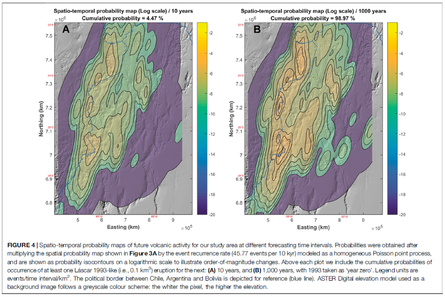
Figure in a journal article
Spatio-temporal probability maps of future volcanic activity for our study area at different forecasting time intervals
Figure 4 in: Bertin, D., Lindsay, J.M., Cronin, S.J., de Silva, S.L., Connor, C.B., Caffe, P.J., Grosse, P., Báez, W., Bustos, E., & Constantinescu, R. (2022). Probabilistic Volcanic Hazard Assessment of the 22.5–28° S Segment of the Central Volcanic Zone of the Andes. Frontiers in Earth Science, 10. https://doi.org/10.3389/feart.2022.875439

Figure in a journal article
Spatiotemporal probability map of vent opening at Mt. Etna for the next 10 years within the summit area
Figure 4 in: Del Negro, C., Cappello, A., Neri, M., Bilotta, G., Hérault, A., & Ganci, G. (2013). Lava flow hazards at Mount Etna: constraints imposed by eruptive history and numerical simulations. Scientific Reports, 3(1). https://doi.org/10.1038/srep03493
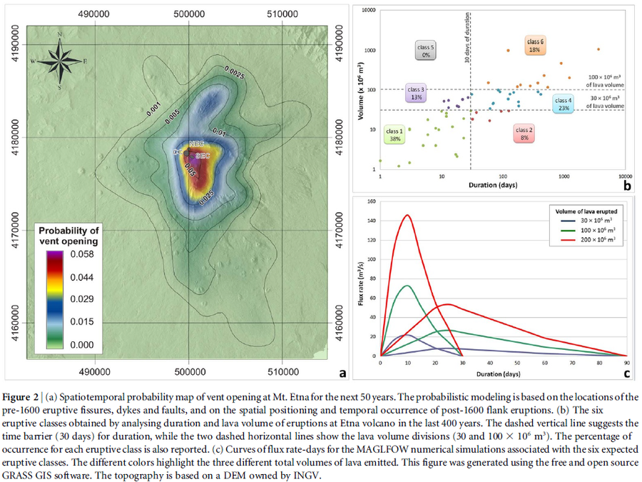
Figure in a journal article
Spatiotemporal probability map of vent opening at Mt. Etna for the next 50 years
Figure 2 in: Del Negro, C., Cappello, A., Neri, M., Bilotta, G., Hérault, A., & Ganci, G. (2013). Lava flow hazards at Mount Etna: constraints imposed by eruptive history and numerical simulations. Scientific Reports, 3(1). https://doi.org/10.1038/srep03493

Official, Figure on website
Spring Village Community Multi-Hazard Map
The University of the West Indies Seismic Research Centre (UWI-SRC) and National Emergency Management Organization (NEMO). (2021). Spring Village Community Multi-Hazard Map. https://uwiseismic.com/wp-content/uploads/2021/10/Spring-Village-Hazard-Map-scaled.jpg
Official, Insert/poster-size map with accompanying report
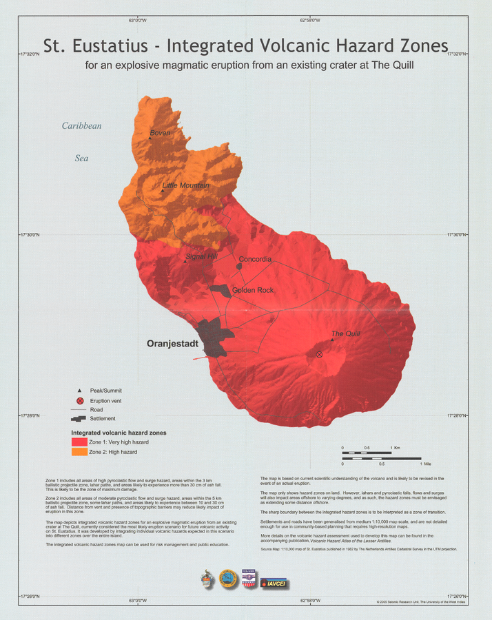
St. Eustatius - Integrated Volcanic Hazard Zones for an explosive magmatic eruption from an existing crater at The Quill
Pocket Insert in: Smith, A.L. & Roobol, M.J. (2005). St. Eustatius. In: Lindsay, J.M., Shepherd, J.B., Robertson, R.E.A., & Ali, S. (Eds) Volcanic hazard atlas of the Lesser Antilles. Seismic Research Unit, The University of the West Indies, Trinidad and Tobago, W.I., p. 193-203
Official, Insert/poster-size map with accompanying report
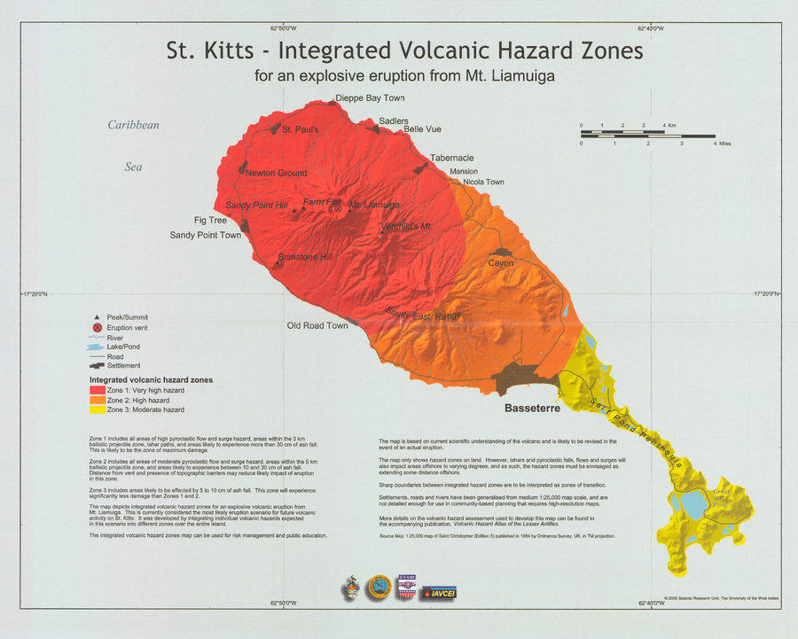
St. Kitts - Integrated Volcanic Hazard Zones for an explosive eruption from Mt. Liamuiga
Pocket insert in: Robertson, R.E.A. (2005). St. Kitts. In: Lindsay, J.M., Shepherd, J.B., Robertson, R.E.A., & Ali, S. (Eds) Volcanic hazard atlas of the Lesser Antilles. Seismic Research Unit, The University of the West Indies, Trinidad and Tobago, W.I., p. 205-217.
Official, Insert/poster-size map with accompanying report
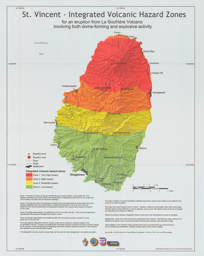
St. Vincent - Integrated volcanic hazard zones for an eruption from La Soufrière Volcano involving both dome-forming and explosive activity
Pocket insert in: Robertson, R. (2005). St. Vincent. In: Lindsay, J.M., Shepherd, J.B., Robertson, R.E.A., & Ali, S. (Eds) Volcanic hazard atlas of the Lesser Antilles. Seismic Research Unit, The University of the West Indies, Trinidad and Tobago, W.I., p. 241-261

Official, Map in a booklet, long fact-sheet, or handbook
Steam eruption risk area prediction map (ash fall, volcanic blocks only)
Page 6 in: Nasudake Volcano Disaster Prevention Council. (2014). Nasudake Volcano Disaster Prevention Handbook.