
Advanced Search for Maps
Showing 421-430 of 2217
Official, Figure in hazard assessment
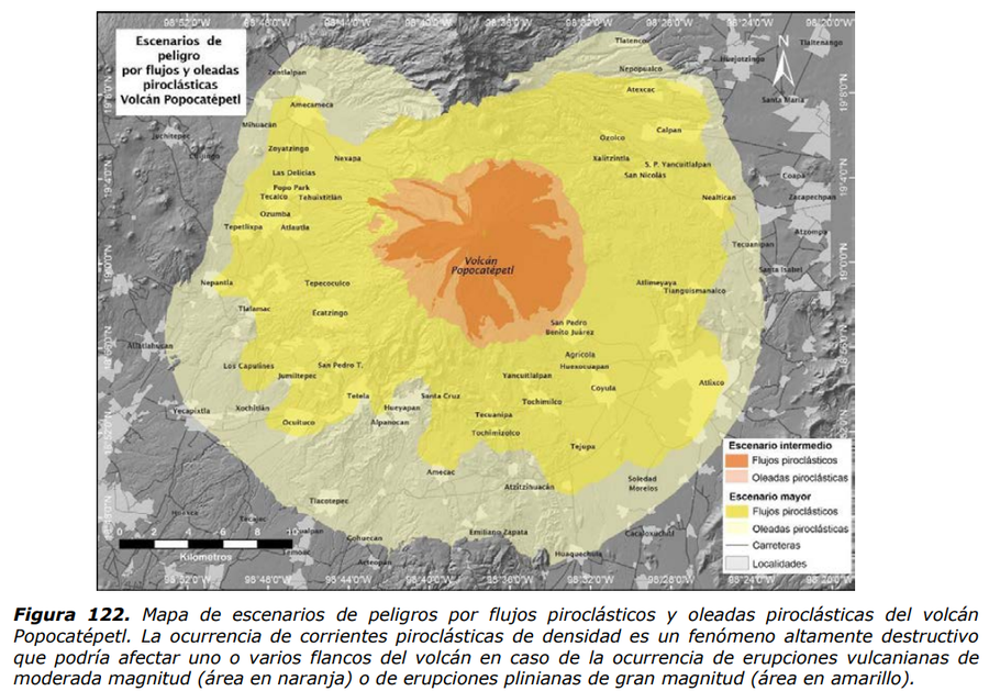
Escenarios de peligro por flujos y oleadas piroclásticas Volcán Popocatépetl
(Hazard scenarios due to pyroclastic flows and surges Popocatépetl Volcano)
Figure 122 in: Martin Del Pozzo, A.L, Alatorre Ibargüengoitia M., Arana Salinas L., Bonasia R., Capra Pedol L., Cassata W., Cordoba G., Cortés Ramos J., Delgado Granados H., Ferrés López M.D., Fonseca Álvarez R., García Reynoso J.A., Gisbert G., Guerrero López D.A., Jaimes Viera M., Macías Vázquez J.L., Nieto Obregon J., Nieto Torres A., Paredes Ruiz P.A., Portocarrero Martínez J., Renne P., Rodríguez Espinosa D.M., Salinas Sánchez S., Siebe Grabach C., & Tellez Ugalde E. (2017). Estudios geológicos y actualización del mapa de peligros del volcán Popocatépetl. Memoria técnica del mapa de peligros del volcán Popocatépetl. Instituto de Geofísica, Universidad Nacional Autónoma de México (UNAM).
Official, Figure in hazard assessment
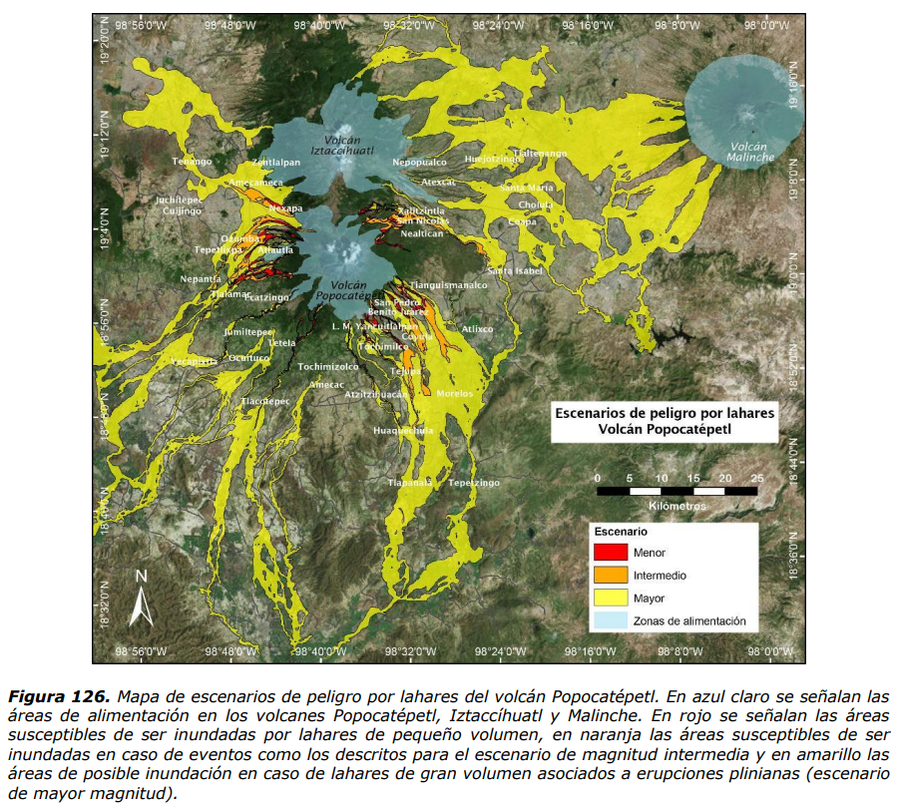
Escenarios de peligro por lahares Volcán Popocatépetl
(Hazard scenarios due to lahars Popocatépetl Volcano)
Figure 126 in: Martin Del Pozzo, A.L, Alatorre Ibargüengoitia M., Arana Salinas L., Bonasia R., Capra Pedol L., Cassata W., Cordoba G., Cortés Ramos J., Delgado Granados H., Ferrés López M.D., Fonseca Álvarez R., García Reynoso J.A., Gisbert G., Guerrero López D.A., Jaimes Viera M., Macías Vázquez J.L., Nieto Obregon J., Nieto Torres A., Paredes Ruiz P.A., Portocarrero Martínez J., Renne P., Rodríguez Espinosa D.M., Salinas Sánchez S., Siebe Grabach C., & Tellez Ugalde E. (2017). Estudios geológicos y actualización del mapa de peligros del volcán Popocatépetl. Memoria técnica del mapa de peligros del volcán Popocatépetl. Instituto de Geofísica, Universidad Nacional Autónoma de México (UNAM).
Official, Map in a booklet, long fact-sheet, or handbook
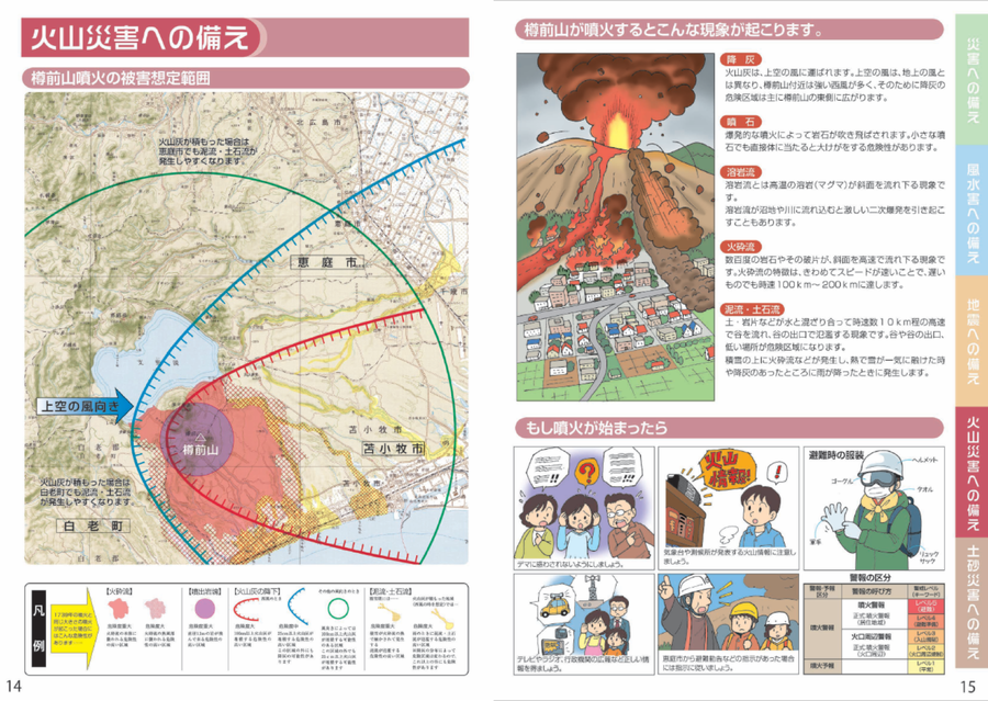
Estimated damage range of a Tarumaeyama eruption
Page 14 in: Eniwa City Hall General Affairs Department. (2021). Eniwa City Disaster Prevention Guidebook. 19 p.
Official, Figure in hazard assessment
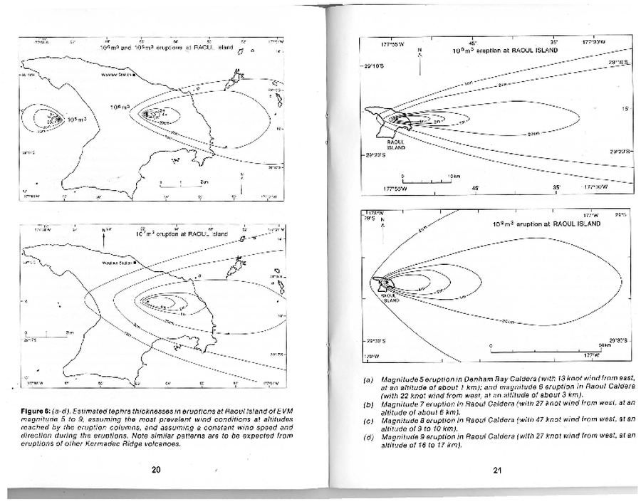
Estimated tephra thickness in eruptions at Raoul Island of EVM magnitude 5 to 9
Figure 6 in: Latter, J. H., Lloyd, E. F., Smith, I. E. M., Nathan, S. (1992). Volcanic Hazards in the Kermadec Islands, and at Submarine Volcanoes between Southern Tonga and New Zealand. Volcanic Hazards Information Series No. 4. Volcanic Hazards Working Group of the Scientific Advisory Committee, Ministry of Civil Defence. pp. 44.
Official, Figure in hazard assessment
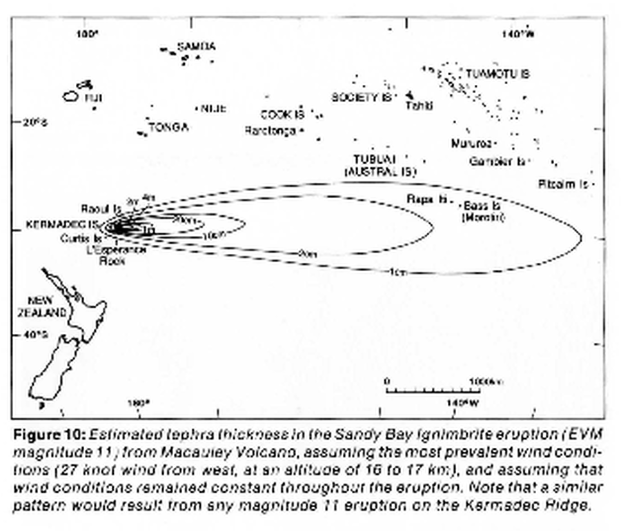
Estimated tephra thickness in the Sandy Bay Ignimbrite eruption
Figure 10 in: Latter, J. H., Lloyd, E. F., Smith, I. E. M., Nathan, S. (1992). Volcanic Hazards in the Kermadec Islands, and at Submarine Volcanoes between Southern Tonga and New Zealand. Volcanic Hazards Information Series No. 4. Volcanic Hazards Working Group of the Scientific Advisory Committee, Ministry of Civil Defence. pp. 44.

Figure in a journal article
Estimated Travel Time of Mudflows at Mount Hood, Oregon
Preppernau, C. A., & Jenny, B. (2016). Estimated travel time of mudflows at Mount Hood, Oregon. Journal of Maps, 12(5), p. 711-715. https://doi.org/10.1080/17445647.2015.1120244
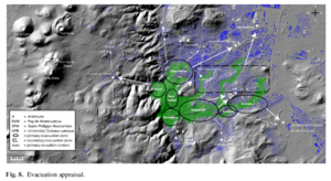
Figure in a journal article
Evacuation appraisal
Figure 8 in: Latutrie, B., Andredakis, I., De Groeve, T., Harris, A. J. L., Langlois, E., de Vries, B. V. W., Saubin, E., Bilotta, G., Cappello, A., Crisci, G.M., D'ambrosio, D., Del Negro, C., Favalli, M., Fujita, E., Iovine, G., Kelfoun, K., Rongo, R., Spataro, W., Tarquini, S., Coppola, D., Ganci, G., Marchese, F., Pergola, N., & Tramutoli, V. (2016). Testing a geographical information system for damage and evacuation assessment during an effusive volcanic crisis. In: Harris, A.J.L., De Groeve, T., & Carn, S.A. (Eds.) Detecting, Modelling and Responding to Effusive Eruptions. Geological Society, London, Special Publications, 426(1), p. 649-672. https://doi.org/10.1144/SP426.19
Official, Hiking or trail map
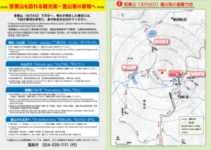
Evacuation direction at the time of eruption of Mount Azuma (Oana Crater)
Azumayama Volcanic Disaster Management Council. (2019). Evacuation direction at the time of eruption of Munt Azuma (Oana Crater).
Official, Map in a booklet, long fact-sheet, or handbook
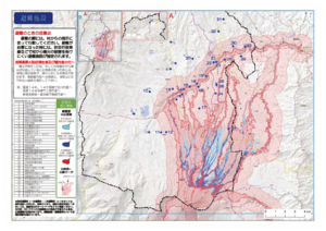
Evacuation facilities
Asamayama Volcanic Disaster Prevention Committee. (2019). Asamayama Volcanic Disaster Prevention Map. Tsumagoi Village.
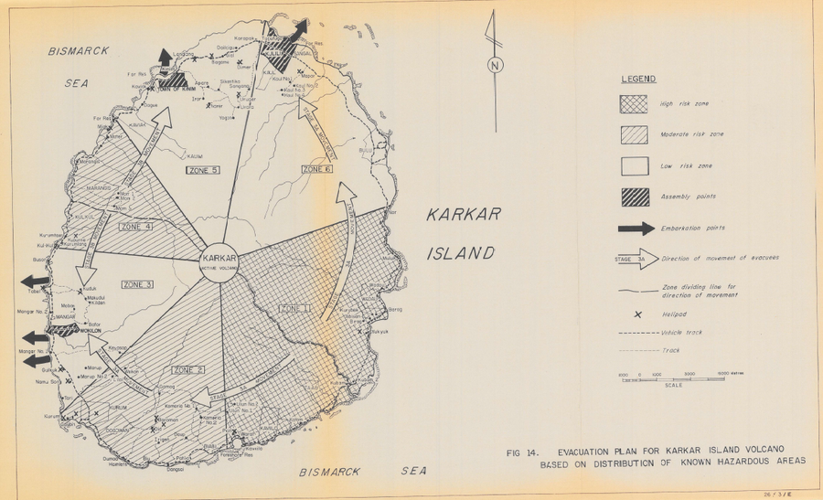
Official, Figure in hazard assessment
Evacuation Plan for Karkar Island Volcano Based on Distribution of Known Hazardous Areas
Figure 14 in: Lowenstein, P.L. (1982). Problems of volcanic hazards in Papua New Guinea. Geological Survey of Papua New Guinea, Report 82/7, 62 p.