
Advanced Search for Maps
Showing 391-400 of 2217
Official, Figure on website
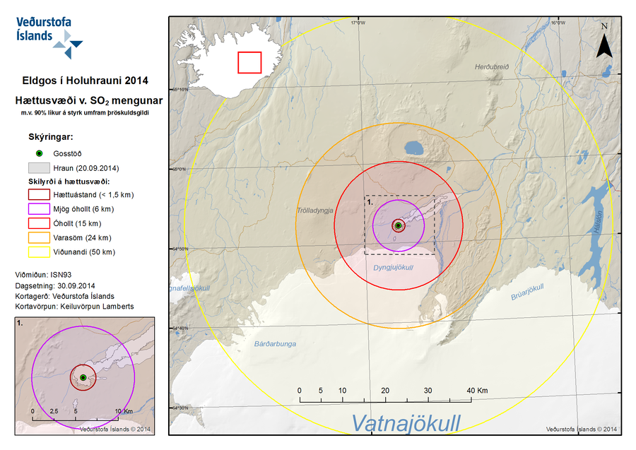
Eldgos í Holuhrauni 2014 Hættusvæði v. SO2 Mengunar m.v. 90% líkur á styrk umfram þröskuldsgildi
(Volcanic Eruption at Holuhraun 2014 Hazardous Area SO2 pollution 90% likelihood of concentration exceeding a threshold value)
Iceland Meteorological Office (IMO). (2014). Eldgos í Holuhrauni 2014 Hættusvæði v. SO2 Mengunar [Volcanic Eruption at Holuhraun 2014 Hazardous Area SO2 pollution]. (Reprinted in: Barsotti, S. (2015). Hazard Zoning: Probabilistic hazard maps of SO2 ground concentration for Holuhraun eruption. https://en.vedur.is/pollution-and-radiation/volcanic-gas/hazard-zoning/)
Official, Figure on website
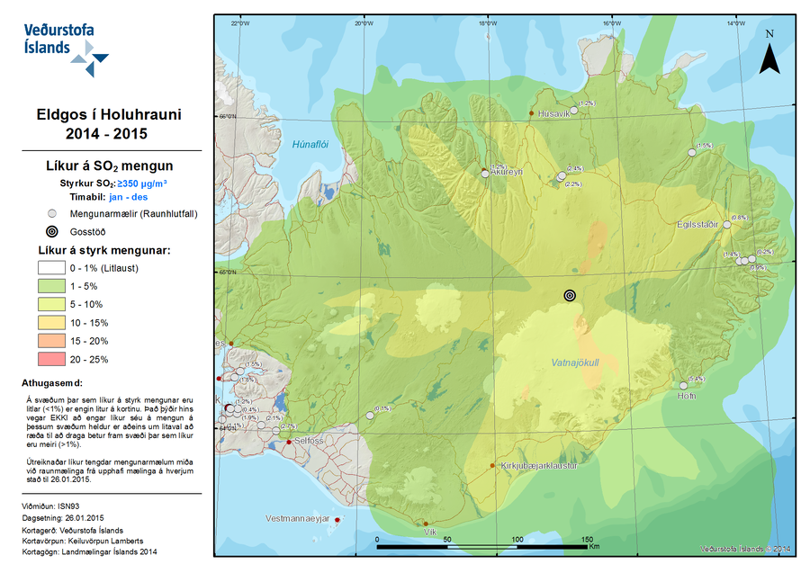
Eldgos í Holuhrauni 2014-2015 Líkur á SO2 Mengun
(Volcanic Eruption at Holuhraun 2014-2015 Probability of SO2 Contamination)
Iceland Meteorological Office (IMO). (2015). Eldgos í Holuhrauni 2014-2015 Líkur á SO2 Mengun [Volcanic Eruption at Holuhraun 2014-2015 Probability of SO2 Contamination]. (Reprinted in: Barsotti, S. (2015). Hazard Zoning: Probabilistic hazard maps of SO2 ground concentration for Holuhraun eruption. https://en.vedur.is/pollution-and-radiation/volcanic-gas/hazard-zoning/)
Official, Figure on website
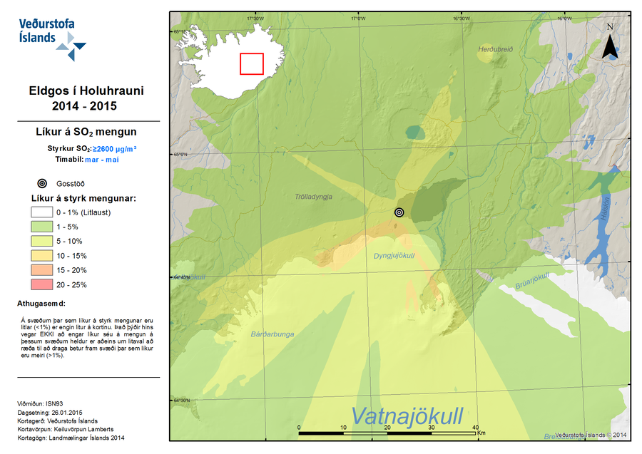
Eldgos í Holuhrauni 2014-2015 Líkur á SO2 Mengun
(Volcanic Eruption at Holuhraun 2014-2015 Probability of SO2 Contamination)
Iceland Meteorological Office (IMO). (2015). Eldgos í Holuhrauni 2014-2015 Líkur á SO2 Mengun [Volcanic Eruption at Holuhraun 2014-2015 Probability of SO2 Contamination]. (Reprinted in: Barsotti, S. (2015). Hazard Zoning: Probabilistic hazard maps of SO2 ground concentration for Holuhraun eruption. https://en.vedur.is/pollution-and-radiation/volcanic-gas/hazard-zoning/)
Official, Figure on website
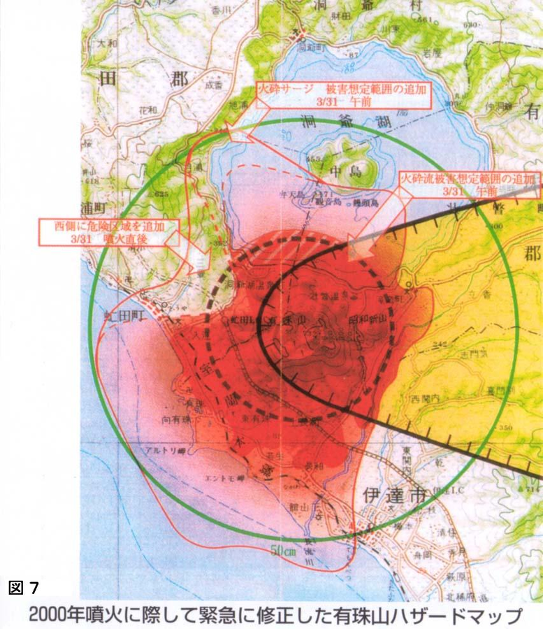
Emergency hazard map of Mt. usu revised after the 2000 eruption
Figure 7 in: Nakao, M. (2005). Eruption of Mt Usu, March 31 st 2000, at Mt Usu in Hokkaido. In: Failure Knowledge Database, 100 Selected Cases. http://www.shippai.org/fkd/en/cfen/CA1000619.html. Reprinted from: The Hokkaido Shimbun Press. (2002) 2000-Nen Usu-Zan Funka (The 2000 Mt. Usu Eruption). The Hokkaido Shimbun Press.
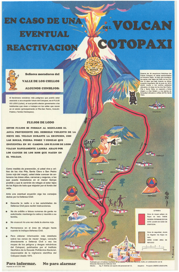
Official, Sign or billboard
En Caso de Una Eventual Reactivacion del Volcan Cotopaxi
(In Case of a Possible Reactivation of the Cotopaxi Volcano)
Mothes, P. (1990). En Caso de Una Eventual Reactivacion del Volcan Cotopaxi. Instituto Geofísico de la Escuela Politecnica Nacional and Dirección Nacional (IG-EPN) de Defensa Civil, Quito.
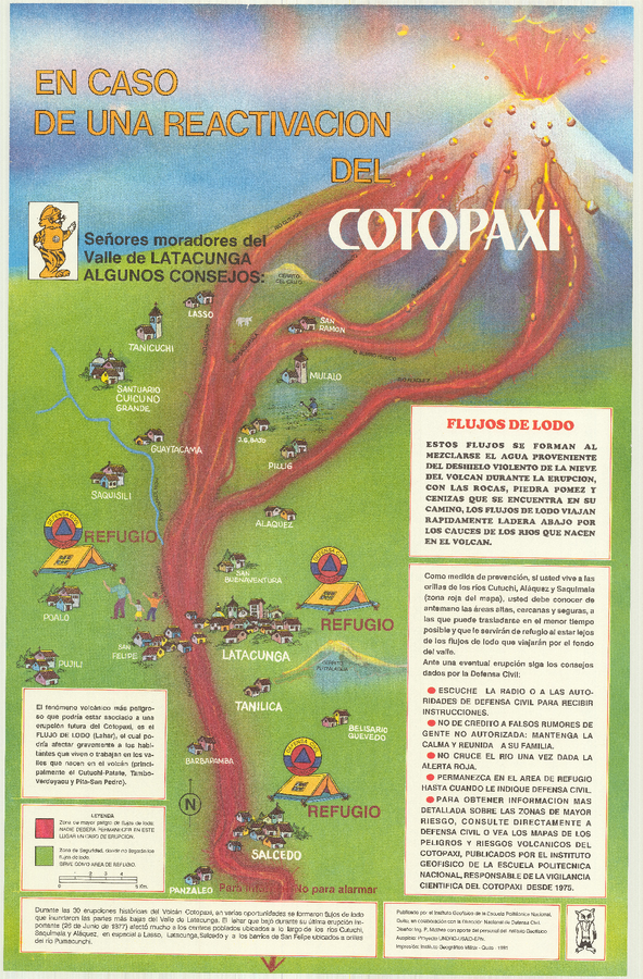
Official, Sign or billboard
En Caso de Una Eventual Reactivacion del Volcan Cotopaxi
(In Case of a Possible Reactivation of the Cotopaxi Volcano)
Mothes, P. (1991). En Caso de Una Eventual Reactivacion del Volcan Cotopaxi. Instituto Geofísico de la Escuela Politecnica Nacional (IG-EPN) and Dirección Nacional de Defensa Civil, Quito.
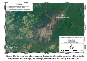
Figure in a thesis or dissertation
En color morado se muestra la zona de afectación por gases y lluvia ácida propuesta en este trabajo y en naranja, la delimitada por Soto y Martínez (2012)
(The zone of affectation by gases and acid rain proposed in this work is shown in purple, and the one delimited by Soto and Martínez (2012) in orange.)
Figure 19 in: Alpízar, Y. (2018). Mapa Preliminar de Peligros Volcánicos para el Volcán Rincón de la Vieja (Costa Rica): Descripción de un Escenario de Afectación por Lahares. Ciudad Universitaria Rodrigo Facio, Costa Rica. 160 p.
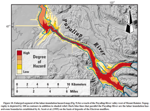
Official, Figure in a journal article
Enlarged segment of the lahar-inundation hazard map (Fig. 9) for a reach of the Puyallup River valley west of Mount Rainier
Figure 10 in: Iverson, R. M., Schilling, S. P., & Vallance, J. W. (1998). Objective delineation of lahar-inundation hazard zones. Geological Society of America Bulletin, 110(8), 972-984. https://doi.org/10.1130/0016-7606(1998)110<0972:ODOLIH>2.3.CO;2
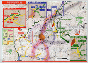
Official, Map in a booklet, long fact-sheet, or handbook
Enlarged view around Yakeyama
Akita Prefecture. (2002). Akita-Yakeyama Volcanic Disaster Prevention Map.
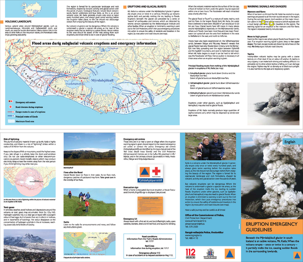
Official, Flyer, brochure, short fact-sheet, or handout
Eruption emergency guidelines – Katla in Mýrdalsjökull: English
Almannavarnir. (2017). Eruption emergency guidelines - Katla in Mýrdalsjökull.