
Advanced Search for Maps
Showing 11-20 of 24
Official, Map in an information statement
Predicted Ashfall Area for a Tongariro eruption at 0600 Thursday 16 August 2012
GNS Science. (2012). Volcanic Alert Bulletin TON2012-21.

Official, Map in an information statement
Predicted Ashfall Area for a Tongariro eruption at 0600 Tuesday 14 August 2012
GNS Science. (2012). Volcanic Alert Bulletin TON2012-19.

Official, Map in an information statement
Predicted Ashfall Area for a Tongariro eruption at 0600 Wednesday 15 August 2012
GNS Science. (2012). Volcanic Alert Bulletin TON2012-20.
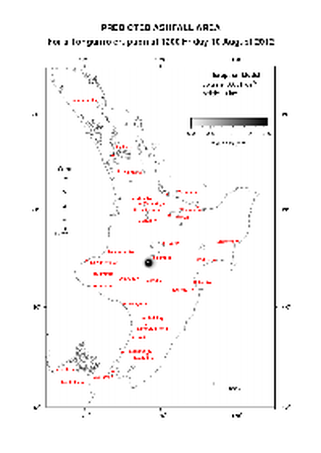
Official, Map in an information statement
Predicted Ashfall Area for a Tongariro eruption at 1200 Friday 10 August 2012
GNS Science. (2012). Volcanic Alert Bulletin TON2012-13.

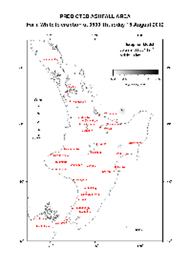
Official, Map in an information statement
Predicted Ashfall Area for a Tongariro eruption at 1200 Thursday 09 August 2012
GNS Science. (2012). Volcanic Alert Bulletin TON2012-12.
Official, Map in an information statement
Predicted Ashfall Area for a Tongariro eruption at 1200 Tuesday 07 August 2012
GNS Science. (2012). Volcanic Alert Bulletin TON2012-08.

Official, Map in an information statement
Predicted Ashfall Area for a Tongariro eruption at 1200 Wednesday 08 August 2012
GNS Science. (2012). Volcanic Alert Bulletin TON2012-09.

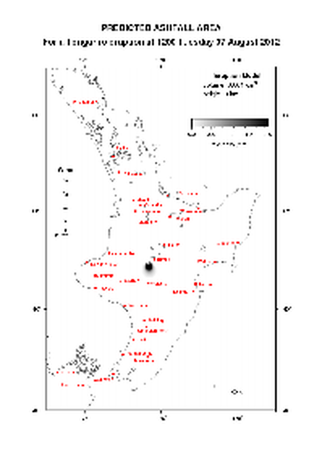
Official, Map in an information statement
Predicted Ashfall Area for a Tongariro eruption at 1500 Monday 13 August 2012
GNS Science. (2012). Volcanic Alert Bulletin TON2012-18.
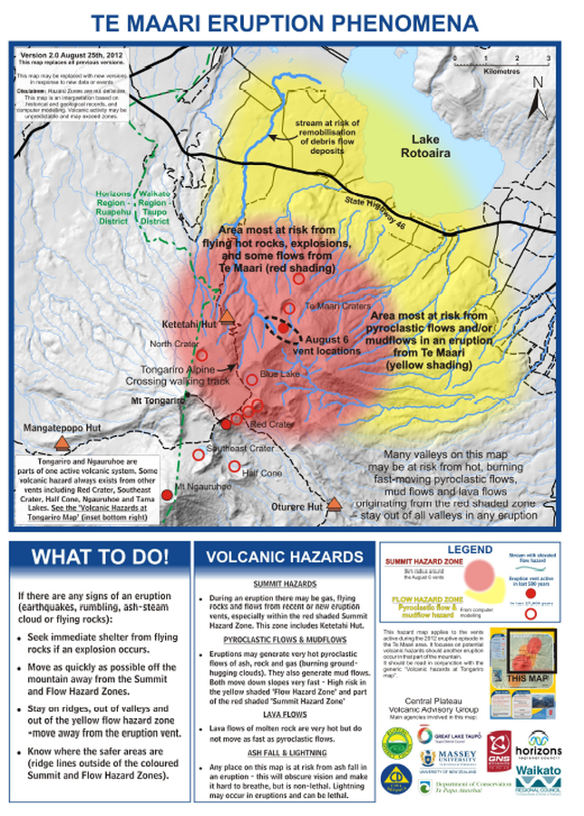
Official, Map sheet or poster
Te Maari Eruption Phenomena
GNS Science (compiler). (2012). Te Maari Eruption Phenomena. Version 2.0, 25 August 2012.
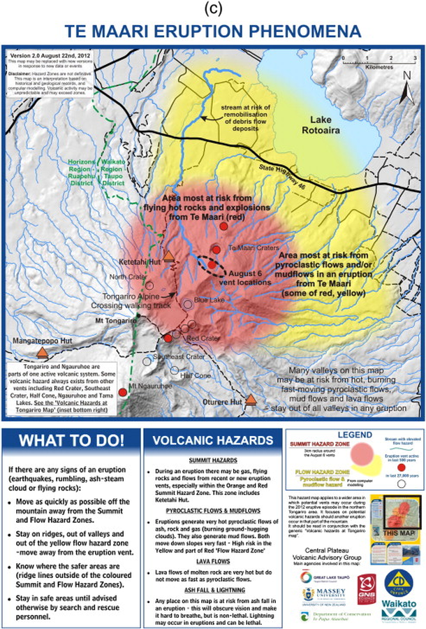
Official, Map sheet or poster
Te Maari Eruption Phenomena
GNS Science (compiler). (2012). Te Maari Eruption Phenomena. Version 2.0, 22 August 2012.