
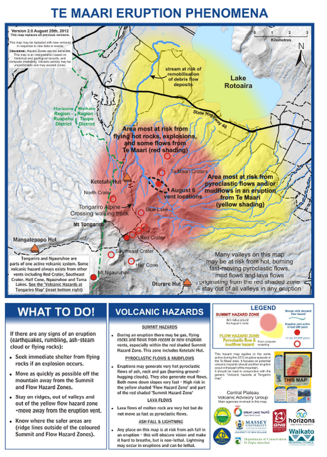
Te Maari Eruption Phenomena
Te Maari (Tongariro), New Zealand, 2012
GNS Science (compiler). (2012). Te Maari Eruption Phenomena. Version 2.0, 25 August 2012.
This map was produced by an official agency, but may not be the most recent, most complete, or main operational map.
For the current operational hazard map, please consult the proper institutional authorities.
Click on image for full-size map. If link seems broken, try the archived version.
Leonard, G. S., Stewart, C., Wilson, T. M., Procter, J. N., Scott, B. J., Keys, H. J., Jolly, G.E., Wardman, J.B., Cronin. S.J. & McBride, S. K. (2014). Integrating multidisciplinary science, modelling and impact data into evolving, syn-event volcanic hazard mapping and communication: a case study from the 2012 Tongariro eruption crisis, New Zealand. Journal of Volcanology and Geothermal Research, 286, p. 208-232. https://doi.org/10.1016/j.jvolgeores.2014.08.018Map Set
https://doi.org/10.1016/j.jvolgeores.2014.08.018
Other Maps In Set: