
Advanced Search for Maps
Showing 11-15 of 15
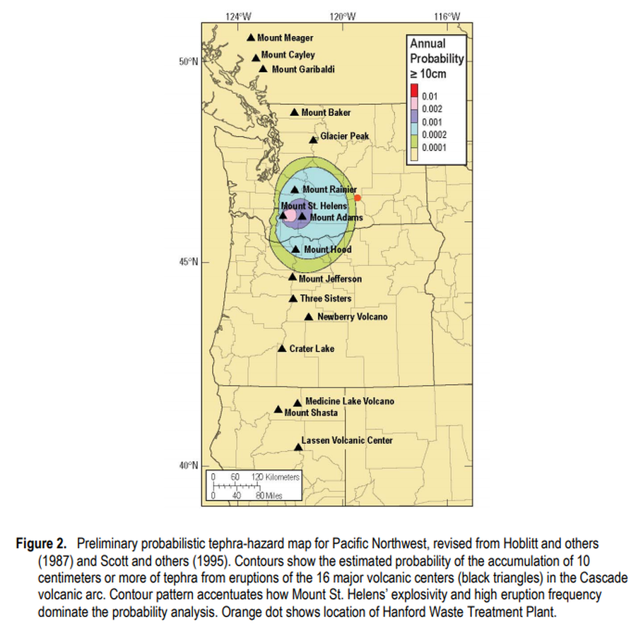
Official, Figure in hazard assessment
Preliminary probabilistic tephra-hazard map for Pacific Northwest
Figure 2 in: Hoblitt, R.P., & Scott, W.E. (2011). Estimate of tephra accumulation probabilities for the U.S. Department of Energy's Hanford Site, Washington. U.S. Geological Survey, Open-File Report 2011-1064, 15 p. https://doi.org/10.3133/ofr20111064
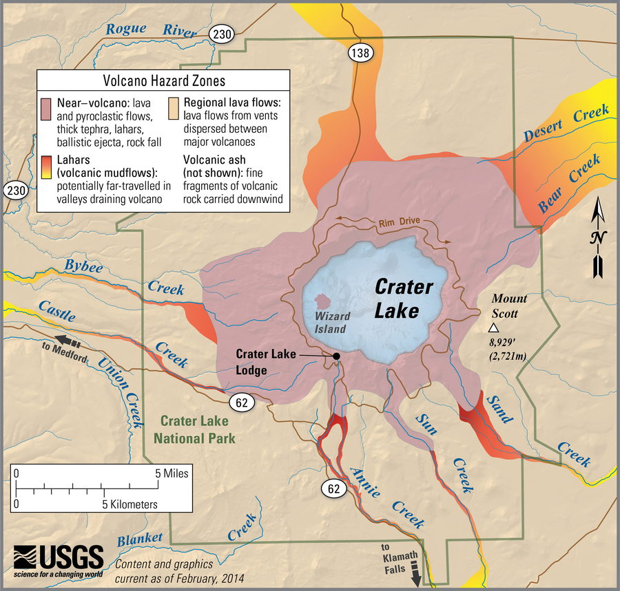
Official, Figure on website
Simplified volcano hazards map of Crater Lake, Oregon
Bacon, C.R., Mastin, L.G., Scott, K., Nathenson, M., Driedger, C.L., Scott, W.E., Iverson, R.M., Ramsey, D.W., & Faust, L.M. (2014). Simplified volcano hazards map of Crater Lake, Oregon. U.S. Geological Survey. Crater Lake, OR Simplified Hazards Map. https://www.usgs.gov/media/images/crater-lake-or-simplified-hazards-map (Modified from: U.S. Geological Survey, Open-File Report 97-487)
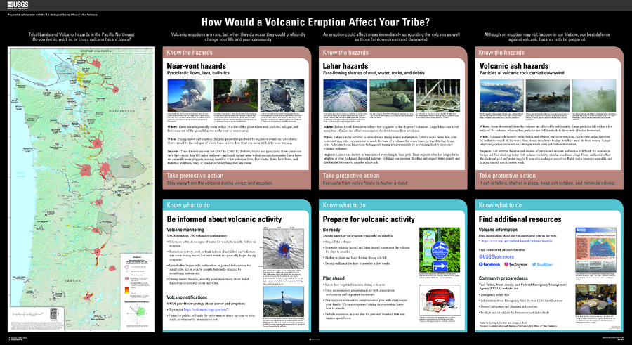
Official, Map sheet or poster
Tribal Lands and Volcano Hazards in the Pacific Northwest
Gardner, C.A. and Bard, J.A. (2021). How would a volcanic eruption affect your Tribe? U.S. Geological Survey General Information Product 209, https://doi.org/10.3133/gip209.
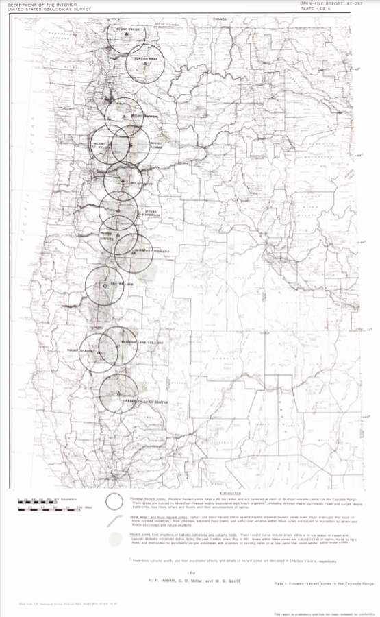
Official, Insert/poster-size map with accompanying report
Volcanic-hazard zones in the Cascades Range
Plate 1 in: Hoblitt, R. P., Miller, C. D., & Scott, W. E. (1987). Volcanic hazards with regard to siting nuclear-power plants in the Pacific Northwest. U.S. Geological Survey, Open-File Report 87-297. https://doi.org/10.3133/ofr87297
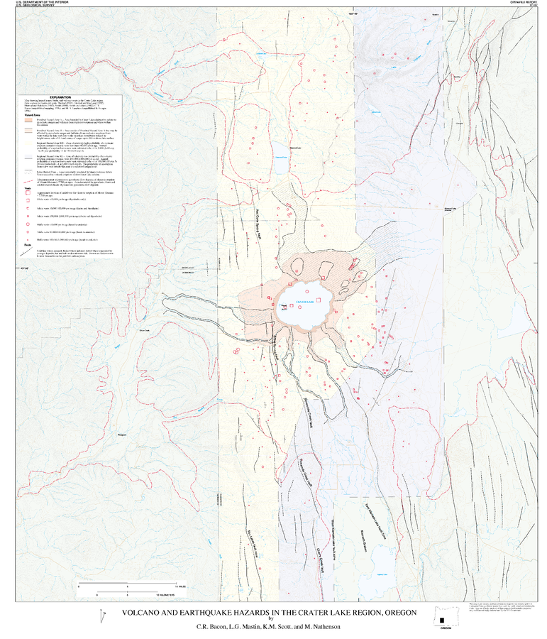
Official, Insert/poster-size map with accompanying report
Volcano and Earthquake Hazards in the Crater Lake Region, Oregon
Plate 1 in: Bacon, C.R., Mastin, L.G., Scott, K.M., & Nathenson, M. (1997). Volcano and earthquake hazards in the Crater Lake region, Oregon. U.S. Geological Survey, Open-File Report 97-487, 32 p. https://doi.org/10.3133/ofr97487
Page: 1 2