← Back to Search Results

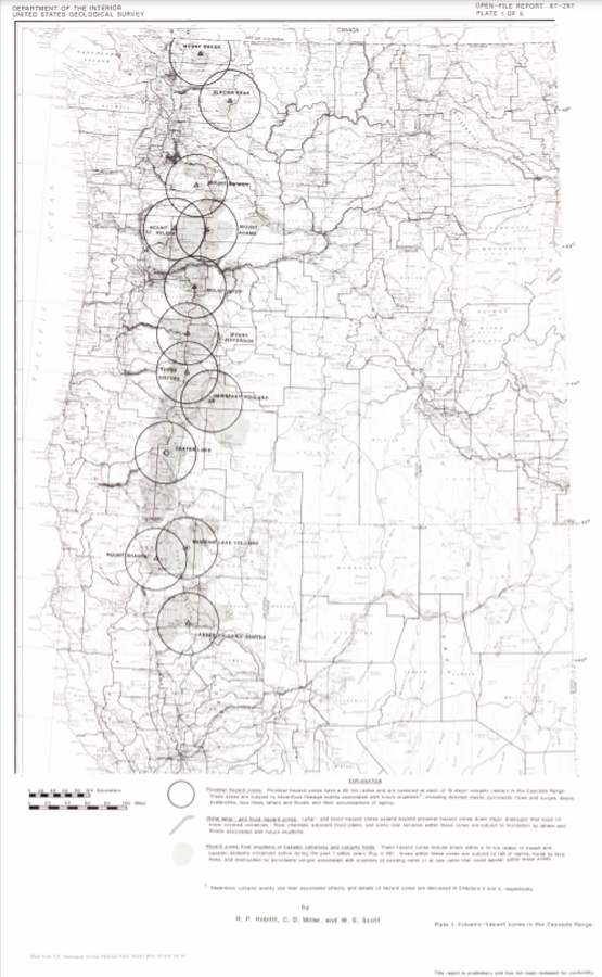
Volcanic-hazard zones in the Cascades Range

Cascades Range (regional, USA only), United States, 1987

Plate 1 in: Hoblitt, R. P., Miller, C. D., & Scott, W. E. (1987). Volcanic hazards with regard to siting nuclear-power plants in the Pacific Northwest. U.S. Geological Survey, Open-File Report 87-297. https://doi.org/10.3133/ofr87297


This map was produced by an official agency, but is NOT the most recent, most complete, or main operational map. For the current operational hazard map, please consult the proper institutional authorities.


Click on image for full-size map. If link seems broken, try the archived version.

Map Set

Hoblitt, R. P., Miller, C. D., & Scott, W. E. (1987). Volcanic hazards with regard to siting nuclear-power plants in the Pacific Northwest. U.S. Geological Survey, Open-File Report 87-297. https://doi.org/10.3133/ofr87297
https://doi.org/10.3133/ofr87297

Other Maps In Set:

Map Data

Map ID3378
Hazard Process(es)Debris avalanches; Distal hazards; Floods or jokulhaups; Lahars; Lateral or directed blasts; Lava flows; PDCs; Proximal hazards; Regional hazards; Surges; Tephra fall; Vent-opening hazards
Hazard Zone PresentationGrouped by location (e.g. proximal/distal zones) on a main map panel
Temporal ScaleBackground, or long-term, map
Spatial ScaleRegional
Publication FormatPoster-style map insert in hazard assessment
Zonation Method(s)Geologic history
Zonation Model(s)
Scenario(s) ConsideredComposition; Source location or direction
Hazard Zone Label(s)Location or source name
Probability Definition(s)No probability definition was discernable from the map
PurposeLand-use planning: Intended to inform citing of facilities, building restrictions, resource management, and infrastructure development
AudienceLand-use planners, city planners, government officials, etc.
Language(s)English
Basemap(s)Street map
Basemap overlay(s)
DiemsionalityPlanimetric (2D or map) view
Color SchemeDark to Light (greyscale)