
Advanced Search for Maps
Showing 31-40 of 2217
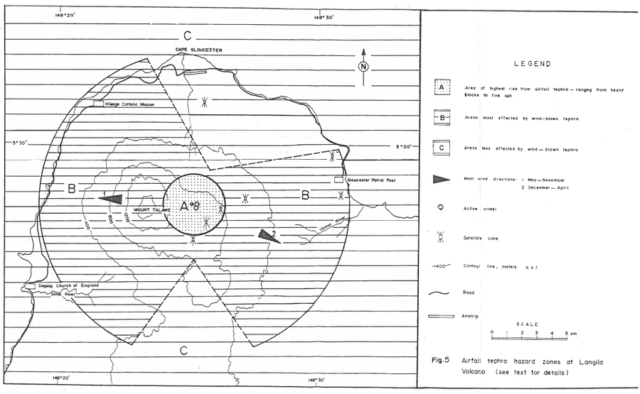
Official, Figure in hazard assessment
Airfall tephra hazard zones at Langila Volcano
Figure 5 in: Talai, B. (1987). Volcanic hazards at Langila volcano. Geological Survey of Papua New Guinea, Report 87/25
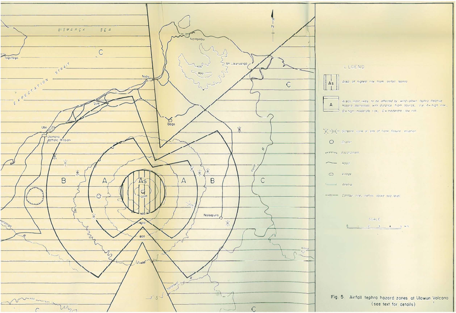
Official, Figure in hazard assessment
Airfall tephra hazard zones at Ulawun Volcano
Figure 5 in: McKee, C.O. (1983). Volcanic hazards at Uluwan volcano. Geological Survey of Papua New Guinea, Report 83/13, 1:100,000
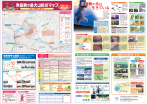
Official, Map sheet or poster
Akita Komagatake Volcano Disaster Prevention Map
Akita Prefecture. (2013). Akita Komagatake Volcano Disaster Prevention Map.
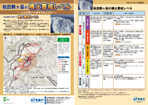
Official, Flyer, brochure, short fact-sheet, or handout
Akita-Komagatake Volcanic Alert Levels
Japan Meteorological Agency. (2016). Akita-Komagatake Volcanic Alert Levels. Volcano Monitoring and Warning Center, Volcano Division, Earthquake and Volcano Department.
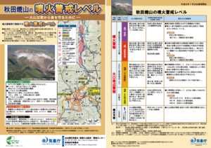
Official, Flyer, brochure, short fact-sheet, or handout
Akita-Yakeyama Volcanic Alert Levels
Japan Meteorological Agency. (2016). Akita-Yakeyama Volcanic Alert Levels. Volcano Monitoring and Warning Center, Volcano Division, Earthquake and Volcano Department.
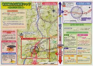
Official, Map in a booklet, long fact-sheet, or handbook
Akita-Yakeyama Volcanic Disaster Prevention Map
Akita Prefecture. (2002). Akita-Yakeyama Volcanic Disaster Prevention Map.
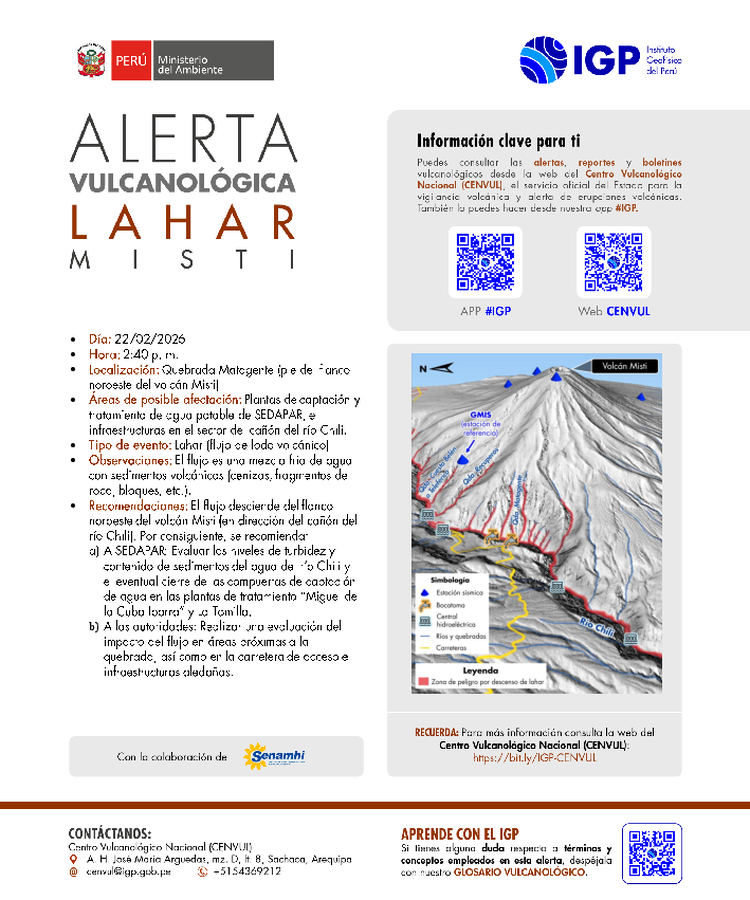
Official, Map in an information statement
Alerta Vulcanológica Lahar Misti
(Volcanological Alert Lahar Misti)
Centro Vulcanológico Nacional (CENVUL) Instituto Geofísico del Perú (IGP). (2026). Alerta Vulcanológica Lahar Misti. https://cenvul.igp.gob.pe/backend/uploads/alerta_misti_lahar_matagente_22_02_2026_b227415ea4.pdf
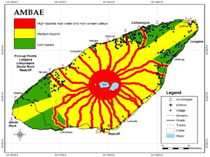
Figure in a journal article
Ambae
Cronin, S.J., Gaylord, D.R., Charley, D., Alloway, B.V., Wallez, S., & Esau, J.W. (2004). Participatory methods of incorporating scientific with traditional knowledge for volcanic hazard management on Ambae Island, Vanuatu. Bulletin of volcanology, 66(7), p. 652-668. https://doi.org/10.1007/s00445-004-0347-9. (Reprinted in: Cronin, S. J., & Németh, K., Stewart, R.B. (2006). Volcanic hazards planning on rifting island and fissure volcanoes. Joint Conference of the Geological Society of New Zealand and the New Zealand Geophysical Society.)
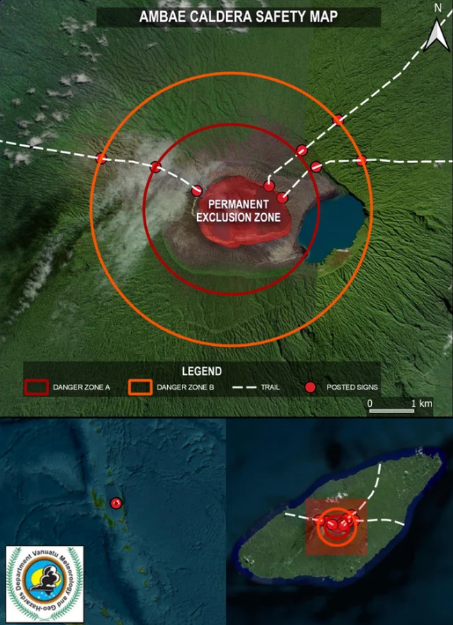
Official, Map in an information statement
Ambae Caldera Safety Map
Vanuatu Meteorology & Geo-Hazards Department. (2017). Vanuatu Volcano Alert Bulletin n°01 - Ambae Activity (Thursday January 30th 2025). Government of Vanuatu, Vanuatu Meteorology & Geo-Hazards Department.
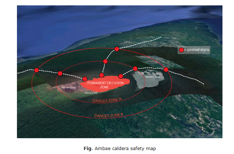
Official, Map in an information statement
Ambae caldera safety map
Figure 1 in: Vanuatu Meteorology & Geo-Hazards Department. (2020). Vanuatu Volcano Alert Bulletin No. 4 - Ambae Activity, Thursday May 28th 2020.