← Back to Search Results

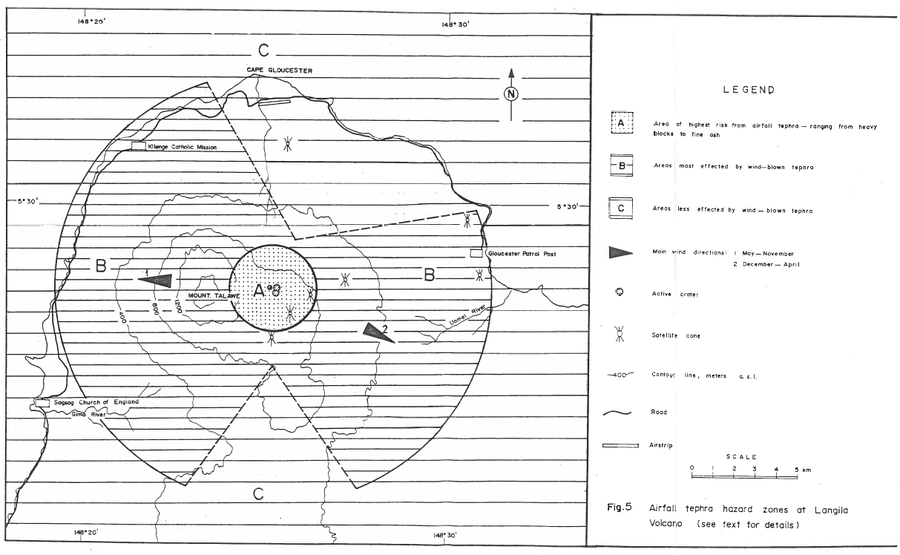
Airfall tephra hazard zones at Langila Volcano

Langila, Papua New Guinea, 1987

Figure 5 in: Talai, B. (1987). Volcanic hazards at Langila volcano. Geological Survey of Papua New Guinea, Report 87/25


This map was produced by an official agency, but is NOT the most recent, most complete, or main operational map. For the current operational hazard map, please consult the proper institutional authorities.

Map Set

Talai, B. (1987). Volcanic hazards at Langila volcano. Geological Survey of Papua New Guinea, Report 87/25

Other Maps In Set:

Map Data

Map ID559
Hazard Process(es)Tephra fall
Hazard Zone PresentationSingle hazard: A single hazard process is represented on a main map panel
Temporal ScaleBackground, or long-term, map
Spatial ScaleVolcano and surrounding area
Publication FormatFigure in a hazard assessment or mitigation plan
Zonation Method(s)Geologic history
Zonation Model(s)
Scenario(s) ConsideredNo scenarios were discernable from the map
Hazard Zone Label(s)Qualitative relative probability (e.g. high-medium-low)
Probability Definition(s)Qualitative relative probability (e.g. high-medium-low)
PurposeMultiple: intended for multiple purposes including general hazard awareness, planning, and crisis management
AudienceMultiple audiences (usually the public, civil authorities, and land-use planners)
Language(s)English
Basemap(s)Contour lines
Basemap overlay(s)Street map
DiemsionalityPlanimetric (2D or map) view
Color SchemeSymbols and/or lines only
Go to Global Volcanism Program page for Langila →