Advanced Search for Maps
Showing 61-64 of 64

Official, Figure in hazard assessment
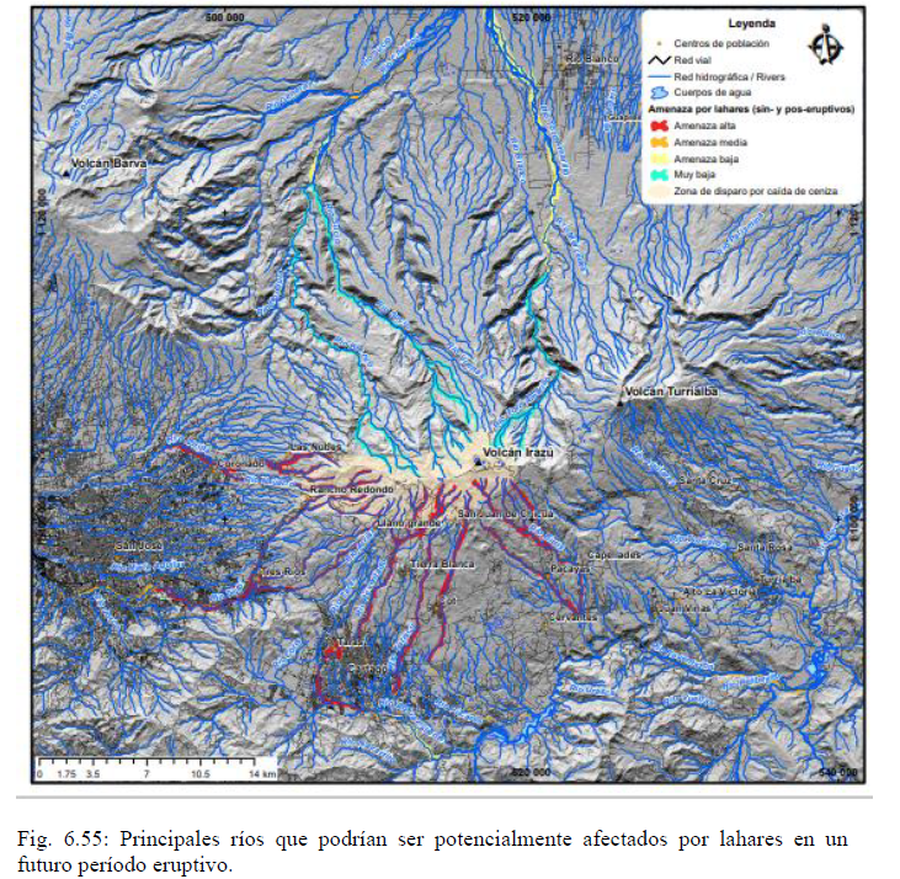
Principales ríos que podrían ser potencialmente afectados por lahares en un futuro período eruptivo
(Main rivers that could potentially be affected by lahars in a future eruptive period)
Figure 6.55 in: Alvarado, G.E., Campos-Durán, D., Brenes-André, J., Alpízar, Y., Núñez, S., Esquivel, L., Sibaja, J.P. & Fallas, B. (2021). Peligro Volcánico del Irazú, Costa Rica. Comisión Nacional de Prevención de Riesgos y Atención de Emergencias (CNE). Deciembre 2021.

Official, Figure in hazard assessment
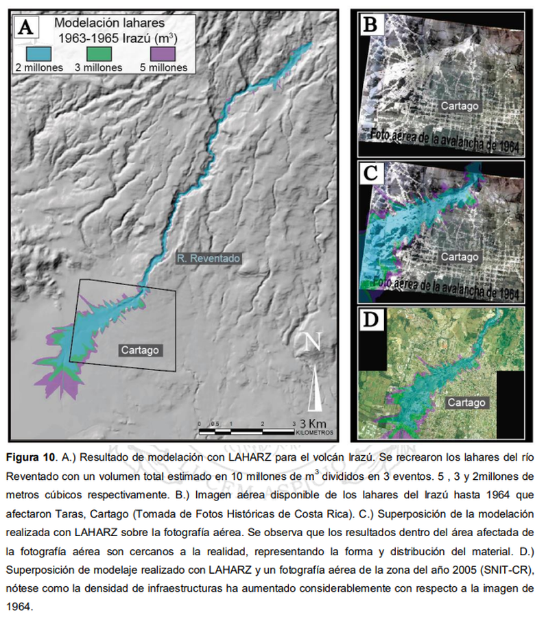
Resultado de modelación con LAHARZ para el volcán Irazú
(Modeling result with LAHARZ for the Irazú volcano)
Figure 10 in: Ruiz, P., Vega, P. & Barrantes, R. (2015). Modelación de lahares generados por el volcán Turrialba y su posible afectación a la red vial nacional. Laboratorio Nacional de Materiales y Modelos Estructurales. Universidad de Costa Rica 42 pp.

Figure in a thesis or dissertation
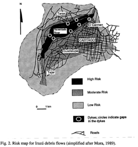
Risk map for Irazú debris flows (simplified after Mora, 1989)
Figure 2, Page 196 in: Alvarado I., G.E. (1993). Volcanology and Petrology of Irazú Volcano, Costa Rica. Christian-Albrechts-Universität, Kiel. PhD Dissertation. 288 p. (Simplified from: Mora 1993)

Figure in a thesis or dissertation
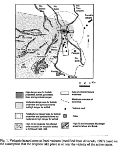
Volcanic hazard zone at Irazú volcano (modified from Alvarado, 1987) based on the assumption that the eruption take place at or near the vicinity of the active crater
Figure 1, Page 195 in: Alvarado I., G.E. (1993). Volcanology and Petrology of Irazú Volcano, Costa Rica. Christian-Albrechts-Universität, Kiel. PhD Dissertation. 288 p. (Modified from: Alvarado 1987)
