
Advanced Search for Maps
Showing 11-20 of 45
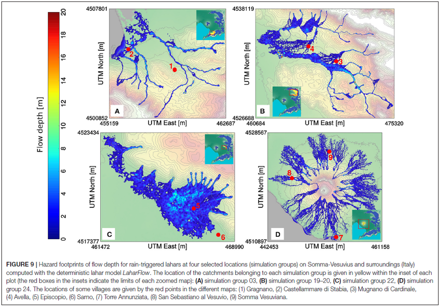
Figure in a journal article
Hazard footprints of flow depth for rain-triggered lahars at four selected locations (simulation groups) on Somma-Vesuvius and surroundings (Italy) computed with the deterministic lahar model LaharFlow
Figure 9 in: Tierz, P., Woodhouse, M.J., Phillips, J.C., Sandri, L., Selva, J., Marzocchi, W., & Odbert, H.M. (2017). A framework for probabilistic multi-hazard assessment of rain-triggered lahars using Bayesian belief networks. Frontiers in Earth Science, 5 (73). https://doi.org/10.3389/feart.2017.00073
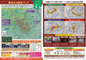
Official, Map sheet or poster
Kirishima Volcano Disaster Prevention Map
Kan-Kirishima Conference. (2009). Kirishima Volcano Disaster Prevention Map. Miyakonojo, Kogen Town, Kobayashi City, Ebino City, Yusui Town, Shima City, Fuo City.
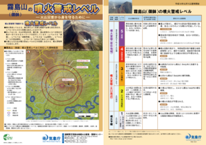
Official, Flyer, brochure, short fact-sheet, or handout
Kirishimayama (Ohachi) Volcanic Alert Levels
Japan Meteorological Agency. (2019). Kirishimayama (Ohachi) Volcanic Alert Levels. Volcano Monitoring and Warning Center, Volcano Division, Earthquake and Volcano Department.
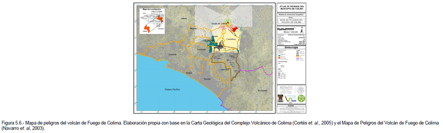
Official, Figure in hazard assessment
Mapa de Peligros del Volcán de Colima
(Colima Volcano Hazard Map)
Figure 5.6 in: Grupo de Análisis, Evaluación y Gestión de Riesgos de la Universidad de Colima. (2014). Atlas de Riesgos Naturales del Municipio de Colima. Universidad de Colima, Colima, Mexico.
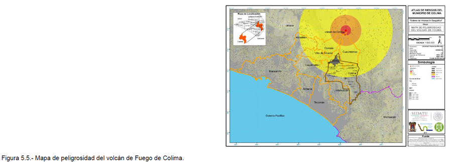
Official, Figure in hazard assessment
Mapa de Peligrosidad del Volcán de Colima
(Colima Volcano Hazard Map)
Figure 5.5 in: Grupo de Análisis, Evaluación y Gestión de Riesgos de la Universidad de Colima. (2014). Atlas de Riesgos Naturales del Municipio de Colima. Universidad de Colima, Colima, Mexico.

Official, Map sheet or poster
Mapa Preliminar de Amenaza por Avalanchas y Deslaves, Complejo Volcánico San Cristóbal-Casita
(Preliminary Map of Hazard by Avalanches and Landslides, San Cristóbal-Casita Volcanic Complex)
Strauch, W. (1999). Mapa Preliminar de Amenaza por Avalanchas y Deslaves, Complejo Volcánico San Cristóbal-Casita. Instituto Nicaragüense de Estudios Territoriales (INETER), Dirección de Geofisica, Managua.
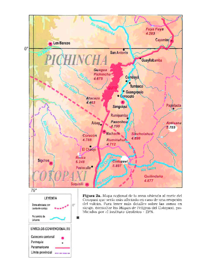
Official, Figure in hazard assessment
Mapa regional de la zona ubicada al norte del Cotopaxi que seria más afectada en caso de una erupción del volcán
(Regional map of the area located to the north of Cotopaxi that would be most affected in the event of an eruption of the volcano)
Figure 2a in: Andrade, D., Hall, M., Mothes, P., Troncoso, L., Eissen, J.-P., Samaniego, P., Egred, J., Ramón, P., Rivero, D., and Yepes, H. (2005). Los peligros volcánicos asociados con el Cotopaxi. Instituto Geofísico Escuela Politécnica Nacional (IG-EPN), Institut de Recherche pour la Développement (IRD), Corporación Editora Nacional, Quito. https://horizon.documentation.ird.fr/exl-doc/pleins_textes/divers20-05/010036189.pdf
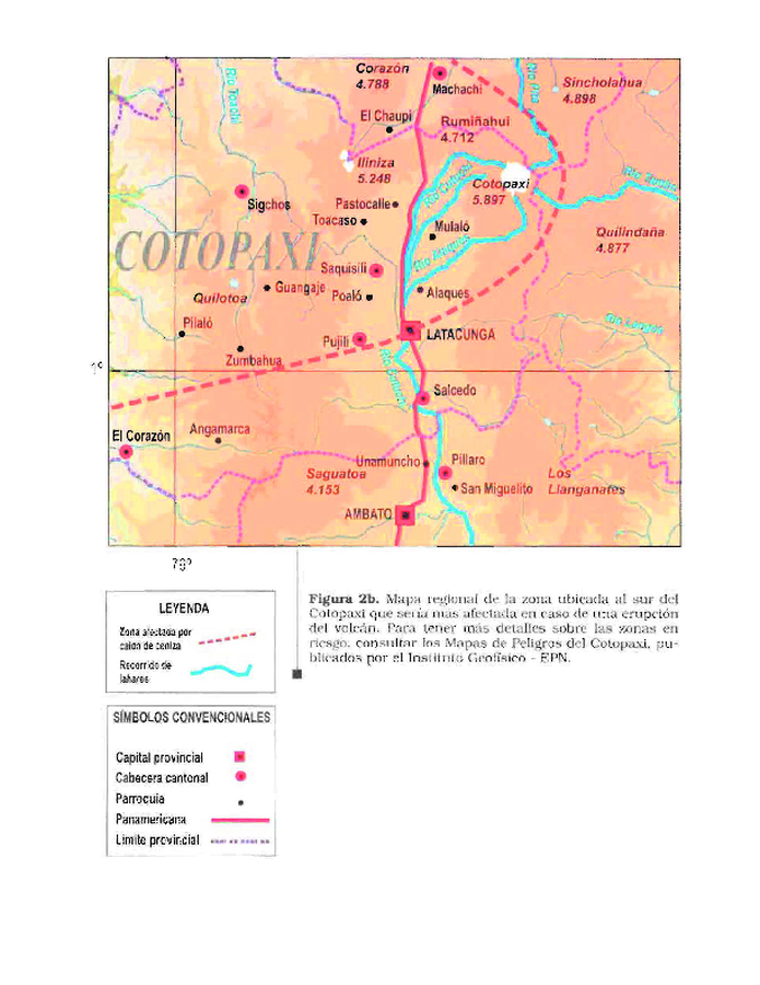
Official, Figure in hazard assessment
Mapa regional de la zona ubicada al sur del Cotopaxi que seria más afectada en caso de una erupción del volcán
(Regional map of the area located to the south of Cotopaxi that would be most affected in the event of an eruption of the volcano)
Figure 2b in: Andrade, D., Hall, M., Mothes, P., Troncoso, L., Eissen, J.-P., Samaniego, P., Egred, J., Ramón, P., Rivero, D., and Yepes, H. (2005). Los peligros volcánicos asociados con el Cotopaxi. Instituto Geofísico Escuela Politécnica Nacional (IG-EPN), Institut de Recherche pour la Développement (IRD), Corporación Editora Nacional, Quito. https://horizon.documentation.ird.fr/exl-doc/pleins_textes/divers20-05/010036189.pdf
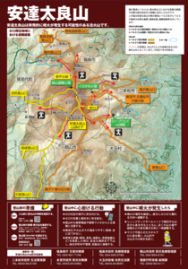
Official, Hiking or trail map
Mt. Adatara Evacuation Routes Around the Crater Area
Adatarayama Volcanic Disaster Management Council. (2019). Mt. Adatara Evacuation Routes Around the Crater Area.
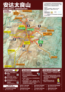
Official, Hiking or trail map
Mt. Adatara Evacuation Routes Around the Crater Area [Chinese version]
Adatarayama Volcanic Disaster Management Council. (2019). Mt. Adatara Evacuation Routes Around the Crater Area.