← Back to Search Results

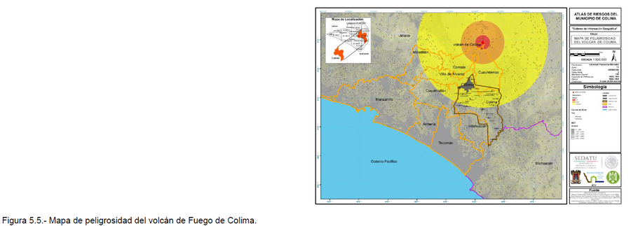
Mapa de Peligrosidad del Volcán de Colima

Colima Volcano Hazard Map

Colima, Mexico, 2014

Figure 5.5 in: Grupo de Análisis, Evaluación y Gestión de Riesgos de la Universidad de Colima. (2014). Atlas de Riesgos Naturales del Municipio de Colima. Universidad de Colima, Colima, Mexico.


This map was produced by an official agency, but is NOT the most recent, most complete, or main operational map. For the current operational hazard map, please consult the proper institutional authorities.


Click on image for full-size map. If link seems broken, try the archived version.

Map Set

Grupo de Análisis, Evaluación y Gestión de Riesgos de la Universidad de Colima. (2014). Atlas de Riesgos Naturales del Municipio de Colima. Universidad de Colima, Colima, Mexico.
http://rmgir.proyectomesoamerica.org/PDFMunicipales/06002_COLIMA.pdf

Other Maps In Set:

Map Data

Map ID3810
Hazard Process(es)Ballistics; Debris avalanches; Lahars; Lava flows; PDCs; Tephra fall
Hazard Zone PresentationHazard level-focused: All or most hazards are combined by hazard level on a main map panel
Temporal ScaleBackground, or long-term, map
Spatial ScaleVolcano and surrounding area
Publication FormatFigure in a hazard assessment or mitigation plan
Zonation Method(s)Derived/simplified from another map
Zonation Model(s)
Scenario(s) ConsideredSeason or weather
Hazard Zone Label(s)Qualitative relative probability (e.g. high-medium-low)
Probability Definition(s)Qualitative relative probability (e.g. high-medium-low)
PurposeLand-use planning: Intended to inform citing of facilities, building restrictions, resource management, and infrastructure development
AudienceLand-use planners, city planners, government officials, etc.
Language(s)Spanish
Basemap(s)Digital Elevation Model (DEM)
Basemap overlay(s)Administrative boundaries (e.g. county, park, intl.); Contour lines
DiemsionalityPlanimetric (2D or map) view
Color SchemeRed to Yellow
Go to Global Volcanism Program page for Colima →