
Advanced Search for Maps
Showing 11-20 of 906
Official, Map sheet or poster
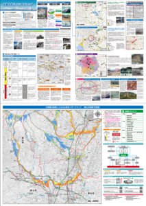
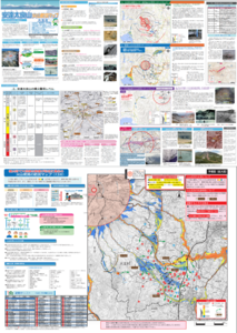
Adatarayama Volcano Disaster Prevention Map [Koriyama City]
Koriyama City. (2016). Adatarayama Volcano Disaster Prevention Map [Koriyama City].
Official, Map sheet or poster
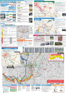
Adatarayama Volcano Disaster Prevention Map [Motomiya City]
Motomiya City. (2016). Adatarayama Volcano Disaster Prevention Map [Motomiya City].
Official, Map sheet or poster
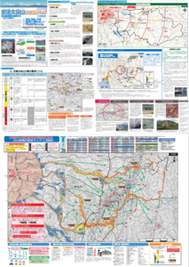
Adatarayama Volcano Disaster Prevention Map [Nihonmatsu City]
Nihonmatsu City. (2016). Adatarayama Volcano Disaster Prevention Map [Nihonmatsu City].
Official, Map sheet or poster
Adatarayama Volcano Disaster Prevention Map [Otama Village]
Fukushima City. (2016). Adatarayama Volcano Disaster Prevention Map [Fukushima City].
Official, Map sheet or poster
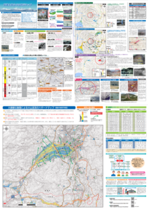
Adatarayama Volcano Disaster Prevention Map [Otama Village]
Otama Village. (2016). Adatarayama Volcano Disaster Prevention Map [Otama Village].
Official, Flyer, brochure, short fact-sheet, or handout
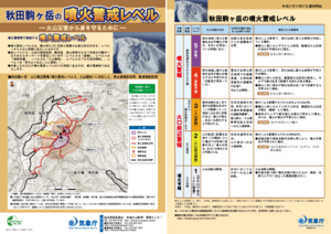
Akita-Komagatake Volcanic Alert Levels
Japan Meteorological Agency. (2016). Akita-Komagatake Volcanic Alert Levels. Volcano Monitoring and Warning Center, Volcano Division, Earthquake and Volcano Department.
Official, Flyer, brochure, short fact-sheet, or handout
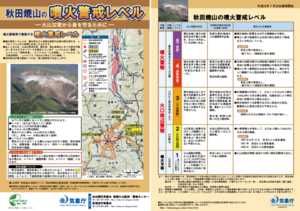
Akita-Yakeyama Volcanic Alert Levels
Japan Meteorological Agency. (2016). Akita-Yakeyama Volcanic Alert Levels. Volcano Monitoring and Warning Center, Volcano Division, Earthquake and Volcano Department.
Official, Map sheet or poster
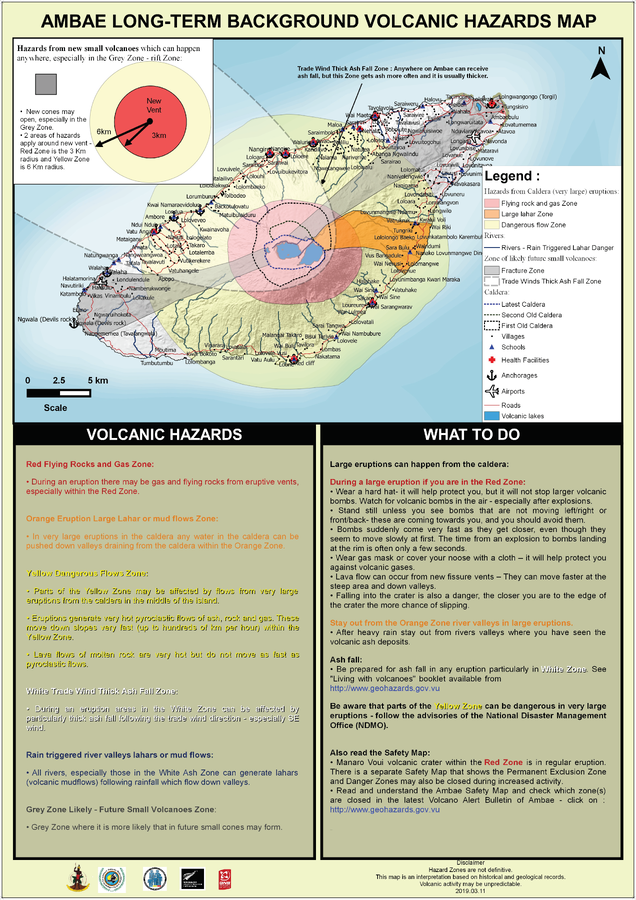
Ambae Long-Term Background Volcanic Hazards Map
Vanuatu Meteorology & Geo-Hazards Department. (2019). Ambae Long-Term Background Volcanic Hazards Map. Government of Vanuatu, Vanuatu Meteorology & Geo-Hazards Department, Vanuatu National Disaster Risk Management Office, New Zealand Foreign Affairs & Trade Aid Programme, GNS Science.
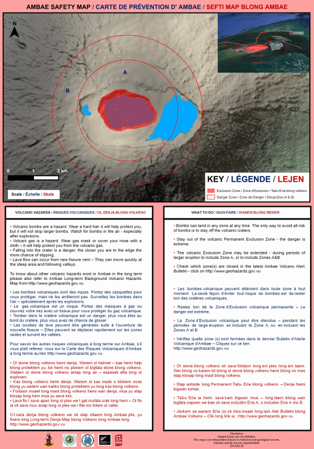
Official, Map sheet or poster
Ambae Safety Map
Vanuatu Meteorology & Geo-Hazards Department. (2019). Ambae Safety Map. Government of Vanuatu, Vanuatu Meteorology & Geo-Hazards Department, Vanuatu National Disaster Risk Management Office, New Zealand Foreign Affairs & Trade Aid Programme, GNS Science.
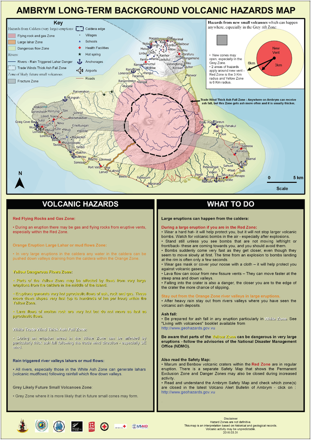
Official, Map sheet or poster
Ambrym Long-Term Background Volcanic Hazards Map
Vanuatu Meteorology & Geo-Hazards Department. (2016). Ambrym Long-Term Background Volcanic Hazards Map. Government of Vanuatu, Vanuatu Meteorology & Geo-Hazards Department, Vanuatu National Disaster Risk Management Office, New Zealand Foreign Affairs & Trade Aid Programme, GNS Science, The Vanuatu Red Cross Society, Croix Rouge Francaise, USAID.