
Advanced Search for Maps
Showing 241-247 of 247

Official, Figure in hazard assessment
Zones of relative risk from lava-flow burial
Figure 9 in: Mullineaux, D.R. & Peterson, D.W. (1974). Volcanic hazards on the Island of Hawaii. U.S. Geological Survey, Open-File Report 74-239. https://doi.org/10.3133/ofr74239
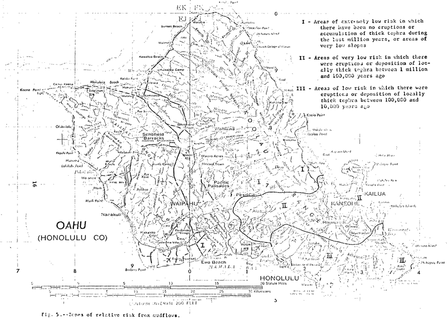
Official, Figure in hazard assessment
Zones of relative risk from mudflows
Figure 5 in: Crandell, D. R. (1975). Assessment of volcanic risk on the island of Oahu, Hawaii. U.S. Geological Survey, Open-File Report 75-287. https://doi.org/10.3133/ofr75287
Official, Insert/poster-size map with accompanying report
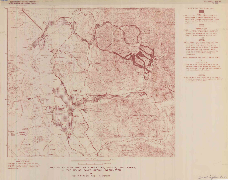
Zones of relative risk from mudflows, floods, and tephra, in the Mount Baker region, Washington
Plate 1 in: Hyde, J.H. & Crandell, D.R. (1975). Origin and age of postglacial deposits and assessment of potential hazards from future eruptions of Mount Baker, Washington. U.S. Geological Survey, Open-File Report 75-286, 22 p. https://doi.org/10.3133/ofr75286
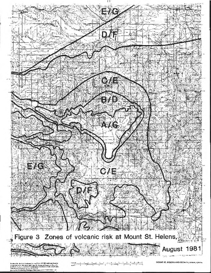
Official, Figure in hazard assessment
Zones of volcanic risk at Mount St. Helens August 1981
Figure 3 in: Newhall, C.G. (1982). A method for estimating intermediate- and long-term risks from volcanic activity, with an example from Mount St. Helens, Washington. U.S. Geological Survey, Open-File Report 82-396, 59 p. doi: 10.3133/ofr82396
Official, Figure in hazard assessment
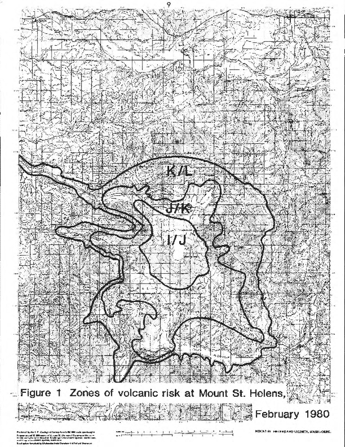
Zones of volcanic risk at Mount St. Helens February 1980
Figure 1 in: Newhall, C.G. (1982). A method for estimating intermediate- and long-term risks from volcanic activity, with an example from Mount St. Helens, Washington. U.S. Geological Survey, Open-File Report 82-396, 59 p. doi: 10.3133/ofr82396
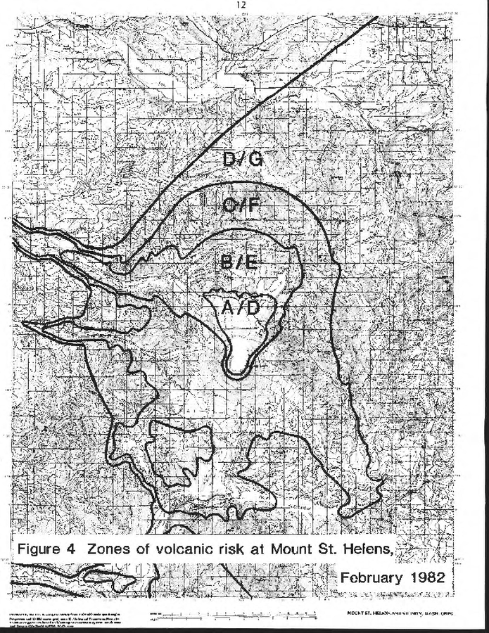
Official, Figure in hazard assessment
Zones of volcanic risk at Mount St. Helens February 1982
Figure 4 in: Newhall, C.G. (1982). A method for estimating intermediate- and long-term risks from volcanic activity, with an example from Mount St. Helens, Washington. U.S. Geological Survey, Open-File Report 82-396, 59 p. doi: 10.3133/ofr82396
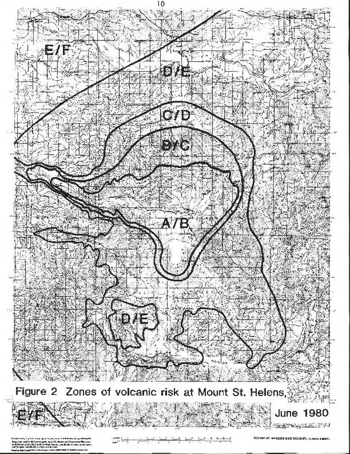
Official, Figure in hazard assessment
Zones of volcanic risk at Mount St. Helens June 1980
Figure 2 in: Newhall, C.G. (1982). A method for estimating intermediate- and long-term risks from volcanic activity, with an example from Mount St. Helens, Washington. U.S. Geological Survey, Open-File Report 82-396, 59 p. doi: 10.3133/ofr82396