
Advanced Search for Maps
Showing 171-180 of 180
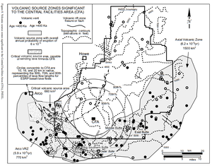
Official, Figure in hazard assessment
Volcanic Source Zones Significant to the Central Facilities Area (CFA)
Figure 8 in: Hackett, W.R., Smith, R.P., & Khericha, S. (2002). Volcanic hazards of the Idaho National Engineering and Environmental Laboratory, southeast Idaho. In: Bonnichsen, B., White, C.M., and McCurry, M. (eds.). Tectonic and Magmatic Evolution of the Snake River Plain Volcanic Province. Idaho Geological Survey Bulletin 30, p. 461-482.
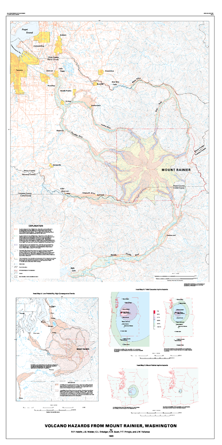
Official, Insert/poster-size map with accompanying report
Volcano Hazards from Mount Rainier, Washington
Hoblitt, R.P., Walder, J.S., Driedger, C.L., Scott, K.M., Pringle, P.T. & Vallance, J.W. (1995). Volcano Hazards from Mount Rainier, Washington. U.S. Geological Survey Open-File Report 95-273. https://doi.org/10.3133/ofr95273
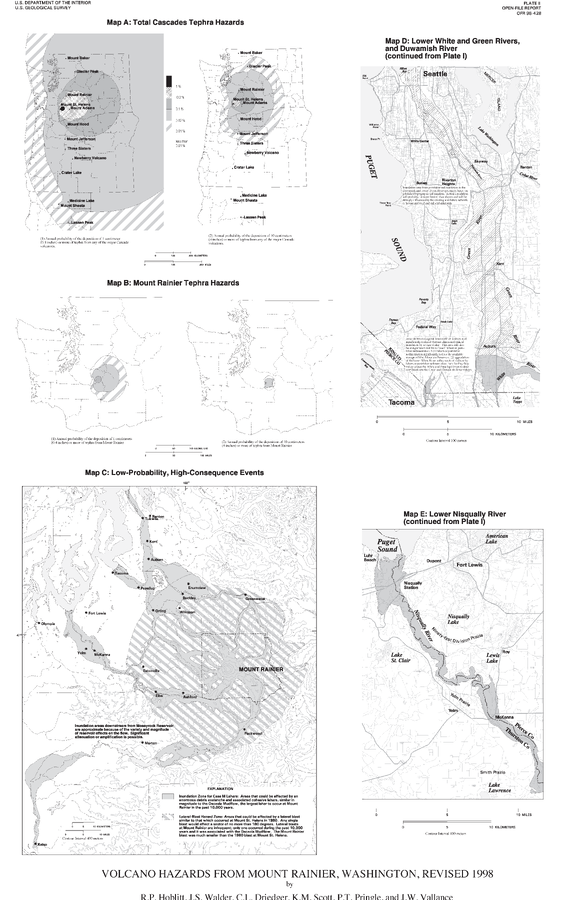
Official, Insert/poster-size map with accompanying report
Volcano Hazards From Mount Rainier, Washington, Revised 1998
Plate 2 in: Hoblitt, R.P., Walder, J.S., Driedger, C., Scott, K., Pringle, P.T. & Vallance, J.W. (1998). Volcano Hazards from Mount Rainier, Washington, Revised 1998. U.S. Geological Survey, Open-File Report 98-428, 11 p., 2 plates. https://doi.org/10.3133/ofr98428
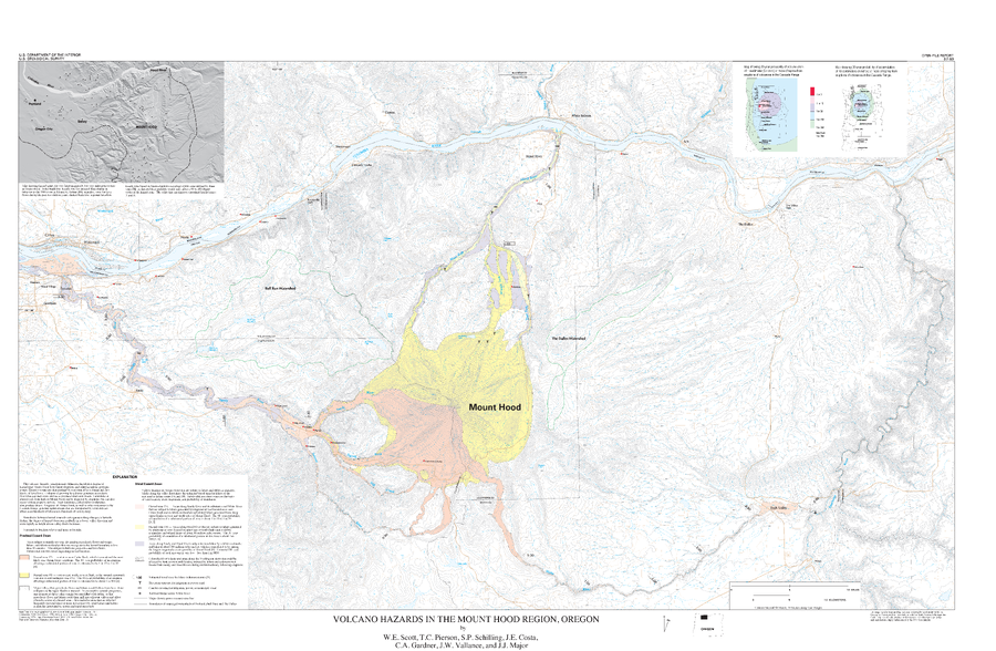
Official, Insert/poster-size map with accompanying report
Volcano Hazards in the Mount Hood Region, Oregon
Plate Of1997 in: Scott, W.E., Pierson, T., Schilling, S.P., Costa, J., Gardner, C., Vallance, J.W. & Major, J. (1997). Volcano hazards in the Mount Hood region, Oregon. U.S. Geological Survey, Open-File Report 97-89, 14 p., 1 map. https://doi.org/10.3133/ofr9789
Official, Insert/poster-size map with accompanying report
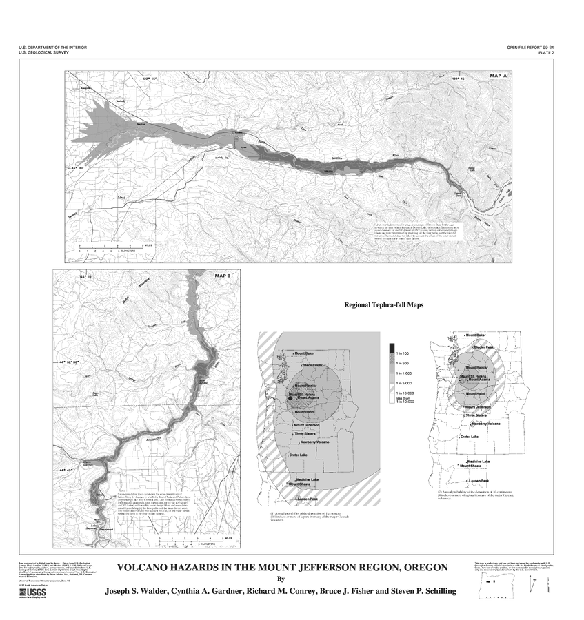
Volcano Hazards in the Mount Jefferson Region, Oregon
Plate 2 in: Walder, J.S., Gardner, C.A., Conrey, R.M., Fisher, B.J., & Schilling, S.P. (1999). Volcano Hazards in the Mount Jefferson Region, Oregon. U.S. Geological Survey, Open-File Report 99-24, 14 p. https://doi.org/10.3133/ofr9924

Official, Insert/poster-size map with accompanying report
Volcano hazards in the Three Sisters Region, Oregon
Plate 1 in: Scott, W.E., Iverson, R., Schilling, S.P. & Fisher, B.J. (2001). Volcano Hazards in the Three Sisters Region, Oregon. U.S. Geological Survey, Open-File Report 99-437, 14 p., 1 plate. https://doi.org/10.3133/ofr99437
Official, Figure in hazard assessment
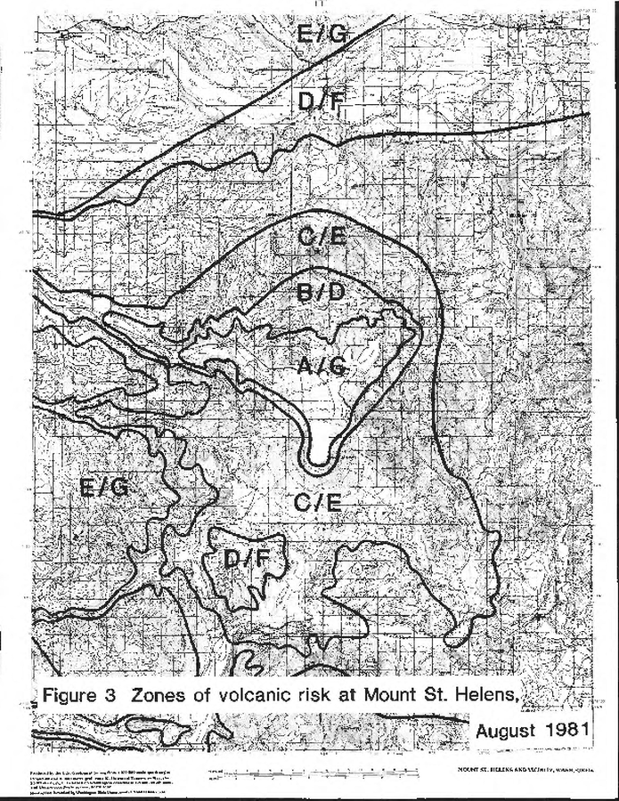
Zones of volcanic risk at Mount St. Helens August 1981
Figure 3 in: Newhall, C.G. (1982). A method for estimating intermediate- and long-term risks from volcanic activity, with an example from Mount St. Helens, Washington. U.S. Geological Survey, Open-File Report 82-396, 59 p. doi: 10.3133/ofr82396
Official, Figure in hazard assessment
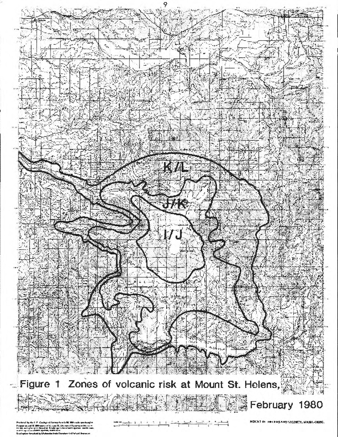
Zones of volcanic risk at Mount St. Helens February 1980
Figure 1 in: Newhall, C.G. (1982). A method for estimating intermediate- and long-term risks from volcanic activity, with an example from Mount St. Helens, Washington. U.S. Geological Survey, Open-File Report 82-396, 59 p. doi: 10.3133/ofr82396
Official, Figure in hazard assessment
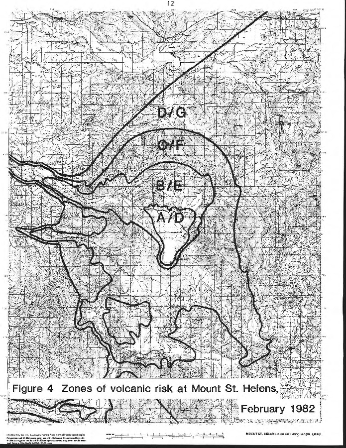
Zones of volcanic risk at Mount St. Helens February 1982
Figure 4 in: Newhall, C.G. (1982). A method for estimating intermediate- and long-term risks from volcanic activity, with an example from Mount St. Helens, Washington. U.S. Geological Survey, Open-File Report 82-396, 59 p. doi: 10.3133/ofr82396
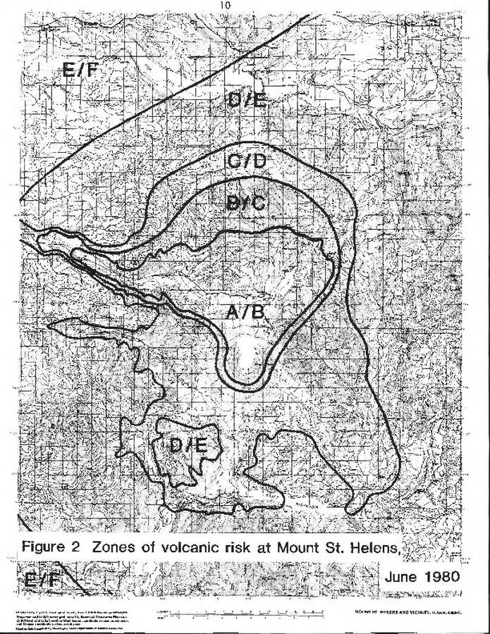
Official, Figure in hazard assessment
Zones of volcanic risk at Mount St. Helens June 1980
Figure 2 in: Newhall, C.G. (1982). A method for estimating intermediate- and long-term risks from volcanic activity, with an example from Mount St. Helens, Washington. U.S. Geological Survey, Open-File Report 82-396, 59 p. doi: 10.3133/ofr82396