
Advanced Search for Maps
Showing 121-123 of 123
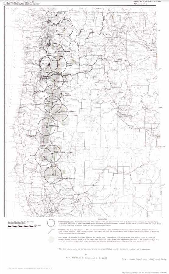
Official, Insert/poster-size map with accompanying report
Volcanic-hazard zones in the Cascades Range
Plate 1 in: Hoblitt, R. P., Miller, C. D., & Scott, W. E. (1987). Volcanic hazards with regard to siting nuclear-power plants in the Pacific Northwest. U.S. Geological Survey, Open-File Report 87-297. https://doi.org/10.3133/ofr87297
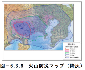
Official, Figure in hazard assessment
Volcano disaster prevention map (ash fall)
Figure 6.3.6 in: Mt. Fuji Hazard Map Review Committee. (2004). Mt. Fuji Hazard Map Review Committee Report. June 2004. https://www.bousai.go.jp/kazan/fuji_map/pdf/report_200406.pdf
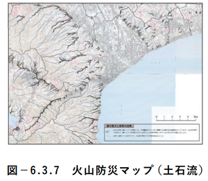
Official, Figure in hazard assessment
Volcano disaster prevention map (debris flow)
Figure 6.3.7 in: Mt. Fuji Hazard Map Review Committee. (2004). Mt. Fuji Hazard Map Review Committee Report. June 2004. https://www.bousai.go.jp/kazan/fuji_map/pdf/report_200406.pdf