
Advanced Search for Maps
Showing 51-60 of 502
Official, Insert/poster-size map with accompanying report
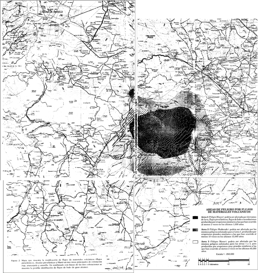
Areas de Peligro por Flujos de Materiales Volcanicos
(Hazard Areas for Flows of Volcanic Materials)
Figure 2 in: Macías J.L., Carrasco, G. Siebe, C. (1995). Zonificación de peligros volcánicos del Popocatepetl. Capitulo III Riesgos y Mapeo.
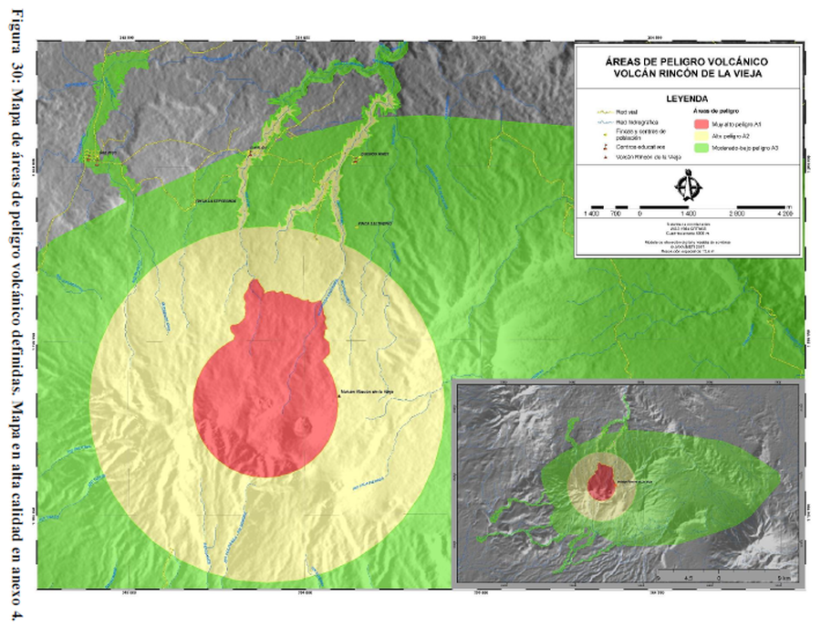
Figure in a thesis or dissertation
Áreas de Peligro Volcánico Volcán Rincón de la Vieja
(Volcanic Hazard Areas Rincón de la Vieja Volcano)
Figure 30 in: Alpízar, Y. (2018). Mapa Preliminar de Peligros Volcánicos para el Volcán Rincón de la Vieja (Costa Rica): Descripción de un Escenario de Afectación por Lahares. Ciudad Universitaria Rodrigo Facio, Costa Rica. 160 p.
Official, Figure in hazard assessment
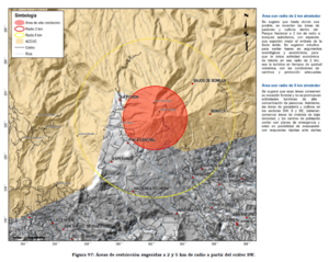
Áreas de restricción sugeridas a 2 y 5 km de radio a partir del cráter SW
(Suggested restriction areas 2 and 5 km radius from SW crater)
Figure 97 in: Soto, G.J. (2012). Preparación de mapas de peligros volcánicos y restricción de uso de la tierra en el volcán Turrialba. FUNDEVI, Universidad de Costa Rica, Escuela Centroamericana de Geología. 186 p.
Official, Figure in hazard assessment
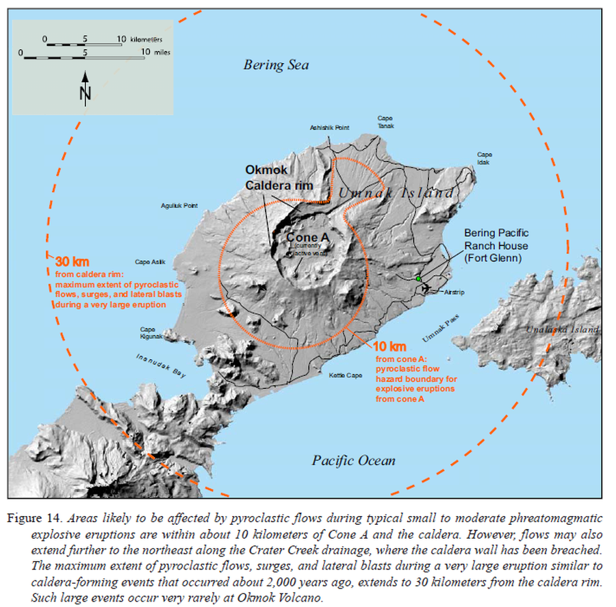
Areas likely to be affected by pyroclastic flows during typical small to moderate phreatomagmatic explosive eruptions
Figure 14 in: Beget, J.E., Larsen, J.F., Neal, C.A., Nye, C.J., & Schaefer, J.R. (2005). Preliminary volcano-hazard assessment for Okmok Volcano, Umnak Island, Alaska. Department of Natural Resources, Division of Geological & Geophysical Surveys (DGGS), Report of Investigation RI 2004-3, 32 p., 1 sheet, scale 1:150,000. http://doi.org/10.14509/7042
Official, Figure in hazard assessment
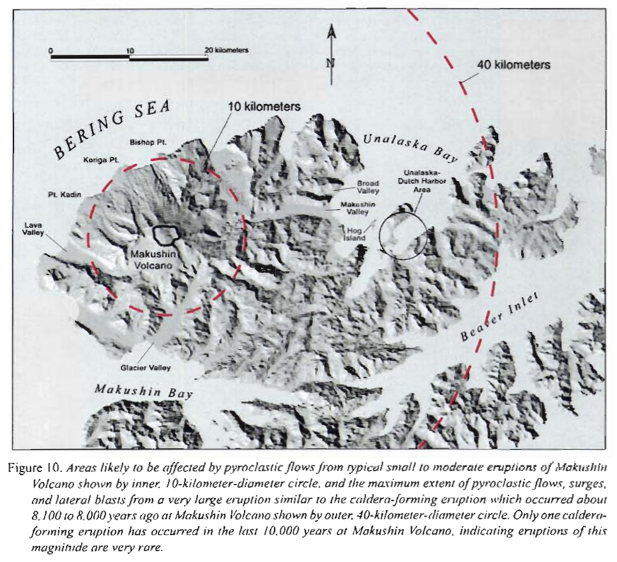
Areas likely to be affected by pyroclastic flows from typical small to moderate eruptions of Makushin
Figure 10 in: Beget, J.E., Nye, C.J. & Bean, K.W. (2000). Preliminary volcano-hazard assessment for Makushin Volcano, Alaska. Alaska Division of Geological & Geophysical Surveys, Report of Investigation 2000-4, 22 p., 1 sheet, scale 1:100,000.
Official, Flyer, brochure, short fact-sheet, or handout
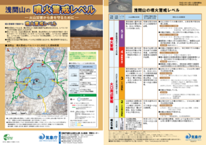
Asamayama Volcanic Alert Levels
Japan Meteorological Agency. (2016). Asamayama Volcanic Alert Levels. Volcano Monitoring and Warning Center, Volcano Division, Earthquake and Volcano Department.
Official, Flyer, brochure, short fact-sheet, or handout
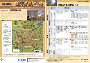
Asosan Volcanic Alert Levels
Japan Meteorological Agency. (2019). Asosan Volcanic Alert Levels. Volcano Monitoring and Warning Center, Volcano Division, Earthquake and Volcano Department.
Official, Map in an information statement
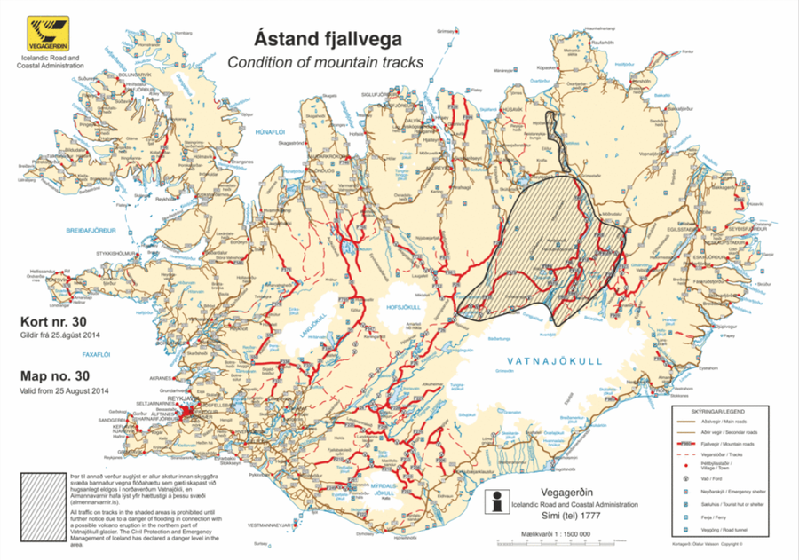
Ástand fjallvega
(Condition of mountain tracks)
Icelandic Road and Coastal Administration. (2014). Condition of mountain tracks. Map no. 30, valid from 25 August 2014.
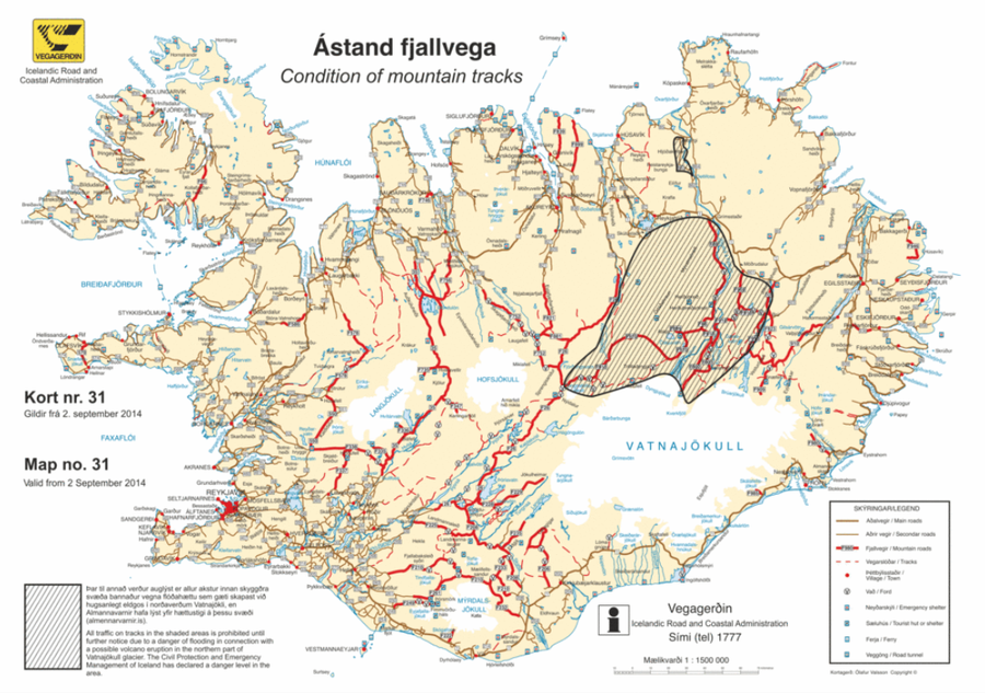
Official, Map in an information statement
Ástand fjallvega
(Condition of mountain tracks)
Icelandic Road and Coastal Administration. (2014). Condition of mountain tracks. Map no. 31, valid from 2 September 2014.
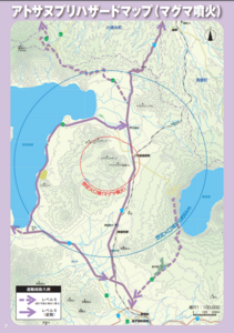
Official, Map in a booklet, long fact-sheet, or handbook
Atosanupuri Hazard map (magma eruption)
Page 7 in: Teshikaga Town Office. (2018). Teshikaga Town Disaster Prevention Guidebook.