
Advanced Search for Maps
Showing 61-70 of 502
Official, Map in a booklet, long fact-sheet, or handbook
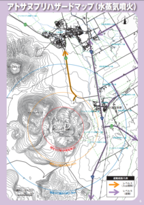
Atosanupuri Hazard Map (steam eruption)
Page 6 in: Teshikaga Town Office. (2018). Teshikaga Town Disaster Prevention Guidebook.
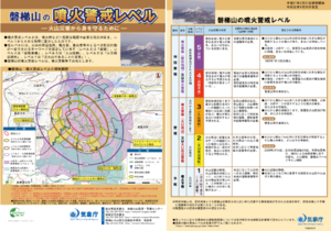
Official, Flyer, brochure, short fact-sheet, or handout
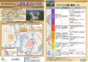
Atosanupuri Volcanic Alert Levels
Japan Meteorological Agency. (2018). Atosanupuri Volcanic Alert Levels. Volcano Monitoring and Warning Center, Volcano Division, Earthquake and Volcano Department.
Official, Interactive web-based map
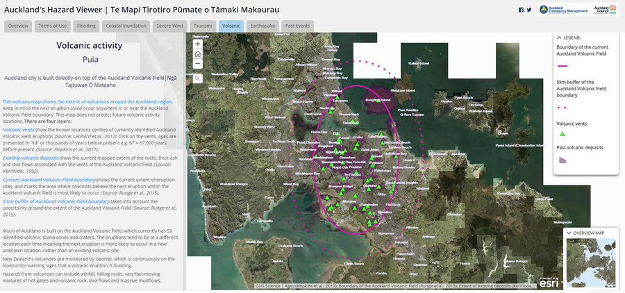
Auckland's Hazard Viewer Volcanic Activity
Auckland Council. Auckland's Hazard Viewer: Volcanic Activity.
Official, Flyer, brochure, short fact-sheet, or handout
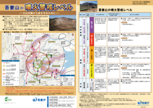
Azumayama Volcanic Alert Levels
Japan Meteorological Agency. (2019). Azumayama Volcanic Alert Levels. Volcano Monitoring and Warning Center, Volcano Division, Earthquake and Volcano Department.
Official, Flyer, brochure, short fact-sheet, or handout
Bandaisan Volcanic Alert Levels
Japan Meteorological Agency. (2019). Bandaisan Volcanic Alert Levels. Volcano Monitoring and Warning Center, Volcano Division, Earthquake and Volcano Department.

Figure in a thesis or dissertation
Batur Community Hazard Map
Figure 5.5 in: Donovan, K.H.M. (2010). Cultural responses to volcanic hazards on Mt Merapi, Indonesia. University of Plymouth, PhD Dissertation.
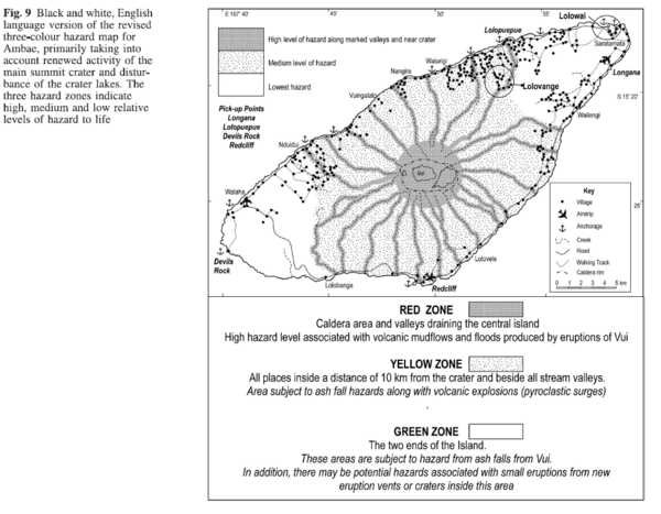
Figure in a journal article
Black and white, English language version of the revised three-colour hazard map for Ambae, primarily taking into account renewed activity of the main summit crater and disturbance of the crater lakes
Figure 9 in: Cronin, S.J., Gaylord, D.R., Charley, D., Alloway, B.V., Wallez, S., & Esau, J.W. (2004). Participatory methods of incorporating scientific with traditional knowledge for volcanic hazard management on Ambae Island, Vanuatu. Bulletin of volcanology, 66(7), p. 652-668. https://doi.org/10.1007/s00445-004-0347-9
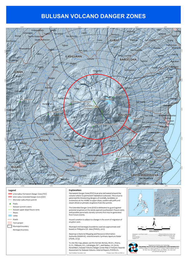
Official, Insert/poster-size map with accompanying report
Bulusan Volcano Danger Zones
Bornas, M.A.V., Rivera, D.J.V., Pidlaoan, A.C., Cahulogan, M.T., & Nadua, J.H. (2016). Bulusan Volcano Danger Zones Map. in: Volcanic Hazard Assessment for Bulusan Volcano. Internal Report, Philippine Institute of Volcanology and Seismology (PHIVOLCS)..
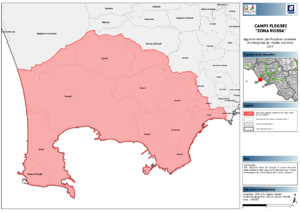
Official, Map sheet or poster
Campi Flegrei "Zona Rossa"
(Campi Flegrei "Red Zone")
Dipartimento della Protezione Civile. (2014). Campi Flegrei "Zona Rossa" - Aggiornamento Pianificazione Nazionale di Emergenza per Rischio Vulcanico.
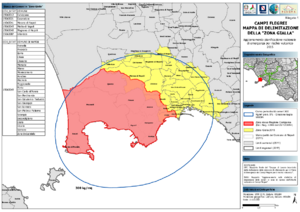
Official, Map sheet or poster
Campi Flegrei Mappa di Delimitazione della "Zona Gialla"
(Campi Flegrei Delimitation Map of the "Yellow Zone")
Dipartimento della Protezione Civile. (2015). Campi Flegrei Mappa di Delimitazione della "Zona Gialla" - Aggiornamento Pianificazione Nazionale di Emergenza per Rischio Vulcanico.