
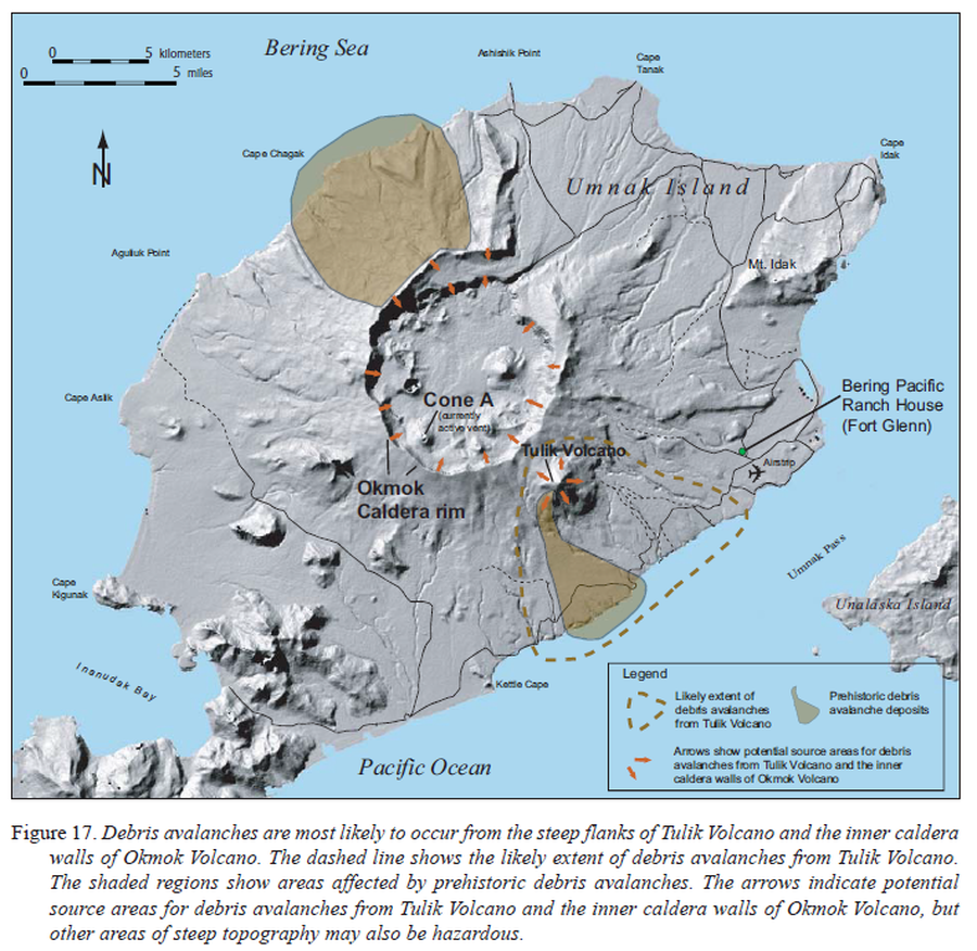
Debris avalanches are most likely to occur from the steep flanks of Tulik Volcano and the inner caldera walls of Okmok Volcano
Okmok, United States, 2005
Figure 17 in: Beget, J.E., Larsen, J.F., Neal, C.A., Nye, C.J., & Schaefer, J.R. (2005). Preliminary volcano-hazard assessment for Okmok Volcano, Umnak Island, Alaska. Department of Natural Resources, Division of Geological & Geophysical Surveys (DGGS), Report of Investigation RI 2004-3, 32 p., 1 sheet, scale 1:150,000. http://doi.org/10.14509/7042
This map was produced by an official agency, but may not be the most recent, most complete, or main operational map.
For the current operational hazard map, please consult the proper institutional authorities.
Click on image for full-size map. If link seems broken, try the archived version.
Beget, J.E., Larsen, J.F., Neal, C.A., Nye, C.J., and Schaefer, J.R. (2005). Preliminary volcano-hazard assessment for Okmok Volcano, Umnak Island, Alaska. Department of Natural Resources, Division of Geological & Geophysical Surveys (DGGS), Report of Investigation RI 2004-3, 32 p., 1 sheet, scale 1:150,000. http://doi.org/10.14509/7042 Map Set
http://doi.org/10.14509/7042
Other Maps In Set:
Map Data
Map ID 3556 Hazard Process(es) Debris avalanches Hazard Zone Presentation Single hazard: A single hazard process is represented on a main map panel Temporal Scale Background, or long-term, map Spatial Scale Volcano and surrounding area Publication Format Figure in a hazard assessment or mitigation plan Zonation Method(s) Geologic history Zonation Model(s) Scenario(s) Considered No scenarios were discernable from the map Hazard Zone Label(s) Hazard process name Probability Definition(s) Qualitative relative probability (e.g. high-medium-low) Purpose Multiple: intended for multiple purposes including general hazard awareness, planning, and crisis management Audience Multiple audiences (usually the public, civil authorities, and land-use planners) Language(s) English Basemap(s) Hillshade Basemap overlay(s) Street map Diemsionality Planimetric (2D or map) view Color Scheme Single color