
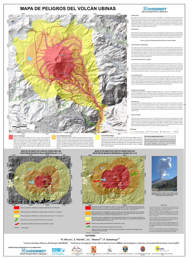
Mapa de Peligros del Volcán Ubinas
Ubinas Volcano Hazard Map
Ubinas, Peru, 2011
Rivera, M., Mariño, J., Thouret, J. C., & Samaniego, P. (2011). Mapa de Peligros del Volcán Ubinas. Instituto Geologico Minero y Metalurgico (INGEMMET), Direccion de Geologia Ambiental y Riesgo, mapa escala 50,000.
This map was produced by an official agency, but is NOT the most recent, most complete, or main operational map.
For the current operational hazard map, please consult the proper institutional authorities.
Click on image for full-size map. If link seems broken, try the archived version.