
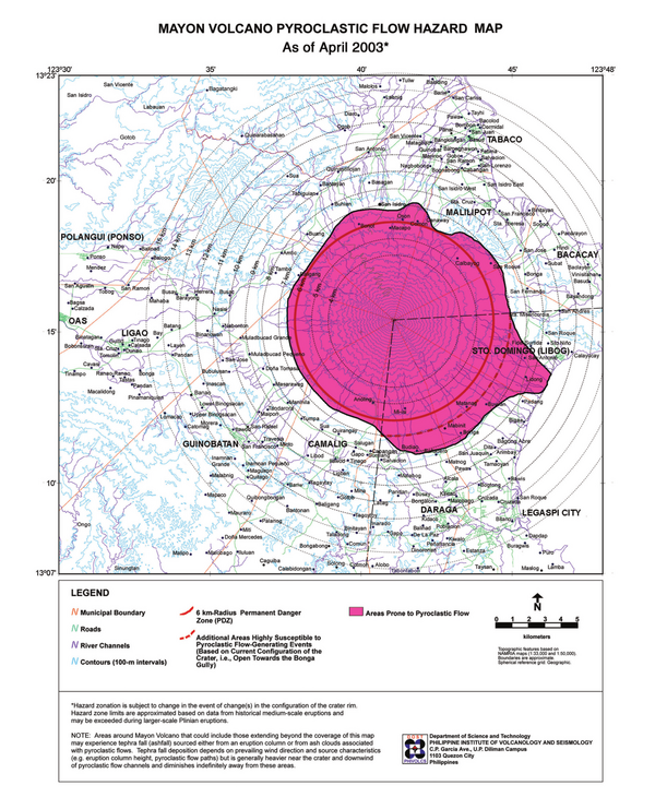
Mayon Volcano Pyroclastic Flow Hazard Map as of April 2003
Mayon, Philippines, 2003
Philippine Institute of Volcanology and Seismology (PHIVOLCS). (2000). Mayon Volcano Pyroclastic Flow Hazard Map as of April 2003
This map was produced by an official agency, but is NOT the most recent, most complete, or main operational map.
For the current operational hazard map, please consult the proper institutional authorities.
Map Set
Philippine Institute of Volcanology and Seismology (PHIVOLCS). (2000-2003). Mayon Volcano Hazard Maps.
Other Maps In Set: