
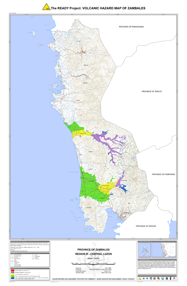
The READY Project: Volcanic Hazard Map of Zambales
Pinatubo, Philippines, 2011
Philippine Institute of Volcanology and Seismology – Department of Science and Technology (PHIVOLCS-DOST). (2011). The Ready Project: Volcanic Hazard Map of Zambales. Province of Zambales, Region III-Central Luzon. Hazards Mapping and Assessment for Effective Community-Based Disaster Risk Management (READY) Project
This map was produced by an official agency, but may not be the most recent, most complete, or main operational map.
For the current operational hazard map, please consult the proper institutional authorities.
Click on thumbnail for full-size map. We do not have copyright permission to display the full-size image. If you are the copyright holder and wish to provide copyright, please contact us at admin@volcanichazardmaps.org. If link seems broken, try the archived version.