
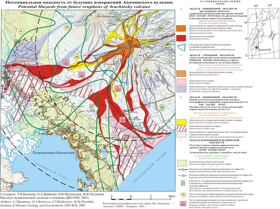
Potential Hazards from future eruptions of Avachinsky volcano
Avachinsky, Russia, 2001
Bazanova, L.I., Braitseva, O.A., Melekestsev, I.V., & Puzankov, M.Yu. (2001). Potential Hazards from future eruptions of Avachinsky volcano. Institute of Volcanic Geology and Geochemistry FED RAS.
This map was produced by an official agency, but may not be the most recent, most complete, or main operational map.
For the current operational hazard map, please consult the proper institutional authorities.
Click on image for full-size map. If link seems broken, try the archived version.