
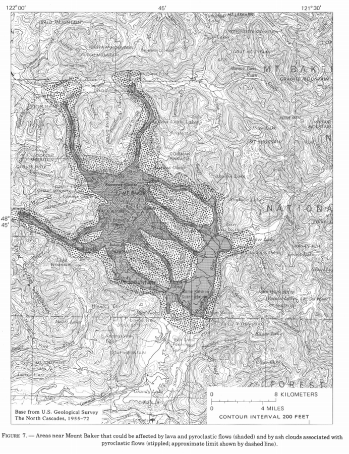
Areas near Mount Baker that could be affected by lava and pyroclastic flows (shaded) and by ash clouds associated with pyroclastic flows (stippled; approximate limit shown by dashed line)
Baker, United States, 1978
Figure 7 in: Hyde, J. & Crandell, D.R. (1978). Postglacial volcanic deposits at Mount Baker, Washington, and potential hazards from future eruptions. U.S. Geological Survey, Professional Paper 1022-C, C1-C17, 1 plate in pocket. https://doi.org/10.3133/pp1022C
This map was produced by an official agency, but is NOT the most recent, most complete, or main operational map.
For the current operational hazard map, please consult the proper institutional authorities.
Click on image for full-size map. If link seems broken, try the archived version.
Hyde, J. & Crandell, D.R. (1978). Postglacial volcanic deposits at Mount Baker, Washington, and potential hazards from future eruptions. U.S. Geological Survey, Professional Paper 1022-C, C1-C17, 1 plate in pocket. https://doi.org/10.3133/pp1022CMap Set
https://doi.org/10.3133/pp1022C
Other Maps In Set: