
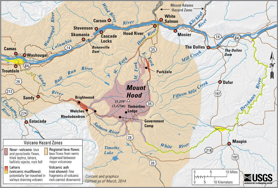
Simplified volcano hazards map of Mount Hood, Oregon
Hood, United States, 2014
Scott, W.E., Pierson, T.C., Schilling, S.P., Costa, J.E., Gardner, C.A., Vallance, J.W., Major, J.J., Driedger, C.L., Iverson, R.M., Ramsey, D.W., & Faust, L.M. (2014). Simplified volcano hazards map of Mount Hood, Oregon. U.S. Geological Survey. Mount Hood, OR Simplified Hazards Map. https://www.usgs.gov/media/images/mount-hood-or-simplified-hazards-map (Modified from: U.S. Geological Survey, Open-File Report 97-89)
This map was produced by an official agency, but may not be the most recent, most complete, or main operational map.
For the current operational hazard map, please consult the proper institutional authorities.
Click on image for full-size map. If link seems broken, try the archived version.