
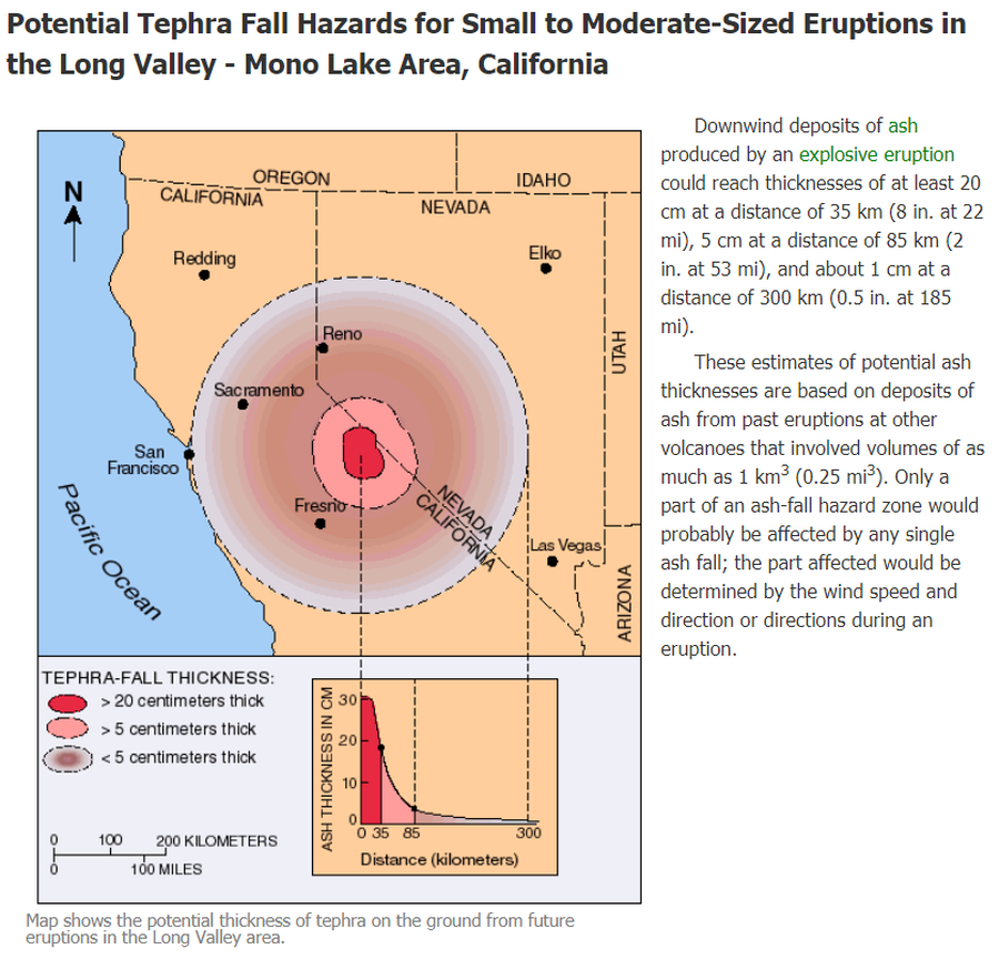
Potential Tephra Fall Hazards for Small to Moderate-Sized Eruptions in the Long Valley - Mono Lake Area, California
Long Valley-Mono Lake Volcanic Field Area, United States, 2012
U.S. Geological Survey (USGS). (2012). Potential Tephra Fall Hazards for Small to Moderate-Sized Eruptions in the Long Valley - Mono Lake Area, California. U.S. Geological Survey. Long Valley Caldera, Volcano Hazards in the Long Valley - Mono Lake Area, California. https://www.usgs.gov/volcanoes/long-valley-caldera/volcano-hazards-long-valley-mono-lake-area-california
This map was produced by an official agency, but may not be the most recent, most complete, or main operational map.
For the current operational hazard map, please consult the proper institutional authorities.
Click on image for full-size map. If link seems broken, try the archived version.
U.S. Geological Survey. (2012). Long Valley Caldera, Volcano Hazards in the Long Valley - Mono Lake Area, California. https://www.usgs.gov/volcanoes/long-valley-caldera/volcano-hazards-long-valley-mono-lake-area-california Map Set
https://volcanoes.usgs.gov/volcanoes/long_valley/hazard_hazards.html
Other Maps In Set: