
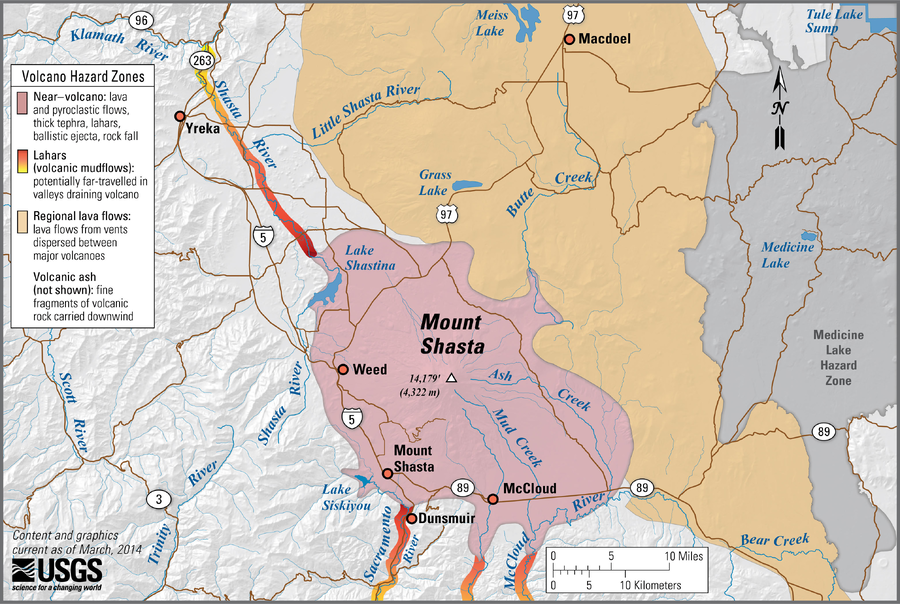
Simplified volcano hazards map of Mount Shasta, California
Shasta, United States, 2014
Miller, C. D., Driedger, C.L., Scott, W.E., Iverson, R.M., Ramsey, D.W., & Faust, L.M. (2014). Simplified volcano hazards map of Mount Shasta, California. U.S. Geological Survey. Mount Shasta, CA Simplified Hazards Map. https://www.usgs.gov/media/images/mount-shasta-ca-simplified-hazards-map (Modified from: U.S. Geological Survey, Bulletin 1503)
This map was produced by an official agency, but may not be the most recent, most complete, or main operational map.
For the current operational hazard map, please consult the proper institutional authorities.
Click on image for full-size map. If link seems broken, try the archived version.
Simplified, modified, or derived from:
- Zones of Potential Hazard from Pyroclastic Flows and Associated Ash Clouds and Mudflows that may Result from future eruptions in the vicinity of Mount Shasta, California
- Zones of Potential Hazard from Lava Flows from Future Eruptions in the Vicinity of Mount Shasta, California