
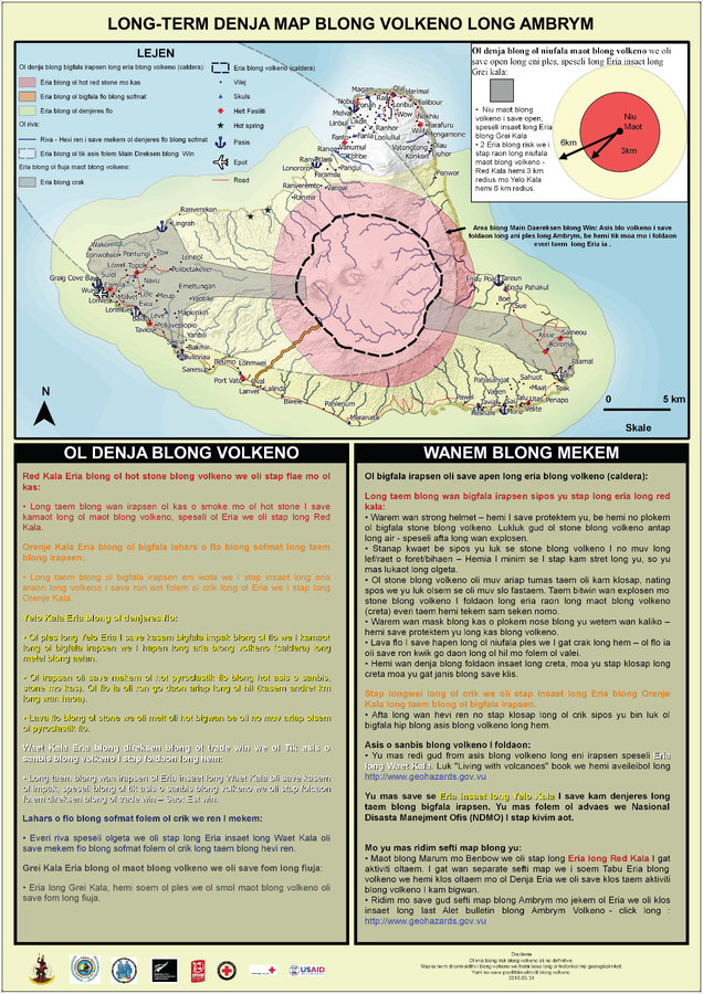
Long-term Denja Map Blong Volkeno Long Ambrym
Ambrym Long-Term Background Volcanic Hazards Map
Ambrym, Vanuatu, 2016
Vanuatu Meteorology & Geo-Hazards Department. (2016). Long-term Denja Map Blong Volkeno Long Ambrym. Government of Vanuatu, Vanuatu Meteorology & Geo-Hazards Department, Vanuatu National Disaster Risk Management Office, New Zealand Foreign Affairs & Trade Aid Programme, GNS Science, The Vanuatu Red Cross Society, Croix Rouge Francaise, USAID.
This map was produced by an official agency, but may not be the most recent, most complete, or main operational map.
For the current operational hazard map, please consult the proper institutional authorities.
Click on image for full-size map. If link seems broken, try the archived version.
Vanuatu Geohazards Observatory. (2016). Ambrym Long-Term Background Volcanic Hazards Map. Vanuatu Meteorology & Geo-Hazards Department, Vanuatu National Disaster Management Office, New Zealand Foreign Affairs & Trade Aid Programme, GNS Science, The Vanuatu Red Cross Society, Croix Rouge Francaise, USAID.Map Set
https://www.vmgd.gov.vu/vmgd/index.php/geohazards/volcano/volcano-info/resources
Other Maps In Set: