
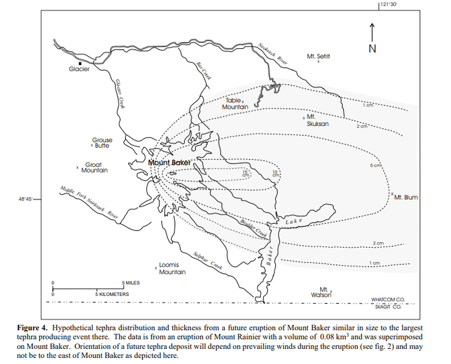
Hypothetical tephra distribution and thickness from a future eruptions of Mount Baker similar in size to the largest tephra producing event there
Baker, United States, 1995
Figure 4 in: Gardner, C.A., Scott, K.M., Miller, C.D., Myers, B., Hildreth, W., & Pringle, P.T. (1995). Potential volcanic hazards from future activity of Mount Baker, Washington. U.S. Geological Survey, Open-File Report 95-498, 16 p., 1 plate, scale 1:100,000. https://doi.org/10.3133/ofr95498
This map was produced by an official agency, but may not be the most recent, most complete, or main operational map.
For the current operational hazard map, please consult the proper institutional authorities.
Click on image for full-size map. If link seems broken, try the archived version.
Gardner, C.A., Scott, K.M., Miller, C.D., Myers, B., Hildreth, W., and Pringle, P.T. (1995). Potential volcanic hazards from future activity of Mount Baker, Washington. U.S. Geological Survey, Open-File Report 95–498, 16 p., 1 plate, scale 1:100,000. https://doi.org/10.3133/ofr95498Map Set
https://doi.org/10.3133/ofr95498
Other Maps In Set: