
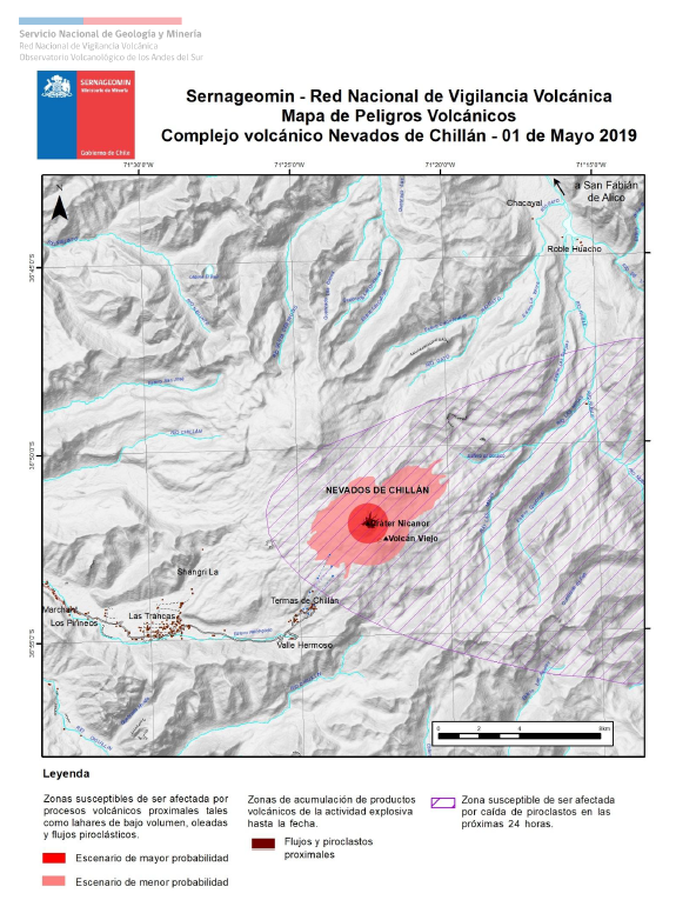
Sernageomin - Red Nacional de Vigilancia Volcánica - Mapa de Peligros Volcánicos - Complejo volcánico Nevados de Chillán - 01 de Mayo 2019
Sernageomin - National Network of Volcanic Surveillance - Map of Volcanic Hazards - Nevados de Chillán volcanic complex - May 1, 2019
Nevados de Chillán, Chile, 2019
Servicio Nacional de Geología y Minería (SERNAGEOMIN) Observatorio Volcanológico de los Andes del Sur (OVDAS). (2019). Reporte de Actividad Volcánica (RAV), 01-5-2019, RAV Región de Ñuble Año 2019 Mayo - Volumen 121. Observatorio Volcanológico de los Andes del Sur (OVDAS).
This map was produced by an official agency, but is NOT the most recent, most complete, or main operational map.
For the current operational hazard map, please consult the proper institutional authorities.
Click on image for full-size map. If link seems broken, try the archived version.
Servicio Nacional de Geología y Minería (SERNAGEOMIN) Observatorio Volcanológico de los Andes del Sur (OVDAS). (2018-2019). Reporte especial de actividad volcánica (REAV) Región de Ñuble Septiembre 2018- Noviembre 2019. Volumen 1 2018-305 2019. Observatorio Volcanológico de los Andes del Sur (OVDAS)Map Set
http://sitiohistorico.sernageomin.cl/volcan.php?iId=32
Other Maps In Set: