
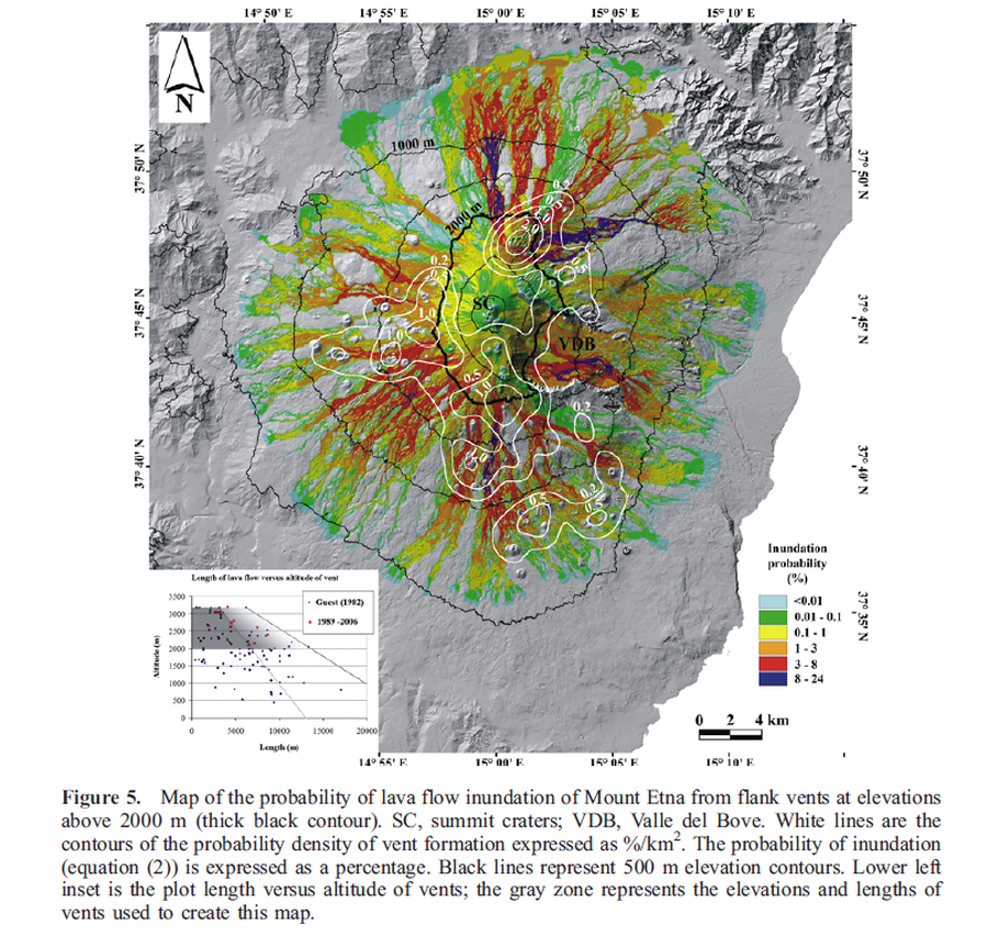
Map of the probability of lava flow inundation of Mount Etna from flank vents at elevations above 2000 m
Etna, Italy, 2009
Figure 5 in: Favalli, M., Mazzarini, F., Pareschi, M. T., & Boschi, E. (2009). Topographic control on lava flow paths at Mount Etna, Italy: implications for hazard assessment. Journal of Geophysical Research: Earth Surface, 114(F1). https://doi.org/10.1029/2007JF000918
This hazard map is the result of scientific research and was published in academic literature.
It is presented here to serve as an example of the map type or the map-making methodology. It is NOT the official, operational map. For the current operational hazard map, please consult the proper institutional authorities.
Click on image for full-size map.
Map Set
Favalli, M., Mazzarini, F., Pareschi, M. T., & Boschi, E. (2009). Topographic control on lava flow paths at Mount Etna, Italy: implications for hazard assessment. Journal of Geophysical Research: Earth Surface, 114(F1). https://doi.org/10.1029/2007JF000918
https://doi.org/10.1029/2007JF000918
Other Maps In Set:
- Map of the probability of lava flow inundation of the Mount Etna area by flank eruptions sourced according to the observed density of vent occurrences
- Map of the probability of lava flow inundation of the Mount Etna area by new eruptions from vents opened at elevations above 3000 m (calculated using a uniform probability of vent opening)
- Map of the probability of lava flow inundation of Mount Etna from flank vents at elevations above 2000 m calculated assuming a uniform probability of vent opening.
- Map of the vent opening probability
- Map of volcano sectors likely to generate lava flows which may invade selected villages at the foot of Mount Etna. SC, summit craters; VDB, Valle del Bove