
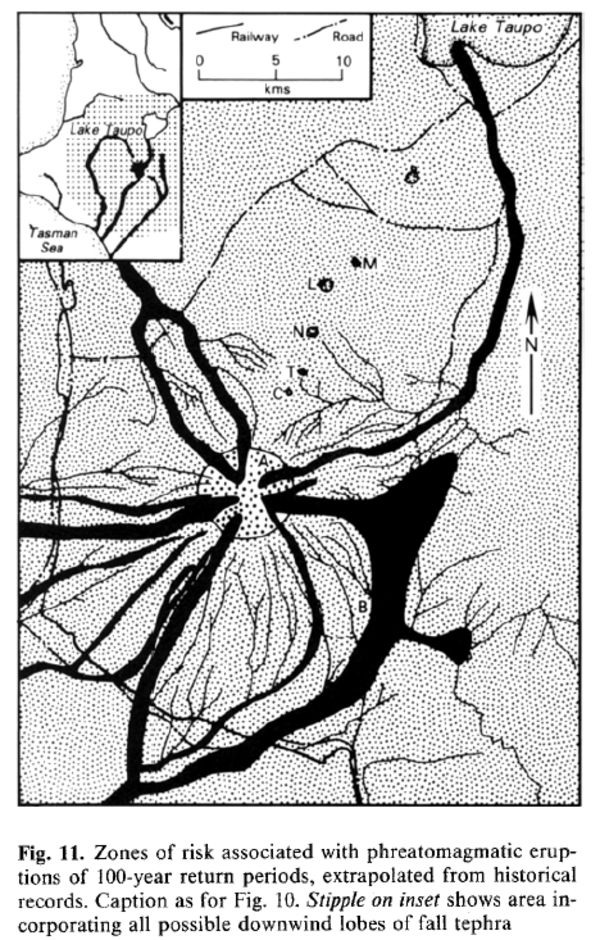
Zones of risk associated with phreatomagmatic eruptions of 100-year return periods, extrapolated from historical records.
Ruapehu, New Zealand, 1987
Figure 11 in: Houghton, B. F., Latter, J. H., & Hackett, W. R. (1987). Volcanic hazard assessment for Ruapehu composite volcano, Taupo volcanic zone, New Zealand. Bulletin of volcanology, 49(6), p. 737-751. https://doi.org/10.1007/BF01079825
This hazard map is the result of scientific research and was published in academic literature.
It is presented here to serve as an example of the map type or the map-making methodology. It is NOT the official, operational map. For the current operational hazard map, please consult the proper institutional authorities.
Click on thumbnail for full-size map. We do not have copyright permission to display the full-size image. If you are the copyright holder and wish to provide copyright, please contact us at admin@volcanichazardmaps.org.
Map Set
Houghton, B. F., Latter, J. H., & Hackett, W. R. (1987). Volcanic hazard assessment for Ruapehu composite volcano, Taupo volcanic zone, New Zealand. Bulletin of volcanology, 49(6), p. 737-751. https://doi.org/10.1007/BF01079825
https://doi.org/10.1007/BF01079825
Other Maps In Set:
- Principal lahar paths at Ruapehu volcano and source areas for the lahars.
- Zones of volcanic risk associated with phreatomagmatic eruptions of return period 1-3 years interpolated from the historical record.
- Zones of volcanic risk associated with phreatomagmatic eruptions of 10-30-year return period interpolated from historical records.